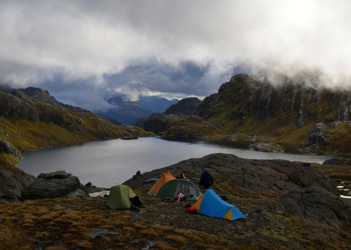
Lake Wilson and the Valley of the Trolls
- 5 hr – 8 hr return by the same track
- Medium
An overnight or multiday scenic diversion from the Routeburn Great Walk. The Valley of the Trolls is easily accessed from Harris Saddle and provides overnight camping for those wanting to get away from the crowds, while Lake Wison provides stunning alpine lake vistas with numerous peaks to climb.
|
Walking time
|
2 – 3 days
5 hr – 8 hr
|
|---|---|
|
Distance
|
13.0km |
|
Type
|
Return by the same track
|
|
Grade
|
Medium
Snow may be present into Summer in the south facing gut used to climb to Lake Wilson. An iceaxe and crampons/bootchains should be carried. Any attempt to climb Mt Erebus will require iceaxe/crampons late into summer. Grades explained
|
|
Bookings
|
No bookings — open access
No — open access
|
|
Starts
|
Routeburn Shelter, Queesntown end of the Routeburn track. But you could also add this trip onto a South-North walk of the Routeburn from The Divide, or from the Caples/Greenstone circuit, or even from the Five Passes route if coming over North Col. |
|---|---|
|
Ends
|
Harris Saddle. Which direction you take from here is up to you and your plans. It is also possible for experienced parties to head north from Lake Wilson to North Col via the Serpentine Range, but that is not covered here. |
|
Maps
|
NZTopo50-CB09
|
|
Altitude
|
1,434m
–
480m
Altitude change -954m
|
From the Routeburn Shelter the Routeburn track is followed all the way to Harris Saddle. Being a Great Walk highway, speedy travel can be achieved. It takes about 2 hours to reach Routeburn Flats from where the track climbs up to Routeburn Falls which are reached in another hour. If this is your first time on the Routeburn it is well worth dropping off your packs and admiring the waterfall. The southern most falls can be accessed in their gorge for a chilly swim by climbing down to the river behind the helicopter pad. {4759}