Stone Hut (Kahurangi)
Kahurangi National Park
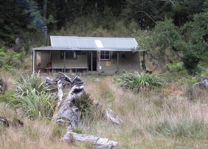
Stone Hut is situated on the banks of the Wangapeka River where it meets Stone Creek. The Wangapeka Track continues past the hut, and a route up Stone Creek leads onto Mount Luna (1630m). Nearby routes also give access to the Biggs Tops and Nugget Knob.
|
Owner
|
Owner: DOC |
|---|---|
|
Category
|
Standard Hut |
|
Sleeps
|
Sleeps 10
10
|
|
Facilities
|
Toilet, Enclosed wood/coal burner, Gas/electric cooking |
|
Water supply
|
No water |
|
Unlocked
|
This hut is unlocked and open to access. |
|---|---|
|
Bookings
|
No bookings — open access
No — open access
|
|
Altitude
|
660m |
|---|---|
|
Mobile phone coverage
|
No coverage |
|
Maps
|
NZTopo50-BQ23
|
|
Link
|
www.doc.govt.nz/p...http://www.doc.govt.nz/parks-and-recreation/places-to-stay/backcountry-huts-by-region/nelson-tasman/motueka/stone-hut/ |