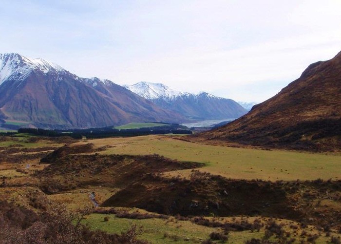
Dry Acheron Track
Korowai/Torlesse Tussocklands Park
- 2 hr 30 min – 8 hr return by the same track
- Easy/medium
- Car park to Clay Gully junction: 1 hour
- Side track to Clay Valley covenant: 10 minutes
- Clay Gully junction to Big Ben Route junction: 1 hour
- Side track to Conical Knoll covenant: 30 minutes
- Big Ben Route junction to Big Ben: 2 hours
A new walk providing access to Big Ben (1416m).
4 members favourited
3 members checked in
|
Walking time
|
0 – 1 day
2 hr 30 min – 8 hr
|
|---|---|
|
Type
|
Return by the same track
|
|
Grade
|
Easy/medium |
|
Bookings
|
No bookings — open access
No — open access
|
|
Starts
|
Coleridge Road, off SH77, Windwhistle |
|---|---|
|
Ends
|
Big Ben |
|
Maps
|
NZTopo50-BW20
NZTopo50-BW21 |
|
Altitude
|
1,416m |
|
Link
|
www.doc.govt.nz/parks-and-recreation/tracks-and-walks/canterbury/north-canterbury-and-arthurs-pass/dry-acheron-track/http://www.doc.govt.nz/parks-and-recreation/tracks-and-walks/canterbury/north-canterbury-and-arthurs-pass/dry-acheron-track/ |
|---|
This new track the Dry Acheron and Big Ben stations. Access is by courtesy of the owners. The track visits two covenant areas and climbs up to the summit of Big Ben in Korowai / Torlesse Tussocklands Park. There are several shorter walking options.
Times:
ID 8380
About this track
131 views in the past year (11 per month).