Mount Grey / Maukatere
- 4 hr 30 min – 6 hr 30 min loop track
- Easy/medium
A pleasant circuit walk to the summit of Mount Grey.
|
Walking time
|
1 day
4 hr 30 min – 6 hr 30 min
|
|---|---|
|
Distance
|
15.5km |
|
Type
|
Loop track
|
|
Grade
|
Easy/medium |
|
Bookings
|
No bookings — open access
No — open access
|
|
Starts
|
Mount Grey picnic area at the end of Cramptons Bush Road, Broomfield |
|---|---|
|
Maps
|
NZTopo50-BV23
NZTopo50-BW23 |
|
Altitude
|
260m
–
934m
Altitude change 674m
|
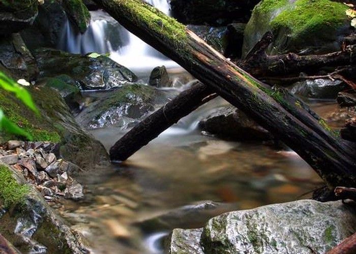
From Amberley, take Douglas Road. This becomes Cramptons Bush Road and enters a forestry block. Exercise caution and watch for logging trucks. The road is closed during times of high fire risk. Call Rayonier on +6433107612 or 0274809279 for an answerphone message indicating whether the road is open.
Two tracks lead to the Mount Grey summit, forming a loop. The Mount Grey Track is smooth and well maintained. The Red Beech Track is a little rougher.
Mount Grey Track
From the picnic area, walk back across the ford in the road. The track starts on the left. The well-benched but sometimes muddy track climbs easily through black beech forest. The scent of honeydew hangs heavily in the air. The track crosses a pine block then approaches a saddle with a viewpoint. Across a stream, the track soon breaks into snowgrass, passing a microwave repeater tower and ending at the trig on Mount Grey's summit.
Red Beech Track
This track sets off along the ridgeline, soon dropping down to low beech forest sprinkled with Hall's totara. The track follows the ridge in an arcing descent for quite some time. Eventually a stream is crossed and the track becomes a rolling sidle under scattered red beech. Clematis and kowhai flowers adorn the forest in spring. The derelict Possumers' Hut is situated on a terrace high above the Grey River just where the track meets the nature walk. Keep left for striking views of the cliffs across the valley.