Glentui Loop Track
- 1 hr loop track
- Easy
Pleasant loop through riverside forest at the foot of Mount Richardson.
|
Walking time
|
1 hr |
|---|---|
|
Type
|
Loop track
|
|
Grade
|
Easy
Track can be muddy in winter Grades explained
|
|
Bookings
|
No bookings — open access
No — open access
|
|
Starts
|
Glentui Picnic Area, Glentui Bush Road, Glentui |
|---|---|
|
Maps
|
NZTopo50-BW23
|
|
Link
|
www.doc.govt.nz/parks-and-recreation/tracks-and-walks/canterbury/north-canterbury-and-arthurs-pass/glentui-walking-tracks/http://www.doc.govt.nz/parks-and-recreation/tracks-and-walks/canterbury/north-canterbury-and-arthurs-pass/glentui-walking-tracks/ |
|---|
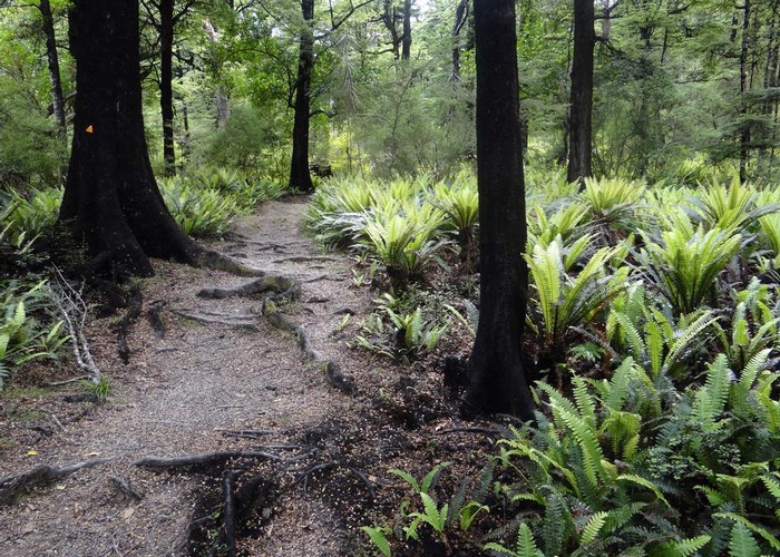
The Glentui Picnic Area is a large patch of grass amongst beech forest at the end of a dirt road. Find it by heading westward from Loburn or north along Ashley Gorge Road from Oxford. Then turn off at the discreetly marked Glentui Bush Road.
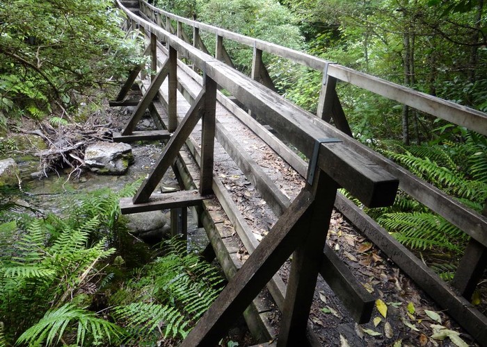
This track begins vaguely at the foot of the picnic area, dropping down to the Glentui River and climbing gently onto the far bank. It passes the end of the Bypass Track then meets the Mount Richardson Track. Follow this track back down to the picnic area past a deep waterfall.
ID 7774
About this track
86 views in the past year (7 per month).