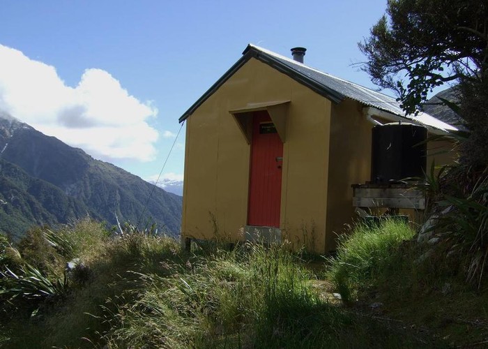
Whymper hut
This is another South Westland 1974 built ex NZFS six bunker. It is set in spectacular surroundings in the headwaters of the Whataroa River. The hut is perched on a narrow scrub covered moraine ridge below the Whymper Glacier. Good views are to be had down the Whataroa River to the NE, across to the ice capped Southern Alps to the SE and to the similarly ice capped Tartare and Maximilian Ranges to the SW. Immediately south of the hut the view of the glaciers etc is blocked by a scrub covered knob but a bit of a walk can take you to a good vantage point.
Whymper hut is mainly used by thar & chamois hunters who often fly in. A trickle of trampers/mountaineers walk in! We day tripped from Butler Junction hut and it was a 3.5hrs walk going up and 3hrs heading back down. The route is well marked. There is a little bit of windthrow at the moment but it's not a problem to get through.
|
Owner
|
Owner: DOC |
|---|---|
|
Category
|
Standard Hut |
|
Sleeps
|
Sleeps 6
6
|
|
Facilities
|
Toilet, Enclosed wood/coal burner |
|
Water supply
|
Tap or tank water |
|
Getting there
|
Usual access is up river from Butler Junction hut. (See that hut page for access notes from the Whataroa roadend to Butler Junction) From B J hut follow the track southward and cross the Butler River swingbridge. Just beyond the bridge at the signposted track junction take the route to Whymper hut. The track is on the TR of the Whataroa to start with then crosses a new swingbridge to the TL just above Rocky Creek which is about half way to the hut. [The DOC time is 4.25hrs] |
|---|---|
|
Unlocked
|
This hut is unlocked and open to access. |
|
Bookings
|
No bookings — open access
No — open access
|
|
Altitude
|
920m |
|---|---|
|
Mobile phone coverage
|
No coverage |
|
Maps
|
NZTopo50-BX16
|