Top Butler hut
This is a six bunk hut built by the NZFS in 1974. It is situated on the TL of the Butler River on the downstream side of the confluence with the South Branch. The Butler River is one of the headwater tributaries of the Whataroa River which is a major South Westland river.
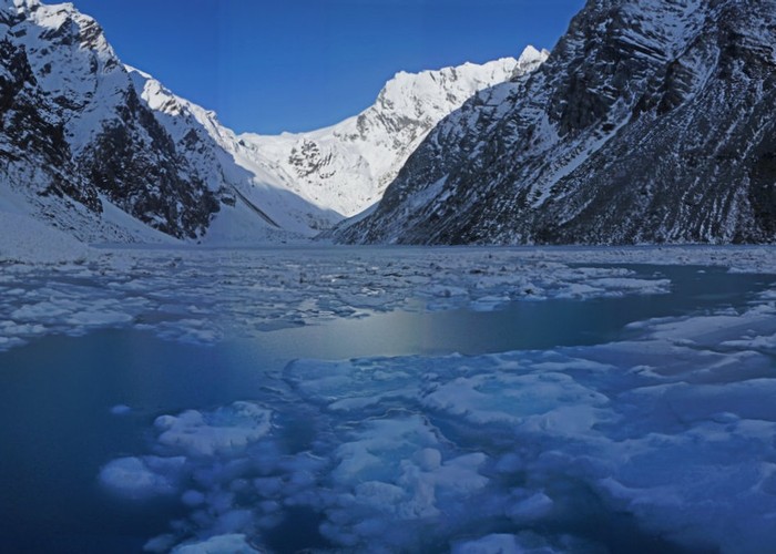
This hut gets a fair bit of use but nearly all is from fly in hunters chasing Thar. There is a pretty good track system in the Whataroa catchment considering the rugged country that is traversed. A fit experienced party in good conditions should have no trouble walking in to this hut in a day from the roadend. Above the hut the track continues up the TL of the Butler River after crossing a swing bridge over the South Branch to give access to Ice Lake.
|
Owner
|
Owner: DOC |
|---|---|
|
Category
|
Standard Hut |
|
Sleeps
|
Sleeps 6
6
|
|
Facilities
|
Toilet, Enclosed wood/coal burner |
|
Water supply
|
No water |
|
Getting there
|
The track start is on the TL of the Whataroa River near the helicopter tourism operation carpark. (Turn inland up a short road just south of the highway bridge) From there head to the Whataroa - Perth track junction & take the track to Butler Junction where there is a hut. Continue past & cross the swing bridge over the Butler River & at the track junction head upstream to the hut. Accumulated DOC guideline walking times to Top Butler hut from the roadend are 10hrs. (This is generous!) |
|---|---|
|
Unlocked
|
This hut is unlocked and open to access. |
|
Bookings
|
No bookings — open access
No — open access
|
|
Altitude
|
599m |
|---|---|
|
Mobile phone coverage
|
No coverage |
|
Maps
|
NZTopo50-BX16
|