Mount Te Kinga Lake Brunner
- 8 hr return via same track
- Medium
To lookout; Time: 3 hrs Distance: 5.4 km return
To summit: Time: 8 hrs Distance: 12.4 km return
The track begins at the end of the Cashmere Bay/Iveagh Bay road and is signposted from the main road (Arnold Valley Road) 5 km south-east of Moana.
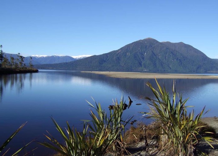
The track begins on a benched track which ascends 300m in altitude to the lookout. It passes through podocarp forest containing Kahikatea, Rimu and Matai. Once at the lookout there are views out across the lake to Iveagh Bay, the outlet of Crooked River and Moana township.
From the lookout the track becomes steep and is recommended for fit and experienced trampers only. From the bushline there is a marked route to the summit at 1200metres. The walk is greatly rewarded with 360 degree views.
|
Walking time
|
8 hr |
|---|---|
|
Distance
|
12.4km |
|
Type
|
Return via same track
|
|
Grade
|
Medium |
|
Bookings
|
No bookings — open access
No — open access
|
|
Starts
|
The track begins at the end of the Cashmere Bay/Iveagh Bay road and is signposted from the main road (Arnold Valley Road) 5 km south-east of Moana |
|---|---|
|
Maps
|
NZTopo50-BU20
|
|
Altitude
|
1,200m |
|
Link
|
www.doc.govt.nz/parks-and-recreation/tracks-and-walks/west-coast/greymouth/lake-brunner-kotuku-whakaoho-tramping-tracks/http://www.doc.govt.nz/parks-and-recreation/tracks-and-walks/west-coast/greymouth/lake-brunner-kotuku-whakaoho-tramping-tracks/ |
|---|