Waiorongomai - Waipapa track - Waitawheta Hut
Kaimai-Mamaku Forest Park
- 1 day one way
- Easy/medium
A track to Waitawheta Hut which takes in the historic Waiorongomai valley and then takes the new Waipapa track which replaces the old eroded track to the hut
|
Walking time
|
1 day
7 hr – 9 hr
|
|---|---|
|
Distance
|
13.5km |
|
Type
|
One way
|
|
Grade
|
Easy/medium |
|
Bookings
|
No bookings — open access
No — open access
|
|
Starts
|
Waiorongomai Rd |
|---|---|
|
Ends
|
Waitawheta Hut |
|
Maps
|
NZTopo50-BC35
|
|
Altitude
|
42m
–
805m
Altitude change 763m
|
There is a network of tracks in the Waiorongomai Valley around the old gold mine workings so there is a choice of which route to take. We went up the High Level track and this seemed to gain height consistently and steadily, which is good when carrying a pack.
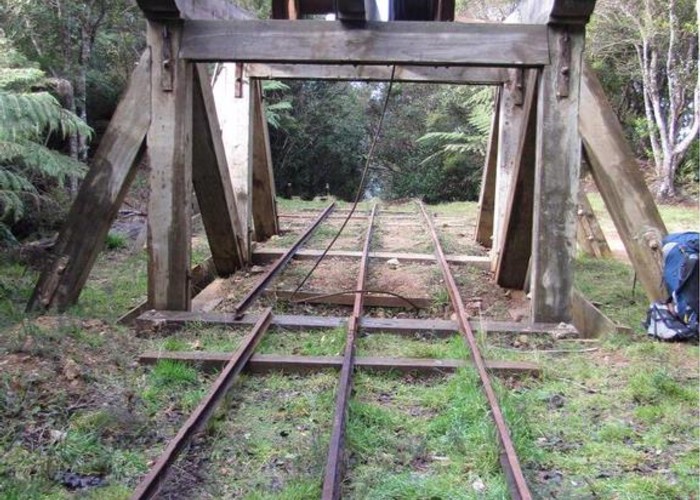
After about an hour the track crosses the historic Butler’s Incline and then comes out at the top. The railway tracks and headworks have been restored so that it is easy to visualise what this must have been like when it was working.
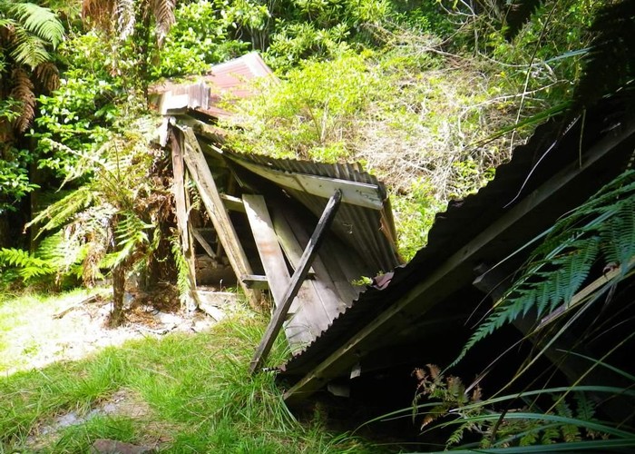
The track continues its climb and after another hour passes a small grassy clearing which would be a good place to stop for a break. A few minutes further on you pass the collapsed remains of Hardies Hut and then arrives at the bench of the Piako County tramway. Soon the track seems to end at the mouth of a rather damp and uninviting tunnel. A short distance in and you will see light. I didn’t believe it at first, but the track goes through the tunnel.
The tramline ends abruptly at a creek but the track continues, climbing more steeply to the ridge at the head of the valley. At the track junction turn right and continue along the Northeast Track which follows the ridge dividing the Waiorongomai Valley from the Mangakino Stream to the north.
The Northeast track ends at the top of the Kaimai range at a point named Pukekohatu. There is another junction here and the signage is unclear. Take the right hand turn, following the orange markers. The left hand track is the old route to the Waitawheta and is in poor condition. Initially the track follows south along the ridge on the old North-South track. It is soggy underfoot, which shows why the North-South track is no longer maintained. The sign at the next intersection, which is another few minutes along suggests that you do not continue on the North-South Track unless “very experienced”. Why the track should be any better because you are very experienced I don’t know but if you want two days of mud and bush bashing, then you are welcome to continue.
Our track drops away from the ridge top and improves rapidly. You soon get views of the head of the Waitawheta Valley. The trip looks like a straight forward descent but unfortunately it isn’t as simple as that. The track is good but is a little frustrating as it goes across the lie of the land and winds in and out of the little creeks and climbs over all the little ridges at the head of the Waipapa stream. It is about two and a half hours from here to the hut.
After the last little creek is crossed the track climbs to as low ridge and then joins an old tramline. It now takes a direct path for the last kilometre the hut, passing through some interesting old cuttings along the way.
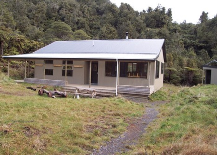
Finally you arrive at the hut, which is on the site of an old mill which operated here.