Mt Dunblane
Hanmer Forest Conservation Park
- 5 hr – 6 hr return by the same track
- Easy/medium
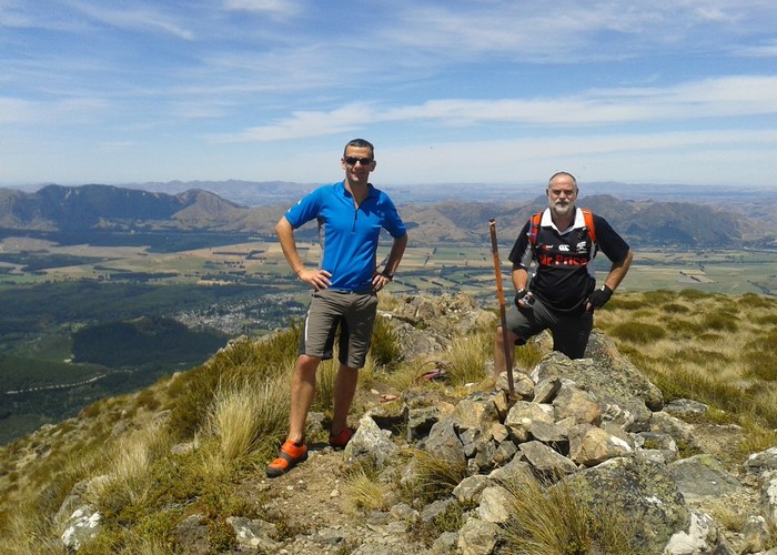
An alternative to the more popular Mt Isobel at Hanmer Springs, this track is an easy climb with a reward of great views over the Hanmer Basin and Jacks Pass. Shown on topo maps as Mt Dumblane.
3 members favourited
6 members checked in
|
Walking time
|
1 day
5 hr – 6 hr
|
|---|---|
|
Distance
|
7.0km |
|
Type
|
Return by the same track
|
|
Grade
|
Easy/medium |
|
Bookings
|
No bookings — open access
No — open access
|
|
Starts
|
Jacks Pass, Clarence Valley Road, Hanmer Springs |
|---|---|
|
Maps
|
NZTopo50-BU24
|
|
Altitude
|
870m
–
1,303m
Altitude change 433m
|
From Jacks Pass, follow an unmarked track westward, away from Mount Isobel. Continue on the rising spur, and ignore the track that turns off down to Chatterton River. Eventually the spur climbs onto a ridge with a relatively flat top. Dunblane is the peak off to the left.
If you want to continue on, the hills out west are all public land: Hanmer Forest Park and Molesworth Reserve.