Track to Mid Styx Hut
- 20 min – 1 hr loop track
- Easy
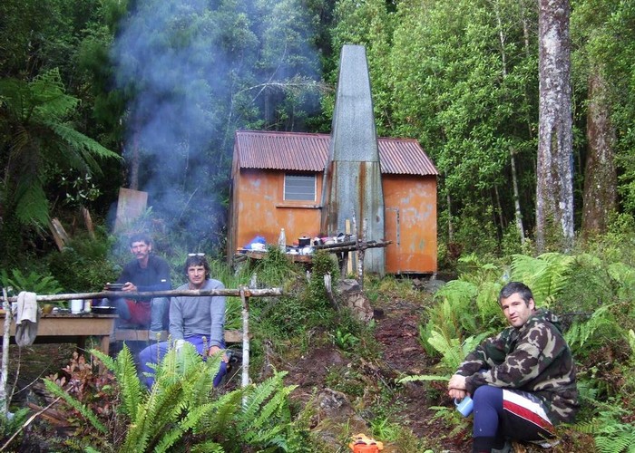
Recently recut 40 minute track to this front country hut renovated by volunteers from the Permolat on-line community.
|
Walking time
|
20 min – 1 hr |
|---|---|
|
Distance
|
1.0km |
|
Type
|
Loop track
|
|
Grade
|
Easy
2 fords possible across the Styx from pack track. Upstream ford shallower and more likely to be used in conditions of increased flow. Grades explained
|
|
Bookings
|
No bookings — open access
No — open access
|
|
Starts
|
On Styx pack track (true right) 2 hours up from 4WD road end, two-thirds of way along to Grassy Flats Hut |
|---|---|
|
Ends
|
Mid Styx Hut |
|
Maps
|
NZTopo50-BV19
|
|
Altitude
|
350m
–
460m
Altitude change 110m
|
|
Link
|
remotehuts.co.nzhttp://remotehuts.co.nz |
|---|
Route to Mid-Styx
Travel up Styx River for 2 to 2 ½ hours until a wooden signpost is encountered indicated the ford across the river. Alternatively, a deeper ford downstream can be used in low flows. This is near the confluence of Tyndall Stream. See remotehuts.co.nz for details of this alternative route. I haven’t used it but it is said to take the same amount of time to get to the hut.
The wooden sign states it will take 40 minutes to get to the hut. It was accurate for us doing it in the dark. A small very short track (?30m) leads to the true right bank of the Styx. Here you will see red fluorescent PVC tape indicating the ford crossing and the opening that leads to the main Styx pack track that you have just travelled on.
Once you’ve crossed the river, you will see a smaller version of this tape indicating the ford and if you travel downstream, there will be 2 further flaggings. One tied on a small coprosma (stinkwood) bush and the other at the start of a trapping track which is marked with pink triangles. This track is a classic 6 ft cut forest service type with grass and small regenerating scrub.
Cross the small side stream and pick up the pink triangles on the other side. After maybe 10 metres you will see the massive orange triangle indicating the start of the track to the hut. This track is very well marked with frequent white permolats and bits of tape etc. and easy to follow (even in the dark). It initially traverses a flat area then winds up a steep slightly exposed arête to the terrace.
From here the track continues hard on the edge of this terrace on the true left of the side creek. After 300 metres travel it suddenly does a dogleg turn to the west, maintaining altitude and crossing the occasional very small side stream. After 250 metres you will suddenly enter the large clearing where the small 4 bunk hut sits.
The track to Tyndall Creek leads from the rear of the hut, across the terrace to the creek for approximately a km. It was cut by volunteers in 2009 and drops into Tyndall Creek which from the map looks reasonable open, pleasant travel.
ID 5556
About this track
45 views in the past year (4 per month).