North Mangahao Bivouac
Tararua Forest Park
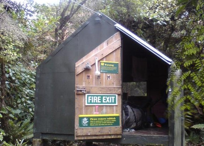
A tidy, well maintained dog-box bivouac in the northern Tararuas. Unlike some of it's Ruahine counterparts, the biv is tall enough to sit up in comfortably. Sleeps 2-3 on the floor (2 mattresses). Features a window, walls lined with building paper, creek water. There's also a tarp and a system of ropes to string it out as a covered extension on the gravel area in front of the biv.
Access (and the exact location) are the two big questions people have. There is a cut (but unmarked) track ascending from Korokpiko road, but it crosses private land and permission is required. About 1 in 4 people come from the other end: Scott's Road on the Palmerston side of the range. See related info for a description of this route.
NOTE: the new topo50 maps have to biv location wrong. The actual grid ref (from DOC) is BN34, E1820790, N5508771 - approximately 1km east an a little north of its marked location. The biv is on the ridge which runs due east from pt 705.
|
Owner
|
Owner: DOC |
|---|---|
|
Category
|
Basic Hut/Bivvy |
|
Sleeps
|
Sleeps 2
2
|
|
Facilities
|
None |
|
Water supply
|
Tap or tank water |
|
Getting there
|
Koropiko Road. 1-2hrs. Cut but unmarked track. Can someone confirm the exact start point? Scotts Road (Palmerston Nth): 3-5hrs. 4km on forestry roads to park boundary. Then cut track - hard to follow in places. See related items for a description. |
|---|---|
|
Unlocked
|
This hut is unlocked and open to access. |
|
Bookings
|
No bookings — open access
No — open access
|
|
Altitude
|
610m |
|---|---|
|
Mobile phone coverage
|
No coverage |
|
Maps
|
NZTopo50-BN34
|