Trounson Kauri Park
- 40 min loop track
- Easy
A short walk through mature podocarp forest.
|
Walking time
|
40 min |
|---|---|
|
Distance
|
1.6km |
|
Type
|
Loop track
|
|
Grade
|
Easy |
|
Bookings
|
No bookings — open access
No — open access
|
|
Starts
|
Trounson Kauri Park picnic area or campground |
|---|---|
|
Maps
|
NZTopo50-AX27
|
|
Link
|
www.doc.govt.nz/parks-and-recreation/places-to-visit/northland/kauri-coast/trounson-kauri-park/http://www.doc.govt.nz/parks-and-recreation/places-to-visit/northland/kauri-coast/trounson-kauri-park/ |
|---|
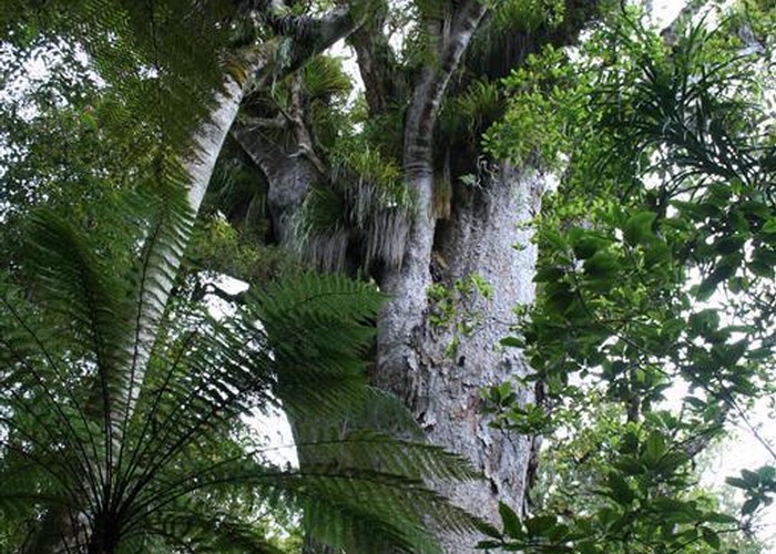
Trounson Kauri Park was the first mainland island established by DOC in Northland. The reserve is 450 hectares, and home to kauri snails, bats, and North Island brown kiwi, along with a substantial stand of kauri trees.
From SH12 north of Dargaville, drive through Kaihu and turn right onto Trounson Park Road. Follow it to the campground or picnic area on the left just near Mangatu Road. The campground is small and basic, with a kitchen, water, unpowered sites, toilets, and showers. The picnic area offers a large interpretation shelter.
A walk sets off from the picnic area or from the back of the campground and forms a loop, meandering through the reserve for 40 minutes. The forest is largely kauri with an understorey of taraire.