Paddy's Pinchgut circuit
- 4 hr loop track
- Easy
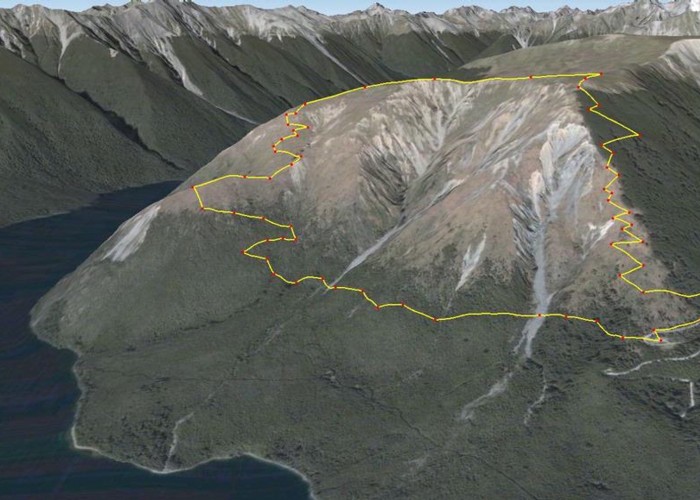
Mt Robert carpark to carpark via Paddy Track, Bushline hut, Relax Shelter and Pinchgut track - 4 hours. 575m up and down. Great lake view from Paddys and views of the area from the top.
|
Walking time
|
4 hr |
|---|---|
|
Distance
|
7.5km |
|
Type
|
Loop track
|
|
Grade
|
Easy
Easy, but expect snow during winter. Grades explained
|
|
Bookings
|
No bookings — open access
No — open access
|
|
Starts
|
Mt Robert car park |
|---|---|
|
Maps
|
-
|
|
Altitude
|
850m
–
1,425m
Altitude change 575m
|
Pinchgut starts off in mature large beech, then breaks out for open views for a while, until you return into the contorted high altitude beech. You break out at the Kea shelter, and then it's a gentle lower alpine amble to Relax shelter for some great views.
Paddy's sidles the hill and you'll make your way up via a steady grade over scree slopes, with ever improving lake views. Turns into a poled route for the last 3rd up to Bushline Hut where you may get to enjoy some shade during summer. Follow track and poles to Relax shelter near summit.
You will be in the snow during the colder months up here, which is why this is the way to the Mt Robert ski field.