Brewster track to Mt.Armstrong
- 1 – 2 days return via same track
- Hard
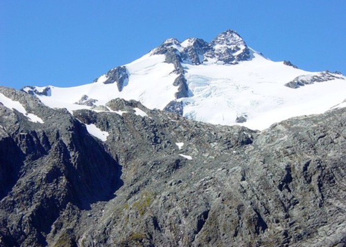
An ascent from the state hwy(SH6),just west of Haast Pass,of over 1700m to a summit on the main divide of the Southern Alps. A climb through beech forest from 450m to the bushline at 1160m and on to Brewster hut at 1450m which was recently upgraded by DOC. A scramble to Mt.Armstrong just above the hut for fantastic views to the east and west of the Alps and toward Mt.Brewster and its glacier which is readily accessible to experienced trampers.
|
Walking time
|
1 – 2 days
8 hr – 12 hr
|
|---|---|
|
Distance
|
9.0km |
|
Type
|
Return via same track
|
|
Grade
|
Hard
Steep ascent and descent, Narrow ridge above the bushline possibly corniced in winter or spring Grades explained
|
|
Bookings
|
No bookings — open access
No — open access
|
|
Starts
|
Fantail Falls carpark on SH6, just west of Haast Pass. |
|---|---|
|
Maps
|
NZTopo50-BZ13
|
|
Altitude
|
450m
–
2,174m
Altitude change 1,724m
|
A short walk down from Fantail Falls carpark and appx 100m downstream from Fantail Falls,it is necessary to cross the water to access the first track marker.(wet feet likely) alt.appx 450m.
Climb the steep bank wall, perhaps using tree roots,, and continue initially in a SE direction following markers which will stay on a spur to the treeline at appx 1160m. The track flattens out briefly in a couple of places and some muddy sections are likely. Water can be heard from Fantail stream to the right (south) in the lower part of the climb but is generally inaccessible and water should be carried for the ascent which may take 3 or more hours.
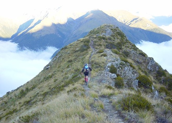
The markers will be replaced by snow poles above the treeline and the ridge will be narrow in sections. If snow is present it may be compelling to traverse to the right (south) a little but be aware of snow conditions leading up to your walk as avalanche is possible and the ridge could be corniced above.
A plateau at about 1450m features a couple of small tarns which drain to the south near to the wall of Mt.Armstrong. Water could be collected here for most of the year but is likely to be dry in late summer. Brewster hut has recently been upgraded by DOC to sleep as much as 12 people now . Details can be obtained from the office in Makarora.