Lake Guyon Hut
St James Conservation Area
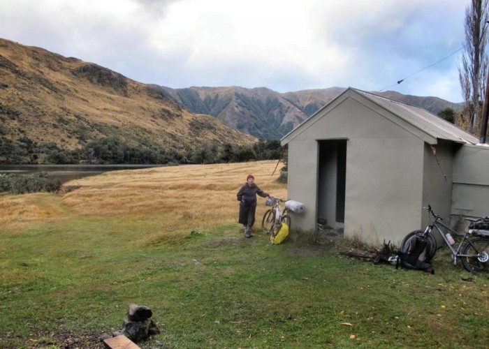
Standard 4 bunk hut on the shore of Lake Guyon, a popular fishing lake. This little hut is just 30 minutes detour from the St James Cycle Trail, so it can be busy with hunters, fishers, and cyclists. There is ample camping space around the hut.
The hut is located next to the Lake Guyon Homestead site. Visible here are the lines of poplars, rock walls, and other archaeological remains. The runholder was William Travers, the Irish lawyer, politician and naturalist, from 1860 to 1879. Travers named the nearby Ada, Henry (his son), Boyle, and Anne Rivers.
More about William Travers: http://www.teara.govt.nz/en/biographies/1t105/travers-william-thomas-locke
|
Owner
|
Owner: DOC |
|---|---|
|
Category
|
Standard Hut |
|
Sleeps
|
Sleeps 4
4
|
|
Facilities
|
Toilet, Enclosed wood/coal burner |
|
Water supply
|
Natural water source
Small stream just behind the hut.
|
|
Getting there
|
Via the Fowler Pass Track in the east, Stanley River Track in the south, or the Waiau River. 30 minutes up from the Waiau River (St James Walkway, Maling Pass, or Charlies Saddle). 4WD access over Maling Pass leads much of the way to the hut. |
|---|---|
|
Unlocked
|
This hut is unlocked and open to access. |
|
Bookings
|
No bookings — open access
No — open access
|
|
Altitude
|
810m |
|---|---|
|
Mobile phone coverage
|
No coverage |
|
Maps
|
NZTopo50-BT24
|
|
Link
|
www.doc.govt.nz/p...http://www.doc.govt.nz/parks-and-recreation/places-to-go/canterbury/places/st-james-conservation-area/things-to-do/huts/lake-guyon-hut/ |
ID 4202
About this hut
Added 12 July 2009 by Andrew BarkerAndrew Barker.
3 revisions, most recently 7 April 2015 by
matthewmatthew.
170 views in the past year (14 per month).