A 5 day loop in the Ureweras
Te Urewera, Waioeka Conservation Area
- 5 – 7 days loop track
- Medium
Wet rocky streams, long hauls over bush ridges on overgrown tracks, not much in the way of open tops. It isn't everyone's cup of tea but there are lots of good huts and the wilderness of the "great untrodden" Urewera is magnificent.
|
Walking time
|
5 – 7 days |
|---|---|
|
Distance
|
67.0km |
|
Type
|
Loop track
|
|
Grade
|
Medium |
|
Bookings
|
No bookings — open access
No — open access
|
|
Starts
|
Moanui Rd |
|---|---|
|
Ends
|
Moanui Rd |
|
Maps
|
NZTopo50-BG40
NZTopo50-BF41 NZTopo50-BF40 |
|
Altitude
|
325m
–
1,325m
Altitude change 1,000m
|
Additional material that may be useful for this trip is the DOC pamphlet entitled “Recreation in Northern Te Urewera National Park” see www.doc.govt.nz/upload/documents/parks-and-recreation/tracks-and-walks/east-coast-hawkes-bay/northern-te-urewera-brochure.pdf
Though we felt some of the times in this pamphlet were quite optimistic.
Makakoere Hut to Te Rangaakapua is quoted as 3-5 hours. We think 5-7 hours more accurate.
Also Te Pua Hut to Tataweka Hut is quoted as 5-7 hours. We think 8-10 hours more like it.
Day 1
From the carpark on Moanui Rd the track follows through farmland on the true right of the Koranga Stream. This track continues down stream to Koranga Forks Hut but that is another trip. After about 20mins our track crosses swing bridge to the true left and immediately begins a long climb along farm tracks to the top of the ridge. On entering the bush at the top the track descends at an easy gradient and is soon alongside the Kahuiti Stream. This easy gradient is maintained all the way to Tawa Hut.
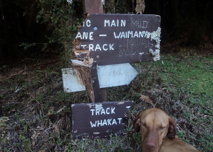
There are two turn-offs along the way, marked by ancient signs. The first leads up the Kahunui Stream to Kahanui Hut, the second up the Makakoere Stream to Makakoere Hut. It is this second turn we will take, 400 meters short of Tawa Hut.
There is no track up Makakoere Stream but the going up the stream is generally easy, if a little slippery and rocky in places. It takes about 3 hours to the hut and you will be wondering when you will get there or if you have gone past it. The hut is on the true right at the foot of a flatter stretch of river and the track to it is marked by a large orange triangle.
Day 2
Continue up the Makakoere Stream for about another 2 hours, the going being very similar to the day before. The track to Te Rangaakupu is marked by a large orange triangle but this is partly obscured by bush. It is just upstream from side stream and a well-established campsite.
The climb to Te Ranaakupu starts off being lightly marked with old white permolats but these get better as you climb and eventually orange triangles take over. The track starts climbing steeply and continues that way for 400 vertical meters. It is also overgrown and not well trodden under foot. I am afraid it is one of those climbs that makes you wish that you had taken up any other hobby than tramping.
After 400m climbing you come to the top of a knoll and the track undulates for a while before proceeding to climb again, this time a little less steeply, eventually getting to the top of the ridge. You will know when you are there from the blast of wind in your face when you arrive.
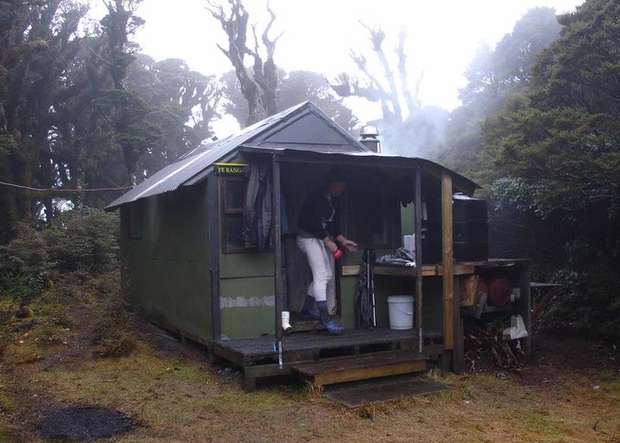
From this point it is 800m to the hut along the ridge through goblin forest. We are at over 1300m in altitude here so you will probably be in the cloud. If not, consider yourself lucky, the views are reputed to be superb.
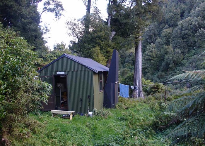
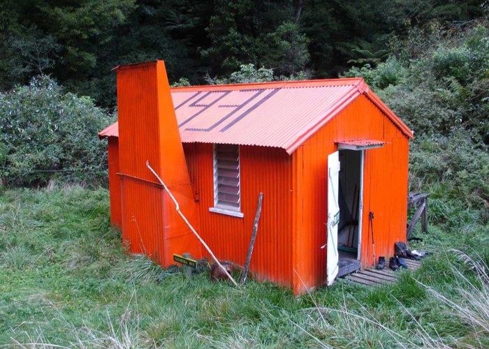
The hut is a welcome sight. Small, 3 bunks, a huge bench, a Kent fire and lots of firewood. It is a magic place to be. Time from Makakoere Hut to here, about 6-7 hours.
Day3
You will be relieved that this day is all downhill. From the hut the track emerges from the goblin forest and into leatherwood scrub for while before dropping back into the bush. The track continues down the ridge, frequently blocked by windfalls, which you have to find your way around. After about 3 hours you suddenly come across an old Forest Service era sign marking the turn off to Mangatoatoa Hut. This hut is about 100m vertically down the hill from here on the Mangatoatoa stream and if you want to spin this trip out a bit you could call this a short day and stop here. However there is plenty of time to get to Te Pua Hut in a day despite the apparent distance on the map.
After about another hour the track drops steeply to the fork of the Mangatoatoa and the Uruwaea Streams. This place is the merger of two rocky canyons so has an eerie feel to it. The marker to the track on the other side is evident and climbs steeply out of the rocky gut to what must be the remains of a sidle track above the river. It is overgrown and intersected by windfalls but after about an hour the track, once again, comes out to the river again. This time the valley is much wider and the river larger. It has now become the Tauranga River.
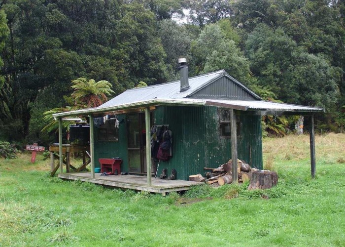
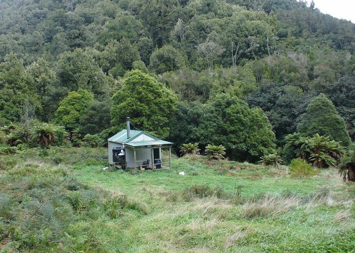
Follow the river downstream, entering into the bush from time to time to cut bends in the river. The valley is wide and opens into pleasant flats in places. Te Pua Hut is, once again, hidden from the river. The point where the track leaves the river and enters the bush is marked by a piece of ribbon tied around a rock on top of a large boulder on the edge of the river. The hut is about 100m back from the river in a large clearing.
Day4
The full day from here to Tataweka Hut takes about 9 hours and involves 2 big hill climbs. However there is an intermediate point in the form of Otane Bivy for those who would wish to break this day in two.
The track begins by crossing the river below the hut and begins climbing on the other side. The gradient is fairly good so this climb is not too arduous. You eventually notice that you have climbed the hill and are following along a ridge. The track then drops very steeply into the Tawawharara Stream losing most of the height you have gained. The Tawawharara Stream down here is very narrow and tight. While this has a scenic quality to it, it would be no place to be in rain or high water.
Follow upstream for about 1km, wading deep in some of the pools, until you get to the junction of the Tawawharara and Maniaroa Streams. Go left here to get to Otane Bivy or go right to continue to Tataweka. There is supposedly a sidle track up on the ridge ahead but we found the going in the river here to be just fine.
After about 1km you come to where the track climbs again, at a fork in the stream and marked by a large orange triangle. The track climbs steeply but is mitigated by the fact that it is in pleasant open beech forest. After about 300 vertical meters on the ridge the bush changes back to the damp potocarp forest and you emerge on a ridge overlooking the Tataweka Stream. However the track continues to climb for a little while yet and then traverses to the north east of point 985 before descending steeply into the head of the Tataweka Stream.
Unfortunately the Tataweka is a major disappointment as it is a buddliah filled drain. Parties coming in the other direction will have difficulty here finding the track as everything is obscured by the pervasive buddliah.
Note also if doing the reverse trip, the climbing in that direction is considerably steeper and more demanding that doing it the way we did.
Follow down the middle stream, between walls of the horrible weed for about 1km to get to the hut. The hut is on the true right and, once again is not visible from the stream. The track to it is marked by ribbon tied to the scrub.
Day 5
The final day of this trip is to continue down the Tataweka to its confluence with the Kahunui. The only real feature of this part of the trip is an attractive little gorge just above the confluence.
Once you are across the Kahunui, climb the bank on the opposite side and gain the track to Tawa Hut, which is 1km up from the Tataweka. From there it is simply a matter of retracing your steps from day 1 to get back to the Moanui Rd carpark.