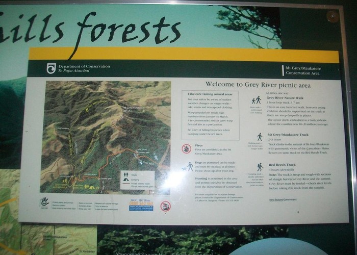
Mount Thomas
Mt Thomas Forest
- 3 hr 30 min loop track
- Easy/medium
Mount Thomas is a prominent hill at the edge of the Canterbury Plains. It is a good daytrip from Christchurch with views of the Puketeraki Range inland, and the Pacific Ocean and Banks Peninsula to the east.
11 members favourited
11 members checked in
|
Walking time
|
3 hr 30 min |
|---|---|
|
Distance
|
8.0km |
|
Type
|
Loop track
|
|
Grade
|
Easy/medium |
|
Bookings
|
No bookings — open access
No — open access
|
|
Starts
|
Wooded Gully Camping and Picnic Area, Hayland Road, west of Loburn |
|---|---|
|
Maps
|
NZTopo50-BW23
|
|
Altitude
|
330m
–
1,023m
Altitude change 693m
|
ID 401
About this track
174 views in the past year (15 per month).