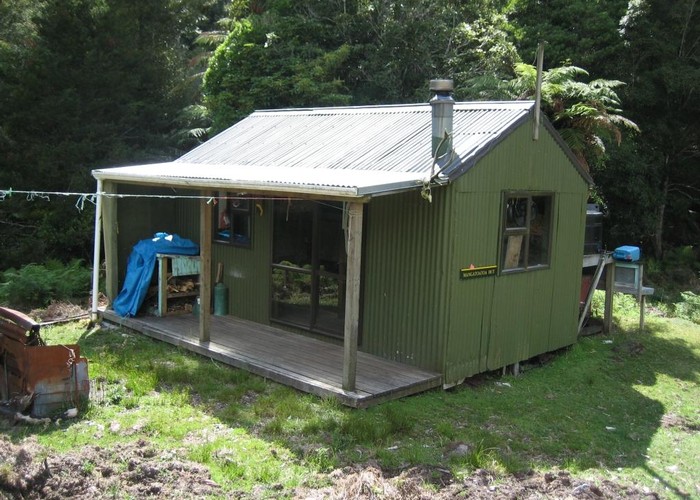
Mangatoatoa Hut
Te Urewera
A pleasant well maintained hut in a clearing high up on the Tauranga River. On the track from Makomako which intersects the Te Rangaakapua to Te Pua 1km NE of the hut. You can also visit off the Te Rangaakapua to Te Pua track by making a detour off and descend 100m to get to the hut.
The hut is situated above a junction between the Mangatoatoa (tributary of the Tauranga) and a side stream.
|
Owner
|
Owner: DOC |
|---|---|
|
Category
|
Standard Hut |
|
Sleeps
|
Sleeps 8
8
|
|
Facilities
|
Toilet, Enclosed wood/coal burner |
|
Water supply
|
Tap or tank water |
|
Getting there
|
Just off the Te Pua - Te Rangaakapua Track Makomako Hut: 4km, good cut track, 1.5-3hrs. Te Rangaakapua Biv: 4km, 1.5-3hrs. 1km to track junction, then good going up ridge, but track not well maintained - markers sparse in places. Te Pua Hut: 9km. 1km climb to track junction on ridge, then track down ridge and Mangatoatoa River. |
|---|---|
|
Unlocked
|
This hut is unlocked and open to access. |
|
Bookings
|
No bookings — open access
No — open access
|
|
Altitude
|
580m |
|---|---|
|
Mobile phone coverage
|
No coverage |
|
Maps
|
NZTopo50-BG40
|
ID 4012
About this hut
58 views in the past year (5 per month).