Nina River
Lewis Pass National Reserve
- 5 hr – 6 hr return via same track
- Easy
Easy tramping up a pretty river valley near Lewis Pass.
|
Walking time
|
2 days
5 hr – 6 hr
|
|---|---|
|
Distance
|
19.0km |
|
Type
|
Return via same track
|
|
Grade
|
Easy |
|
Bookings
|
No bookings — open access
No — open access
|
|
Starts
|
Opposite Palmer Lodge (marked with "NZDA") 4km north of Boyle Village on SH7 |
|---|---|
|
Maps
|
NZTopo50-BT23
NZTopo50-BU23 |
|
Altitude
|
610m
–
761m
Altitude change 151m
|
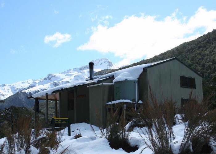
Opposite palmers lodge the track starts by crossing a swing bridge and sidles along the true right of the river. The track climbs steeply but briefly,sidling along a high bank above the river before the track turns up the Nina valley. Its easy going through open beech forrest before you reach the Silvias Ridge turn off after 25mins. The track continues in the same manner for much of the way until you meet the new swing bridge above the Nina gorge, after about 1-1.5hours. From here the new track follows the true right side of the river. The old track still exsists on the true left but is not maintained and swing bridges have been removed. The new track drops to a river flat for a breif moment before climbing slowly through the forrest gradualy gaining height towards where the new hut is situated. The steepest section of the track is just before the hut, after 1.5- 2 hours. The hut is located above the valley exposing great veiws both down into the valley and also of the high peaks surrounding. It is a new Comfortable 10 bunk hut. The hut is an excelent base to explore the surronding area, either up into the devilskin saddle, into the Nina basin or even up the Brass monkey biv. You can return the same way or take the track down towards the nina biv until you reach the old hut site. Turn down stream from here and follow the old track down the true left side. This track is mainly flat but the track can be overgrown or blocked in places, but is still well marked.