Mt Alford
- 3 hr – 4 hr return via same track
- Easy/medium
A walk through beech forest, open farmland and alpine scrub with great views of Mt Somers, Mt Winterslow and Mt Hutt.
|
Walking time
|
0 – 1 day
3 hr – 4 hr
|
|---|---|
|
Distance
|
9.0km |
|
Type
|
Return via same track
|
|
Grade
|
Easy/medium |
|
Bookings
|
No bookings — open access
No — open access
|
|
Starts
|
Carpark at St end of Spoors Rd, Alford Settlement |
|---|---|
|
Maps
|
NZTopo50-BX20
|
|
Altitude
|
480m
–
1,171m
Altitude change 691m
|
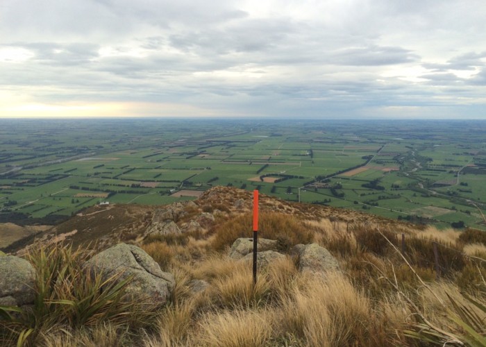
The track alternates between public and private land and this is shown clearly on a signboard at the start of the track. The track begins with a short farm section before it enters Alford Scenic Reserve for a steady climb through beech forest with emerging horopito and lancewoods. The track passes through an open scrubby section then follows a fence to a 4wd track. The 4wd track isn't followed, instead marker poles show the track crossing a small boggy patch/stream and up to another ridge. The poles are a bit sparse for this short section and can be hard to spot but it is easy to find your own way to an open grassy area with a picnic table and great views into the Ashburton River.
The poles lead up the ridge through dracophyllum scrub and again it can be hard to see the next pole but the travel is fairly straightforward. The summit is reached not long after. It provides fantastic views and is a great place to linger on a fine weather day.