Mt Richardson loop
- 4 hr – 6 hr loop track
- Easy
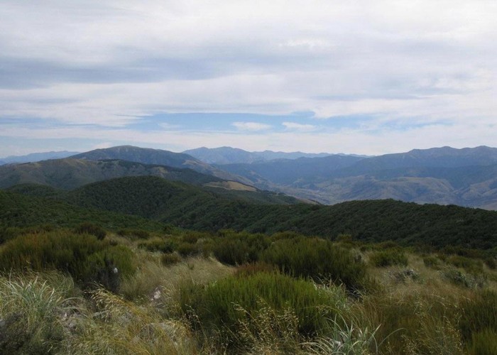
Climb up steadily on a well-made track through tawhai forest and up to Mt Richardson (1047 metres). At the top you get great views of the Puketeraki and Torlesse ranges one side, and across the Canterbury Plains on the other.
|
Walking time
|
1 day
4 hr – 6 hr
|
|---|---|
|
Distance
|
9.0km |
|
Type
|
Loop track
|
|
Grade
|
Easy |
|
Bookings
|
No bookings — open access
No — open access
|
|
Starts
|
Glentui picnic area - a 1 hr drive from Christchurch via Rangiora and Loburn. |
|---|---|
|
Maps
|
NZTopo50-BW22
|
|
Altitude
|
380m
–
1,047m
Altitude change 667m
|
|
Link
|
www.doc.govt.nz/parks-and-recreation/tracks-and-walks/canterbury/waimakariri-area/glentui-tramping-tracks/http://www.doc.govt.nz/parks-and-recreation/tracks-and-walks/canterbury/waimakariri-area/glentui-tramping-tracks/ |
|---|
To get to the start from Christchurch, drive through Rangiora then Loburn. About 5 km east of the Ashley Gorge Bridge turn left onto Glentui Bush Road and drive to the Picnic Area at the end of the road.
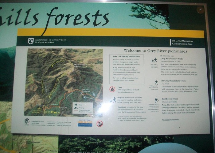
To do a loop of about 4-6 hours, you can head up the Richardson Track to Mt Richardson (2 hours), then down the Blowhard track then the Bypass back down to the picnic area (1 hour to junction then 1 hour to picnic area).
The view at the top is very nice, amongst tussock and dracophyllum.
There are wasps here and at Mt Thomas in the summer so take care, especially with dogs.