Central Whirinaki - Mangamate Loop
Whirinaki Te Pua-a-Tāne Conservation Park
- 2 – 3 days loop track
- Easy/medium
A popular circut in the Whirinaki Forest Park which can easily be done in 2 days or a more leisurly 3 days
|
Walking time
|
2 – 3 days
12 hr – 18 hr
|
|---|---|
|
Distance
|
40.0km |
|
Type
|
Loop track
|
|
Grade
|
Easy/medium |
|
Bookings
|
No bookings — open access
No — open access
|
|
Starts
|
River Rd carpark |
|---|---|
|
Ends
|
River Rd carpark |
|
Maps
|
NZTopo50-BG38
|
|
Altitude
|
410m
–
720m
Altitude change 310m
|
This trip starts from the carpark at the end of River Rd just past Minginui. You should not leave cars here overnight. Gary Aldridge at Whirinaki Forest Lodge in Te Whaiti (Ph- 07-366 3235) will mind cars and has a van to shuttle you to the road end.
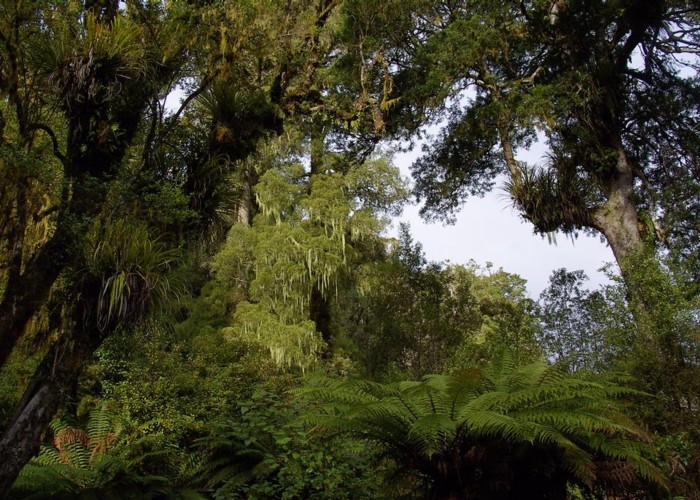
The track to Central Whirinaki Hut is of a very high standard, making for easy travel. Unfortunately after 18kms it actually gets a bit tedious. However the scenery is nice and worthwhile stops can be made at Te Whati Nui a Toi Canyon, the Whirinaki Falls and at Vern’s Camp where there is a newly erected picnic shelter.
As you move up the valley look, and listen, for the endangered native Blue Duck (Whio). There are a number of pairs up near the hut.
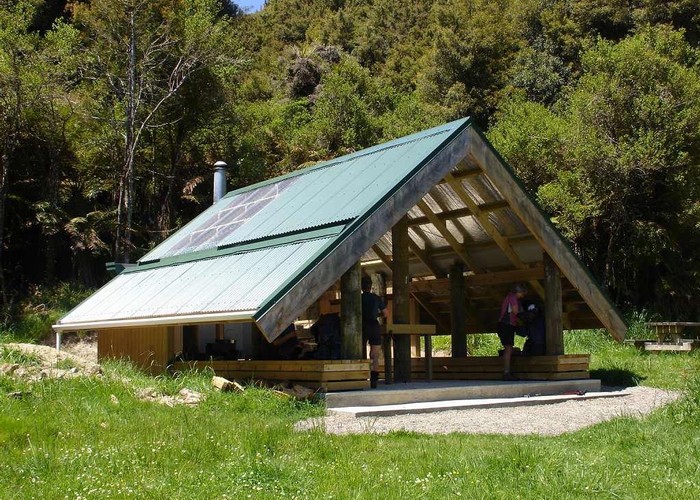
Central Whirinaki Hut is large (24 bunks) and is a popular overnight stop for many trips in the park.
From the hut the track continues up the valley on a good track for about half an hour. At the bridge over the Taumutu Stream, leave the main track (which goes to Plateau Rd) and head up the stream. The track now deteriorates and is in quite poor condition for about 1km. But follow the stream all the way until you come to a sign that directs you to Mangamate Hut. The other track goes to the Upper Whirinaki Hut
The track is now quite narrow and crosses the stream often. It is not as good as the track in the Whirinaki Valley but there are few obstacles and good progress can be made. The track initially goes up the Kakaiti Stream and then crosses a low saddle into the headwaters of the Kakanui Stream.
At a point where the stream veers west the track leaves the stream and turns into a good benched track. It then climbs steadily to the Mangamate Hut, which is in a small clearing on a saddle, facing north.
From Mangamate Hut the good benched track continues down the hill on the other side before dropping into the valley and then out onto a clearing which was where the Mangamate Hut used to be located before being moved to its new location.
Downstream from the clearing the track follows an old 4-wheel drive track, crossing the stream often and sometimes in the stream until you come out to a bridge on the main Whirinaki Track. From here follow the good track back to the River Rd carpark.