Dobson Nature Walk
Arthur's Pass National Park
- 30 min loop track
- Easy
Alpine flora; panoramic views; summit of Arthur's Pass.
|
Walking time
|
30 min |
|---|---|
|
Distance
|
1.0km |
|
Type
|
Loop track
|
|
Grade
|
Easy |
|
Bookings
|
No bookings — open access
No — open access
|
|
Starts
|
Temple Basin car park, near Arthur's Pass Summit |
|---|---|
|
Maps
|
NZTopo50-BV20
|
|
Altitude
|
890m
–
920m
Altitude change 30m
|
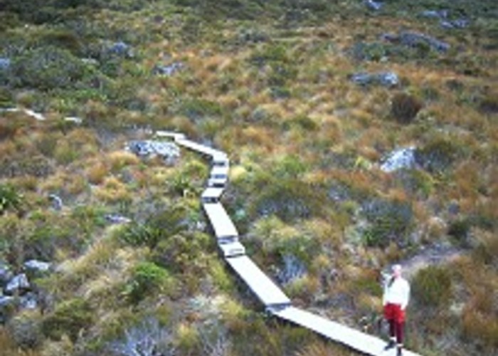
This short loop explores the rich herbfield on the saddle of Arthur's Pass, and offers panoramic alpine views. Visit between October and December for alpine blooms, including the grand New Zealand giant buttercup.
From the Temple Basin Skifield car park, head uphill past ribbonwoods and hebes to a road crossing. A boardwalk winds through the alpine garden, which is punctuated with massive boulders tumbled from the tops above. The wisp of the Ribbon Falls is visible in the distance on the right. The track climbs onto the hillside and drops back to the saddle. From here, the Lake Misery Track leads onward to the Otira Valley, the Arthur's Pass Walking Track leads down to the village, or you can return to the Temple Basin Car Park.
Next to the road by the saddle, a tall cairn memorialises Arthur Dudley Dobson, the explorer who discovered the pass (already known to Maori), and a mountain finder table explains the peaks.