Mt Baldy
- 6 hr – 7 hr return via same track
- Easy/medium
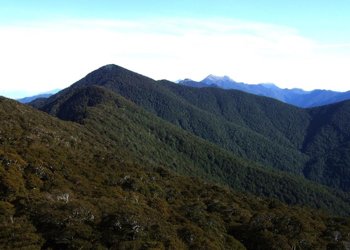
A walk to the summit of Mt Baldy, the first half of the tramp follows the Wakamarina track to Fosters Clearing. From Fosters Clearing the track follows the ridgeline. The track becomes unmarked after a while so basic navigation skills are required to locate the summit. Once on the summit there are good views of the Richmond range and surrounding area.
1 member favourited
|
Walking time
|
6 hr – 7 hr |
|---|---|
|
Type
|
Return via same track
|
|
Grade
|
Easy/medium |
|
Bookings
|
No bookings — open access
No — open access
|
|
Ends
|
Mt Baldy |
|---|---|
|
Maps
|
NZTopo50-BQ27
|
|
Altitude
|
1,315m |