Tongariro Alpine Crossing
Tongariro National Park, Tongariro National Park World Heritage Area
- 6 hr – 8 hr one way
- Medium
- Mangatepopo Road end to South Crater: 2 hours
- South Crater to Emerald Lakes: 1.5 hours
- Emerald Lakes to Ketetahi Shelter: 1.5 hours
- Ketetahi Shelter to Ketetahi Road end: 2 hours
A popular but crowded alpine route through a spectacular volcanic landscape.
|
Walking time
|
1 day
6 hr – 8 hr
|
|---|---|
|
Distance
|
19.4km |
|
Type
|
One way
|
|
Grade
|
Medium
Mountain environment with changeable weather. Grades explained
|
|
Bookings
|
No bookings — open access
No — open access
|
|
Starts
|
Mangatepopo Road, off SH47 |
|---|---|
|
Ends
|
Ketetahi Road, off SH47a |
|
Maps
|
NZTopo50-BH34
NZTopo50-BH35 |
|
Altitude
|
770m
–
1,850m
Altitude change 1,080m
|
The volcanic plateau comprises two massive volcanoes: Ruapehu (2797m) and Tongariro (1967m) — the young, symmetrical cone of Ngauruhoe (2287m) is considered to be a vent of the Tongariro Volcano. The Tongariro Alpine Crossing explores the Tongariro-Ngauruhoe complex. It is not a difficult or especially long walk, although one section is quite strenuous. Near the beginning, a 45-minute hand-over-hand climb over raw, black basalt has most walkers sweating and pausing for breath. But once that's over, walking is fairly easy.
Unlike New Zealand's other popular tracks, the Abel Tasman, Milford, and Routeburn, there are no controls on the numbers of walkers. Consequently, on a sunny summer day a continuous stream of people threads from one end of the track to the other. Because of the high numbers walking the track and the delicacy of the environment at the track edges, it is important that walkers keep to the formed track. Note that there are no toilets or drinkable water supplies between Soda Springs and Ketetahi Shelter.
Hazards
Although deservedly famous as the best day walk in New Zealand, the Tongariro Alpine Crossing is a potentially treacherous tramping route, very exposed to poor weather. Take warm and waterproof clothing. In winter you will need snowcraft skills, ice axe, and crampons. On a fine day, the views are breath taking, stretching as far as Taranaki, almost 140km away. On a poor day think twice before departing: transport operators may not run, and you likely won't see anything anyway. If you can, set aside some days and wait the weather out before departing.
The track section from Emerald Lakes to Ketetahi Shelter crosses an active volcanic zone, which last erupted 2012. Warning signs indicate the current level of volcanic hazard.
Access
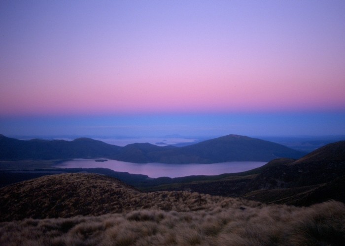
The two ends of the Crossing are widely spaced, but transport runs regularly to both ends from Taupo, Turangi, Whakapapa Village, and National Park. Tickets are easily available, and may be purchased from local information centres. The southern end of the Crossing is to the west of the National Park at the Mangatepopo Road end off SH47. The northern end is at the Ketetahi Road end off SH46. Most walkers start at Mangatepopo to take advantage of a slight height differential. This means you start your morning walking into the sun, and often the best views are over your shoulder. However, if you start at Ketetahi, you will be walking against the stream, which could mean a lot of pleasantries to exchange.
Mangatepopo Road end to South Crater
Departing from the shelter (toilet nearby), a wide and smooth track rises gently up the tussock valley, while the dark cone of Ngauruhoe in the distance lends an air of expectation. A trail leads off to the right, providing access to Whakapapa Village (3 hours), and just moments later, a turn-off to the left leads to Mangatepopo Hut (20 minutes from the car park).
Beyond here, the valley becomes filled with fresh basalt rubble, and the track becomes rockier, hemmed against the northern valley wall. A clamber alongside a small stream, and the track opens onto a long basin curling around the foot of Ngauruhoe. The Soda Springs, a ten-minute side trip from here, are pretty falls edged with flowers, an oasis of greenery in the otherwise barren environment.
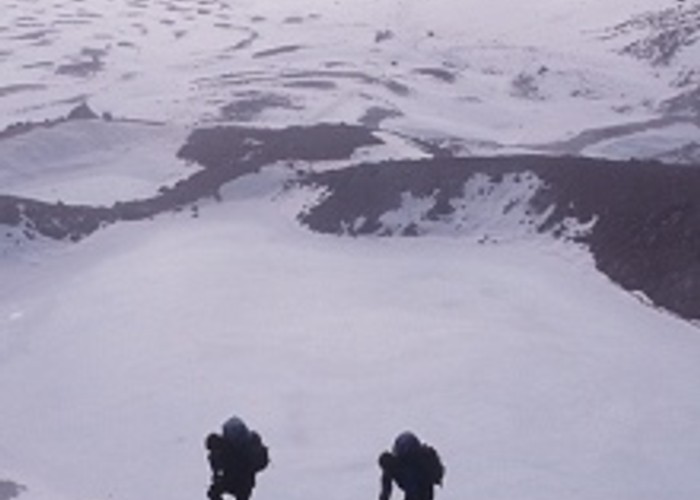
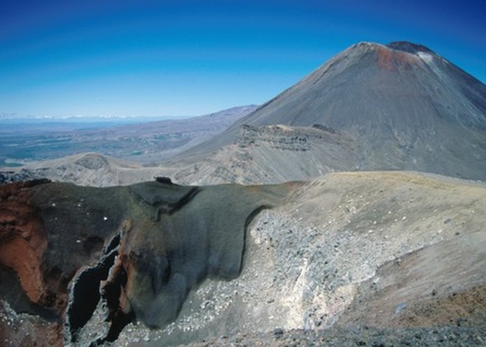
Beyond here, the track climbs out of the valley directly up the volcano's steep face. While a track is marked, one path is as good as another over the rough basalt. The climb takes around 45 minutes to ascend 250m, and rewards with panoramic views from the scoria saddle, including the distant cone of Taranaki to the west and, of course, the very much nearer cone just to the south. A side track ascends Ngauruhoe: a hard 2-3 hours up, and an exhilarating 15 minutes back down!
South Crater to Emerald Lakes
The track opens onto the flat, yellow expanse of South Crater, crossing it, and climbing onto the low ridge opposite. Over the back of this ridge are good views of the strange and desolate Oturere Valley. Here, windblown ash fills the gaps in the rubble, creating a moonscape of smooth arcs and jagged edges.
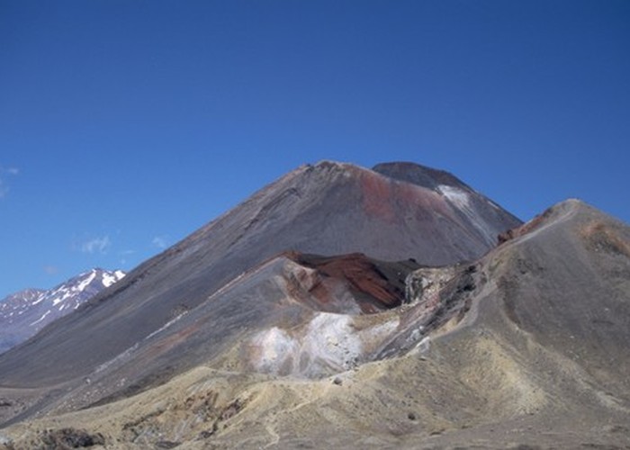
Climbing easily along the ridge, the track bursts unexpectedly upon Red Crater, a disturbingly primordial rift of dark red and charcoal grey. A striking feature of the opposite wall is the hollow shell of a dike. Molten magma once pushed through these ash layers along a vertical crack in the wall. When the magma drained away, only the hardened surface remained. Steam rises from the sides of this active crater and sulphur lingers in the air.
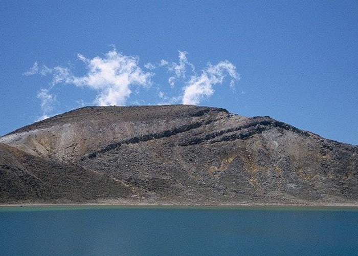
The track drops down a scree slope to the pretty Emerald Lakes, old explosion craters flooded and coloured with minerals leached from the surrounding rock. Sulphur stains and steaming fumaroles are visible here.
Emerald Lakes to Ketetahi Shelter
The track descends easily onto the scoria-dotted floor of Central Crater where the track to Oturere Hut leads off to the right. Across the wide crater, as you climb over the north rim, there is an excellent view back south of a large black lava flow that has spilled out of Red Crater.
Over the rim, the track sidles past the wide, round Te Wai-whakaata-o-te-Rangihiroa / Blue Lake and eases into the V of the Ketetahi Valley. This lake is tapu (sacred). Please do not swim in it or eat food nearby.
The track sidles beneath the large, hidden disc of North Crater through an alpine herb field, lazily dropping in long zigzags to the shelter.
There is evidence of the 2012 Te Maari Crater eruptions around here, including impact craters and teaming vents. The hut was damaged in the eruption and is no longer available for overnight use.
Ketetahi Shelter to Ketetahi Road end
Beyond the shelter, the herb fields give way to tussock, and the track passes beneath the Ketetahi Springs. Once a popular bathing spot, these springs are on private land, and there is currently no public access. Where the track crosses the blue-stained creek beneath the springs, there is a tantalising view into this steaming fissure.
A stepped track descends gently through the sub-alpine shrubs, and eventually drops into forest. Just here, there is a good view of a 450-year-old lava flow from Te Mari that has cut through the forest. After more steps, the track becomes muddy and begins to meander, soon coming alongside a small, babbling stream, and eventually opening onto the car park, with shelter and toilets.