East Hawdon Stream
Arthur's Pass National Park
- 7 hr – 8 hr return via same track
- Easy/medium
A short walk to a new biv located on a branch of the Hawdon River.
|
Walking time
|
1 – 2 days
7 hr – 8 hr
|
|---|---|
|
Distance
|
22.0km |
|
Type
|
Return via same track
|
|
Grade
|
Easy/medium
Unmarked route Grades explained
|
|
Bookings
|
No bookings — open access
No — open access
|
|
Starts
|
Hawdon Shelter, north of Mount White Bridge |
|---|---|
|
Ends
|
East Hawdon Biv |
|
Maps
|
NZTopo50-BV21
|
|
Altitude
|
570m
–
1,060m
Altitude change 490m
|
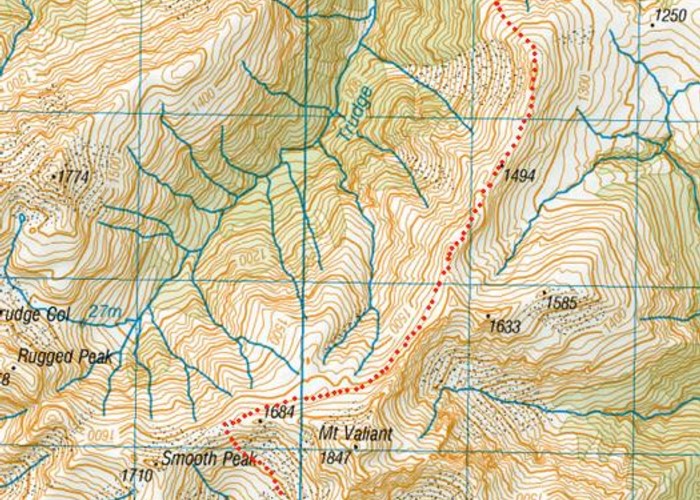
The East Hawdon Stream is easily overlooked and not often visited. Yet it is accessible, and an easy day or overnight trip from Christchurch. The new biv is tidy and solid, yet small and basic, with only two bunks and no heating.
Turn off SH73 at Goldney Saddle north of Cass to cross the Mount White Bridge. Turn right and then left to follow the shingle road leading up to the Hawdon Shelter (camping here). The track up the Hawdon River commences in the trees behind the shelter.
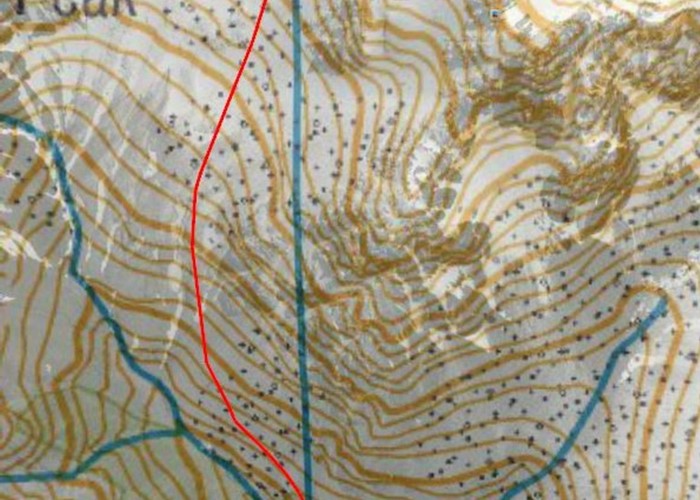
Follow the track down onto the edge of the riverbed and trhough a gate at the true left edge of the electric fence that spans the valley. A poled route continues up the middle of the valley, following a vague 4WD track over shingle and grassy flats. The track returns to the true left and up onto matagouri tracks just before meeting East Hawdon Stream (1.5 hours from the shelter).
The streambed here is wide and shingle-filled. But it soon narrows to a dark valley as the hillsides close in. The route is not formally marked, but generally stays on the true right bank with a few sections of old track marked with cairns or plastic ties. Eventually, point 1708 appears upstream, with Mount Valiant a little further on. The route crosses a series of slips before climbing onto a terrace on the true right bank. The hut is located at the bush edge with a good view of the Savannah Range opposite (2-2.5 hours from the Hawdon Valley). There is limited camping space on the terrace amongst the sub-alpine plants.