Queen Charlotte Track
- 3 – 5 days one way
- Easy
- Bookings required
- Ship Cove to Resolution Bay: 2 hours, 4.5km
- Resolution Bay to Endeavour Inlet: 3 hours, 10.5km
- Endeavour Inlet to Camp Bay: 4 hours, 11.5km
- Camp Bay to Torea Saddle: 8 hours, 24.5km
- Torea Saddle to Mistletoe Bay: 4 hours, 7.5km
- Mistletoe Bay to Anakiwa: 4 hours, 12.5km
- Waterfall Track at Ship Cove: 30 minutes return
- Antimony Track at Endeavour Inlet: 2 hours return. This track leads up to a saddle and antimony mine dating from the 1880s.
- James Vogel Nature Track at Mistletoe Bay: 45 minutes return
- Peninsula Walk at Mistletoe Bay: 30 minutes return
A long but easy walk along Queen Charlotte Sound. This track offers hostel and resort accommodation as well as basic campsites. Pack cartage is also available.
|
Walking time
|
3 – 5 days
18 hr – 26 hr
|
|---|---|
|
Distance
|
71.0km |
|
Type
|
One way
|
|
Grade
|
Easy
Track is mostly benched and well graded. Mountain bikes create a lot of bogs during/after rainfall. Grades explained
|
|
Bookings
|
Bookings required
Required
A Queen Charlotte Track Pass is required, including for day visits. This provides access to the private land and supports maintenance costs. Hut fees are additional. Private accommodation and pack cartage is available.
|
|
Starts
|
Meretoto / Ship Cove, Queen Charlotte Sound / Tōtaranui |
|---|---|
|
Ends
|
Anakiwa, Queen Charlotte Sound / Tōtaranui |
|
Maps
|
NZTopo50-BP29
NZTopo50-BQ28 NZTopo50-BQ29 |
|
Altitude
|
Sea level
–
470m
Altitude change 470m
|
|
Link
|
www.doc.govt.nz/parks-and-recreation/places-to-go/marlborough/places/queen-charlotte-sound-totaranui-area/things-to-do/tracks/queen-charlotte-track/http://www.doc.govt.nz/parks-and-recreation/places-to-go/marlborough/places/queen-charlotte-sound-totaranui-area/things-to-do/tracks/queen-charlotte-track/ |
|---|---|
|
Bookings
|
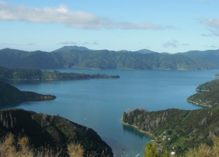
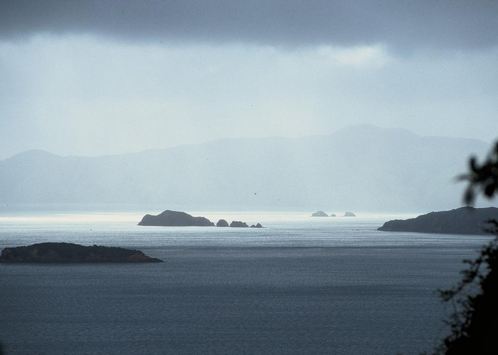
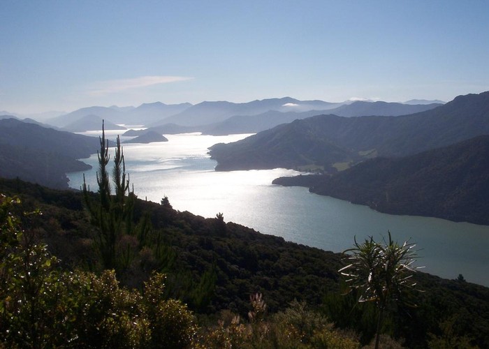
The Marlborough Sounds are a series of drowned river valleys on the northeast corner of the South Island. This well-known trail follows the spine of one of the ridges, dropping to the waterline at various points. The waters of the sounds are often in view, but often frustratingly out of reach. The summer tramp along the track can be hot and dry.
Much of the Marlborough Sounds were cleared and farmed. These ventures failed but left a legacy of old farm houses and fences hidden now amongst scrubby regenerating forest.
The track is open to mountain bikes all year, aside from the Ship Cove to Kenepuru Saddle section, which is closed from December to February.
The track crosses both public and private land. A Queen Charlotte Land Cooperative (QCTLC) Pass is required to walk the private sections. Passes are available from local information centres and businesses, and are $12 for four days, children free. Fees are used for track and facility maintenance. Camping passes are not included in the QCTLC Pass, and are available from DOC.
The Queen Charlotte Track forms part of the Te Araroa Trail.
The track is very suitable for day visits, and may be walked in either direction. Boat access is available to any bay on the track. Road access is available to Kenepuru Saddle, Torea Saddle, Mistletoe Bay, and Anakiwa. It is most convenient to arrange boat transport to Ship Cove, and walk to Anakiwa.
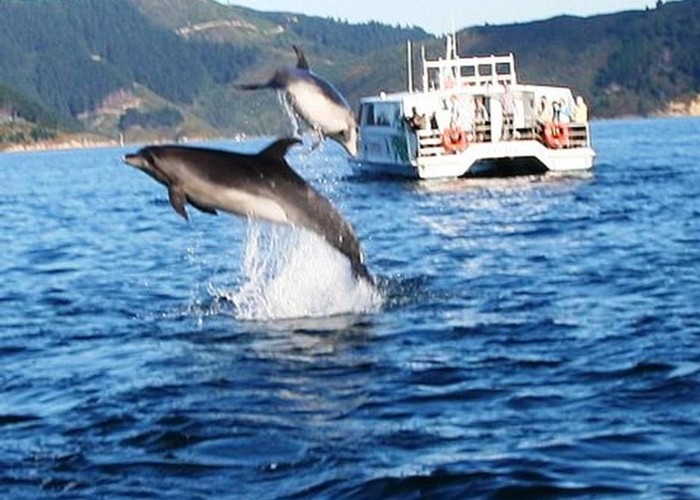
On the boat journey, watch for dusky and bottlenose dolphins, as well as little penguins, gannets, and fluttering shearwaters.
Ship Cove to Resolution Bay
Ship Cove / Meretoto is an historic site with a large monument to Camptain James Cook. Cook named the cove on 15 January 1770, anchoring the HMS Endeavour to replenish supplies. Her returned four more times over his voyages. Camping is prohibited at Ship Cove, but toilets are available.
Ship Cove has perhaps the richest unmodified forest found anywhere on the track. The track climbs quickly, to cross a small saddle (240m) into Resolution Bay. A DOC campsite is located at Schoolhouse Bay, within Resolution Bay. Private cabins are also available.
Resolution Bay to Endeavour Inlet
From Resolution Bay, the track climbs over another saddle (220m) to ease gently into Endeavour Inlet on an old bridle trail. The track leads to the head of the inlet past Furneau Lodge and a campsite at the head of the inlet.
Endeavour Inlet to Camp Bay
Following the shoreline, the track passes through regenerating forest to Big Bay and onward to Kenepuru Saddle above Camp Bay. A side track drops to the Camp Bay DOC campsite and the Punga Cove Resort from here.
Camp Bay to Torea Saddle
From Kenepuru Saddle, the track follows the ridgeline, with views westward over the head of Kenepuru Sound. The ridge bends to the southwest and comes to the Bay of Many Coves campsite high above the bay. From here, the track climbs to a 494m summit where a long side track leads down to Bay of Many Coves Resort.
The track continues along the ridge, past Ruakaka and Blackwood / Tahuahua Bays, then Kumutoto and Kaipakirikiri Bays. Black Rock campsite is located above Kumutoto Bay. Beyond here, the track passes a 436m summit and drops to cross a road at Torea Saddle. Peppers Portage Hotel and the Cowshed Bay DOC campsite are off down the road heading north.
Torea Saddle to Mistletoe Bay
From the saddle, the track climbs to another summit (407m) before dropping just as quickly past Lochmara Bay and climbing past another summit. This one overlooks Te Mahia bay to the north and Onahau Bay to the south. Take the track down to Mistletoe Bay, which is an arm of Onahau Bay. An extensive campsite is located here with cooking shelter, jetty, and short walks.
Mistletoe Bay to Anakiwa
Back up the road and on the track, it climbs onto the hillside but forsakes the summits of Onahau (555m) or Mount Bolton (505m), climbing to just 200m on a bridle track. The track soon drops to Davies Bay campsite, then meanders easily along the shore to Anakiwa village.
Walking times
Side trips: