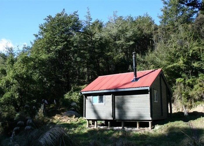
Pinchgut Hut via Mt Thomas summit, Forrestdale Rd, Whare stream
- 3 hr 30 min – 5 hr loop track
- Medium
The track is marked on the map: Follow Forrestdale Rd which deteriorates into a 4WD track overgrown with gorse. This then ends but a foot track begins just on the left side of the terminus (E2457471 N5784279 co-ords from Freshmap, not GPS, sorry). Follow this foot track down to Whare stream. The track has had some snipping. Across the stream the start of the track has been wiped out but it is pretty much opposite where it emerges from the true right.
This section is quite pretty and in good order. Please take some secateurs, slasher, loppers whatever to keep it open.
You can return via the track to Wooded Gully as described in the Wooded Gully/Pinchgut route. It's quite nice too.
4 members favourited
1 member checked in
|
Walking time
|
1 day
3 hr 30 min – 5 hr
|
|---|---|
|
Distance
|
11.0km |
|
Type
|
Loop track
|
|
Grade
|
Medium |
|
Bookings
|
No bookings — open access
No — open access
|
|
Starts
|
Wooded Gully road end |
|---|---|
|
Ends
|
Pinchgut Hut |
|
Maps
|
-
|
|
Altitude
|
360m
–
1,020m
Altitude change 660m
|
((Pinchgut Hut))