Rakiura Track
Rakiura National Park
- 3 days loop track with a road section
- Easy/medium
- Bookings required
- Day 1: 4 hours 20 minutes
- Halfmoon Bay to Lee Bay Road end: 1 hour 15 minutes
- Lee Bay Road End to Little River: 20 minutes
- Little River to Maori Beach: 1 hour
- Maori Beach to Port William junction: 1 hour
- Port William junction to Port William Hut: 45 minutes
- Day 2: 5 hours 15 minutes
- Port William Hut to Port William junction: 45 minutes
- Junction to lookout: 3 hours
- Lookout to North West Circuit junction: 1 hour
- North West Circuit junction to North Arm Hut: 30 minutes
- Day 3: 4 hours
- North Arm Hut to Sawdust Bay: 1 hour
- Sawdust Bay to Kaipipi Road: 1 hour 45 minutes
- Kaipipi Road to Fern Gully Track: 45 minutes
- Fern Gully Track to Halfmoon Bay: 30 minutes
An historic walk through almost deserted, pure podocarp forest.
|
Walking time
|
3 days
13 hr – 14 hr 30 min
|
|---|---|
|
Distance
|
32.0km |
|
Type
|
Loop track with a road section
|
|
Grade
|
Easy/medium |
|
Bookings
|
Bookings required
Required
Huts and campsites must be booked in advance.
|
|
Starts
|
Lee Bay Road, Stewart Island |
|---|---|
|
Ends
|
Main Road, Stewart Island |
|
Maps
|
NZTopo50-CH09
|
|
Altitude
|
Sea level
–
305m
Altitude change 305m
|
|
Link
|
www.doc.govt.nz/parks-and-recreation/tracks-and-walks/southland/stewart-island-rakiura/rakiura-track/http://www.doc.govt.nz/parks-and-recreation/tracks-and-walks/southland/stewart-island-rakiura/rakiura-track/ |
|---|
While there are signs of past visitors -- loggers, farmers, miners and Maori -- all over the island, only the Halfmoon Bay area is now inhabited. Although there are some introduced predators, the island remains a sanctuary for birds with its rich, pure podocarp forest, and rain on three out of every four days (rainfall is frequently a just brief, light shower). The island also has a reputation for its deep, unparalleled mud. A result of the island's granite-based soil type, this mud is little more than ankle-deep on the Rakiura Track, which is largely boardwalked. Walkers venturing off the track along the North West Circuit will soon discover real Stewart Island mud.
The Rakiura Track is a much more relaxed track than some of the other Great Walks, with fewer people and more basic facilities. Views are limited on the track, with much of its charm being in the experience of the forest and the rich birdlife.
The track provides a short and easy introduction to the island, and has been created recently as an alternative to the classic but long North West Circuit. The first two days of walking are over old sections of that track. Only on the third and final day is the newly cut track reached.
The Halfmoon Bay area, with its store, hotel, motel and backpacker accommodation, is the start and end point of this track. Although the track is 32km, the complete circuit requires an additional 7km of road walking.
Bookings and fees
This track is managed as a Great Walk. While the track itself is free to access, huts and campsites must be booked throughout the year.
Hazards
The Rakiura Track is exposed to changeable southern weather conditions. Be prepared with warm layers and wet weather gear.
Children and young people
Children 17 and under must book, but stay for free at huts and campsites. Children and infants lose heat quickly. Particular attention should be paid to their warmth and wet weather.
Winter visits
Winter is an ideal time to visit: the weather is settled, temperatures are mild, and there are just enough people in the huts for company. However, days are particularly short.
Access
Transport to Stewart Island is by ferry from Bluff or by aeroplane from Invercargill. Water taxis are available for transport around the island. On the island, the locals drive old cars, and visitors walk. Air and water transport to distant parts of the island can be arranged.
The track may be walked in either direction. Overnight trips to parts of the track are also allowed.
From the Halfmoon Bay foreshore, follow the sealed Horseshoe Bay Road north as it climbs past the church, drops into Mill Creek, and crosses a headland before the long sandy curve of Horseshoe Bay. After almost 1 hour, near the end of the bay, the shingled Lee Bay Road turns off left and inland over another headland. It is 15 minutes past the start of the rough Garden Mound track to the Lee Bay Road end car park and picnic area.
The track
Lee Bay Road End to Little River
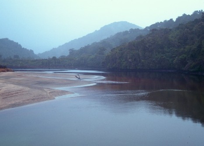
The track departs from Lee Bay as a smooth shingled path under coastal fuchsia boughs. Tui sit above the track feeding and singing. Indeed, tui are widely seen on this walk. Passing the uninviting muddy staircase that is the opposite end of the Garden Mound track, the Rakiura Track descends a pretty stair to the wooden bridge over Little River. Walking, if the tide allows, is over the rippled golden sands, entering the forest opposite after a minute or two.
Little River to Maori Beach
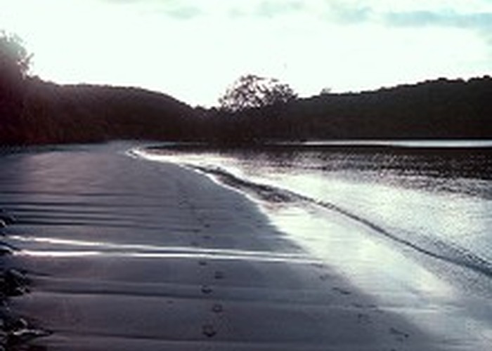
Climbing steps into dark forest, the lower grade track becomes a narrow boardwalk through a forest of kamahi and supplejack. Eventually a long set of stairs leads down to onto Maori Beach through coastal kanuka. A high tide track edges along the shoreline, while a low tide track drops onto the long curve of beach.
Sawmilling relics are scattered around the sandy campsite, and large ostrich foot (Struthiolaria papulosa) shells form bleaching piles near the water. Fossicking is rewarding along this beach with a variety of other shells easily turned up -- including knobbed whelk (Austrofusus glans), southern volute (Alcithoe swainsoni), Cook's turban shell (Cookia sulcata), pink barnacle (Balanus decorus), Stewart Island oyster (Ostrea lutaria), and various bivalves.
Maori Beach to Port William junction
A swingbridge leads over the mouth of a river at the beach's northwest end. Immediately, the track commences a long climb as it crosses the headland between Maori and Magnetic Beaches. Levelling off briefly, the track branches as the route to North Arm heads inland, to the left. After visiting the hut, the Rakiura Track backtracks to this point.
Port William junction to Port William Hut
Abandoning the boardwalk and dropping quickly on what can be a muddy path, the track reaches the curve of Magnetic Beach, with a jetty and eucalyptus trees visible at the far end. A high tide track leads behind the tress, otherwise the beautiful beach can be followed. A grassy beach side camping area marks the point where the North West Circuit begins, leading muddily away to Bungaree Hut.
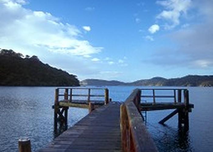
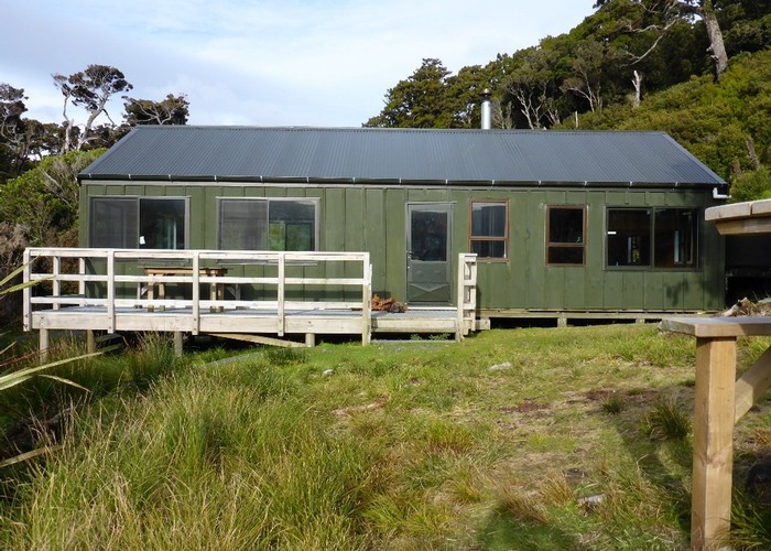
Further along, a short track leads to the jetty, where you can marvel at the clarity of the southern waters. Beyond that the hut is found in a large grassy clearing beneath some tall eucalyptus trees. Port William Hut is a delightful, peaceful spot.
Port William junction to North Arm Hut
A gentle boardwalk rises and falls persistently as it passes through light cutover forest. Nearing the river crossed at Maori Beach, the track follows it inland along a flat logging tramway. A swingbridge crosses a forest-choked side creek before another longer bridge crosses the larger dark-stained river. From here the track climbs steadily into a forest of rata, rimu, stinkwood, broadleaf, and kamahi. Beyond another small creek the track climbs to its summit amongst rata and grass tree. A lookout tower has been constructed here. It provides an excellent view of Paterson Inlet to the south, and the hidden landscape of treetops that rolls away in all directions.
After a brief sidle the track follows a long staircase, dropping most of the way to a junction with the North West Circuit. Bending left, the track drops into the coastal kanuka forest of North Arm. Over some small creeks, the track finally comes to North Arm Hut, nestled amongst horopito, tree fern, and young rimu in a cutover gully.
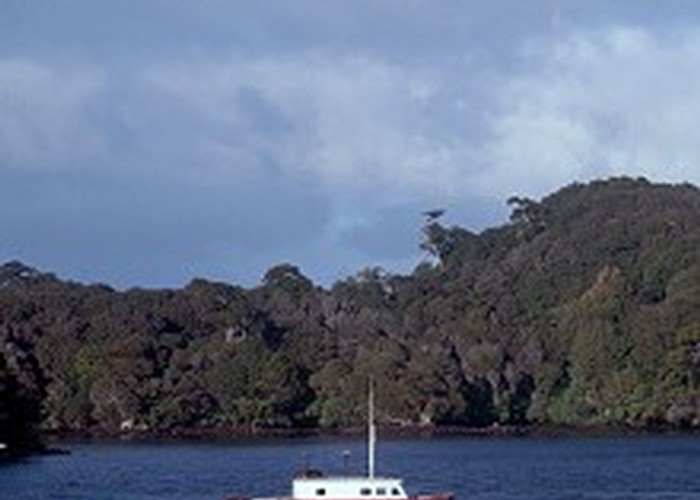
The beach outside the hut consists of mud, twiggy detritus, and broken cockle shells -- it's not a beach conducive to barefoot walking and silent contemplation. But while we may prefer the aesthetic delights of the Port William coastline, the sheltered waters of Paterson Inlet are a biologically rich feeding ground for other species. Fish spawn in the cockle beds around here, brachiopods are found here, and the mud-flats at the mouth of the Freshwater and Rakeahua Rivers sustain large flocks of wading birds, most commonly, pied oystercatchers. A rich flora of seaweeds grows in the inlet, including bull kelp, which grows to 11m in length, and bladder kelp, which grows to 24m. These seaweeds in turn feed and shelter a wealth of fish species.
North Arm Hut to Sawdust Bay
The final day's walk along the new track is relatively flat and easy, although the twiggy kanuka-dominated forest is relatively lifeless and dull. The track climbs gently through open, coastal forest, dropping over a gentle ridge and crossing a creek into Sawdust Bay. A short track provides access down steps to the beach.
Sawdust Bay to Main Road, Halfmoon Bay
As the pretty Prices Inlet is glimpsed through the trees, the site of an historic dam is visible in a small creek beneath the track. Later, the track sidles past Kaipipi Bay and crosses a pretty wooden bridge. Soon after, a junction is reached. The Kaipipi Road begins here, leading left to Halfmoon Bay, and right 2 minutes to a grassy area by the water's edge at Kaipipi Bay. The Kaipipi Road was once the most important road in the island, servicing its first sawmills in the 1860s. It is no coincidence that it joins the end of what is now Halfmoon Bay's Main Road. Here it is wide and smooth, straight, stone-surfaced, and relatively dry.
Eventually a stile is crossed where the Ryan's Creek track leads off to the right. The car park and picnic area is just minutes away at the beginning of the Fern Gully track.
It is still an easy half-hour walk from the end of the track to the Halfmoon Bay settlement. A rough road follows the tumbling Mill Creek until a new road soon joins from the left. Further on, the sealed airstrip road joins from the right. The DOC Visitor Centre is near the end of the Main Road.
Walking times