Abel Tasman Coast Track
Abel Tasman National Park
- 3 – 5 days one way
- Easy
- Bookings required
- Marahau to Anchorage: 12.4km, 4 hours
- Anchorage to Bark Bay
- High tide track: 12.1km, 4 hours
- Estuary crossing: 8.4km, 3 hours
- Bark Bay to Awaroa Inlet:11.4km, 4 hours
- Awaroa Inlet to Whariwharangi Bay: 13.8km, 4 hours 45 minutes
- Whariwharangi Bay to Wainui Bay: 5.5km, 1 hour 30 minutes
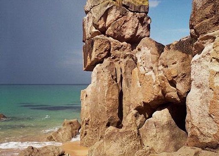
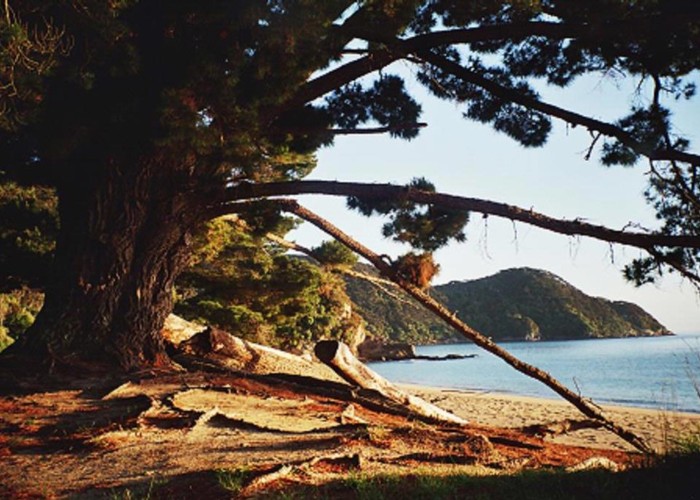
Easy, sunny coastal track with golden sands and excellent swimming. The busiest track in the country, following the length of the national park coastline.
|
Walking time
|
3 – 5 days
17 hr 15 min – 18 hr 15 min
|
|---|---|
|
Distance
|
54.4km |
|
Type
|
One way
|
|
Grade
|
Easy |
|
Bookings
|
Bookings required
Required
Huts and campsites must be booked all year around.
|
|
Starts
|
Marahau River, Abel Tasman National Park |
|---|---|
|
Ends
|
Wainui Bay |
|
Maps
|
NZTopo50-BN25
NZTopo50-BP25 |
|
Altitude
|
Sea level |
|
Link
|
www.doc.govt.nz/parks-and-recreation/tracks-and-walks/nelson-tasman/golden-bay/abel-tasman-coast-track/http://www.doc.govt.nz/parks-and-recreation/tracks-and-walks/nelson-tasman/golden-bay/abel-tasman-coast-track/ |
|---|
Options for walking are very flexible with boat access to most points on the track and vehicle access at Marahau, Wainui Bay, Awaroa Inlet, and Totaranui. Many people only walk the Marahau-Totaranui section, while others arrange to be dropped off and picked up by boat, and don't walk anywhere at all! Both ends connect with the Abel Tasman Inland Track, making a more challenging circuit of the park possible. It is also possible to walk an easy section of the Inland Track to return from Wainui Bay to Totaranui, if desired.
Tidal inlets on the track are crossed at two hours either side of low tide. The first is located at Torrent Bay. The high tide track adds an hour's walking. The second is located at Awaroa Inlet, and no alternative route is available.
Places to stay
Four huts are located on the track, although these are very busy. These are located at Anchorage, Bark Bay, Awaroa, and Whariwharangi Bay. Huts must be booked at all times of year.
18 campsites range from the very large Totaranui to the very small are available from very large to very small Anapai Bay. The main campsites are at Anchorage, Bark Bay, Awaroa, Totaranui, Mutton Cove, and Whariwharangi Bay. These offer better facilities. The smaller campsites offer basic camping and an escape from the crowds. Observation Beach and Mosquito Bay campsites are boat access only and suitable for kayakers exploring the Abel Tasman coastline. Campsites must be booked at all times of year.
Marahau to Anchorage
Crossing the estuary of the Marahau River, the track winds along the coastline, passing the end of the Inland Track. The Coastal Track turns briefly inland before dropping to Anchorage Bay. 7 campsites are passed during this section before the hut.
Anchorage to Bark Bay
Torrent Bay Lagoon can be crossed 2 hrs either side of low tide. Otherwise a track follows the shoreline. Soon the Falls River is passed before the track drops back to the sea. There are 4 campsites along this section.
Bark Bay to Awaroa Inlet
Crossing the estuary or following the all-tide track, the track climbs away from the sea and crosses a saddle before returning to the shoreline by an old granite quarry. This stretch of coastline borders the Tonga Island Marine Reserve. The track soon crosses Tonga Saddle over to the Awaroa Inlet. There are 3 campsites along this section.
Awaroa Inlet to Whariwharangi Bay
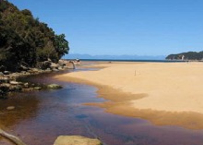
The Awaroa estuary must be crossed 2 hrs either side of low tide. Beyond Goat Bay is a lookout at Skinner Point and a descent into Totaranui.
Edging around Totaranui estuary a track leads off to the left meeting the Inland Track and providing alternative access to or from Wainui Bay. The Coastal Track crosses a saddle to Anapai Bay and Mutton Cove, both of which have campsites. Another saddle with a side trip to Separation Point leads to Whariwharangi Bay and its restored farm homestead.
Whariwharangi Bay to Wainui Bay
A saddle provides views of Wainui Inlet before dropping through gorse to the car park.