Manuoha - Waikareiti Circut
Te Urewera
- 3 days loop track with a road section
- Easy/medium
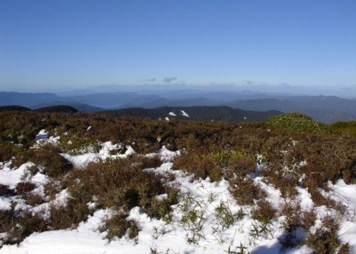
A three day circut in Urewera National Park. Mt Manuoha is the highest point in the Park and offers great views, especially at sunrise. You can stay in the small hut near the summit of Manuoha or camp right on the summit so you can watch the sunrise from in your sleeping bag.
The other night can be spent at Sandy Bay Hut, except it is considered a Great Walk hut and a booking is required.
Or you can camp. The best place to camp is right where the track comes down on to the Kaipo Lagoons from Pukepuke. Gon't be tempted by the clearings around the lagoons. They are very damp and are not good for camping on.
A fearture of this trip is the Goblin Forest near the summit of Manuoha. Old gnarled beech trees hanging with moss make a wierd scene. Allow time to stop and take photographs
|
Walking time
|
3 days
15 hr – 22 hr
|
|---|---|
|
Distance
|
39.0km |
|
Type
|
Loop track with a road section
|
|
Grade
|
Easy/medium |
|
Bookings
|
No bookings — open access
No — open access
|
|
Starts
|
At the bridge over the Te Manawa Stream , near Hopuruahine Landing |
|---|---|
|
Ends
|
Aniwaniwa Township |
|
Maps
|
NZTopo50-BG40
|
|
Altitude
|
630m
–
1,392m
Altitude change 762m
|