Mount Oxford
- 6 hr loop track
- Easy/medium
- Mount Oxford Track to summit: 2.5 hours
- Downhill via the View Hill to Mount Oxford Track: 1 hour 50 minutes
- Wharfedale Track section: 10 minutes
- View Hill to Coopers Creek Link Track: 1 hour 50 minutes
A loop track leading over the summit of Mount Oxford and back through the foothill forest.
|
Walking time
|
1 day
6 hr
|
|---|---|
|
Distance
|
18.0km |
|
Type
|
Loop track
|
|
Grade
|
Easy/medium |
|
Bookings
|
No bookings — open access
No — open access
|
|
Starts
|
Coopers Creek car park, Mountain Road, west of Coopers Creek |
|---|---|
|
Maps
|
NZTopo50-BW22
|
|
Altitude
|
350m
–
1,364m
Altitude change 1,014m
|
Mount Oxford is a classic day trip from Christchurch. This circuit provides good views from the tops and a lot of diversity: dry beech forest, sub-alpine scrub, tussock tops, mountain beech "goblin forest", and lowland podocarp forest.
This description forms a circuit starting off from the Coopers Creek car park. It could also be walked from the View Hill car park.
The turn off to Coopers Creek is on the right at the western outskirts of Oxford. Beyond Coopers Creek, turn right onto Mountain Road and continue to the road end car park.
Just beyond the car park, the track branches with a vehicle track leading over a bridge. Follow this through farm land to Payton Lodge. The walking track heads left just beyond the lodge, dropping into forest and crossing a second bridge over Coopers Creek.
From here, follow a gentle spur through dry beech forest. The spur steepens and breaks out onto sub-alpine scrub soon afterward. The final climb is up a smooth tussock slope to the summit trig (1364m).
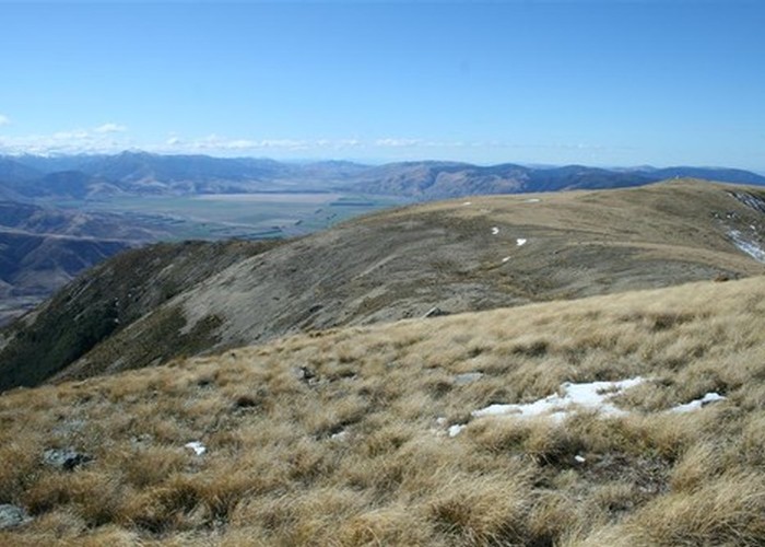
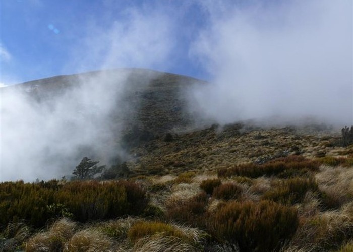
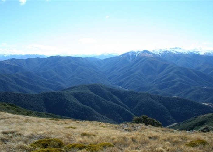
The summit can be very windy if a nor'wester is blowing, making it hard to even stand up. To the east, the rounded ridge leads to Oxford Hill. Ashley Gorge and Mount Richardson are beyond. Northeast is the hemmed-in plain of the Lees Valley. To the north and northwest, the Townshend River and the Wharfedale Track wind throught the green foothills of the Oxford Forest. Beyond is the Puketeraki Range.
The poled route leads westward along the tops, soon dropping along the spur into gnarled beech forest hanging with mosses. After 50 minutes, at the first small rise on this spur (point 1130), a side-track leads down to Wharfedale Shelter. Eventually, the spur drops into dry beech forest, then a change to wetter forest clad in crown ferns marks the junction with the Wharfedale Track.
Turn left onto the wide track and pass the turn-off to Ryde Falls just a few metres onward. The Wharfedale was originally surveyed as a road into the Lees Valley, so it provides smooth gradients. It is now popular with mountain bikers. Watch for the turn-off to the left, clearly marked just 10 minutes along the Wharfedale.
This easy track back to Coopers Creek passes through interesting forest dotted with podocarps (rimu, mataī, tōtara, and kahikatea) and rich with horopito. On the left, the track from Ryde Falls soon joins up again.
Eventually the track breaks out onto exotic scrub with good views to the left back up to Mount Oxford, following the true left bank of the creek back to the car park.
Walking times for the loop:
If you prefer an overnight option, turn off at point 1130, beyond the summit, and drop down to Wharfedale Hut (1.5 hours). From here, you can return along the Wharfedale Track then the View Hill to Coopers Creek Link Track.