Crater Rim Walkway
- 1 day one way
- Easy/medium
- Ahuriri Scenic Reserve to Sign of the Bellbird: 1 hour 15 minutes, 4.4km
- Remainder to come
Follow the ridge of the volcanic Port Hills above Christchurch.
|
Walking time
|
1 day
9 hr
|
|---|---|
|
Distance
|
20.0km |
|
Type
|
One way
|
|
Grade
|
Easy/medium |
|
Bookings
|
No bookings — open access
No — open access
|
|
Starts
|
Ahuriri Scenic Reserve, Summit Road, Christchurch |
|---|---|
|
Ends
|
Godley Head |
|
Maps
|
NZTopo50-BX24
|
|
Altitude
|
200m
–
500m
Altitude change 300m
|
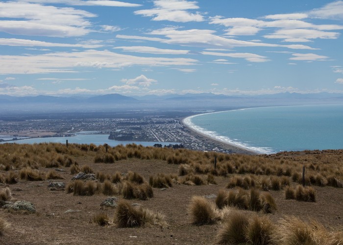
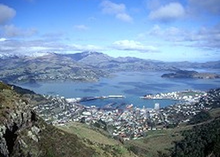
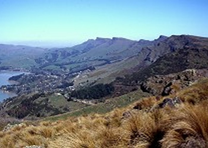
The Crater Rim Walkway follows the arcing rim of the extinct Lyttelton Volcano, from Ahuriri Reserve in the south out to Awaroa / Godley Head in the east. The trail explores the history, geology, and remnant native vegetation of the area.
The track is well accessed by the Summit Road, and most popularly walked in short segments. The central sections are busy, but the ends feel relatively isolated and remote.
With the new Godley Head Campsite now in place, you could now walk the track as an overnight trip: a handy first tramp for kids perhaps. Just decide how far you want to walk, then start that distance back from Godley Head!
Sections of the track cross private property. Keep to the track on these sections.
Ahuriri Scenic Reserve to Sign of the Bellbird
Driving along Summit Road, head on past Rhodes Spring and Gibralter Rock, to a pocket of bush. Tōtara and kahikatea at the roadside give it a damp West Coast feel, although just half an hour from the central city. The road tips over into Lyttelton Harbour and crosses a cattle stop. This is the start of the Crater Rim Walkway. Parking here is scratchy, by the cattle stop or a little farther down the road.
Head up some steps into a classic Port Hills forest of tree fuchsia and horopito. Out in moments onto a grassy ridge, the track heads toward Coopers Knob / Ōmawete (573m). This is the first of a series of dramatic outcrops, near vertical on the harbour side and gently sloping on the city flanks. The track eases over the back of the knob through a patch of forest with wind-sculpted tōtara trees then climbs out onto grass and dropping back toward the road. A track leading up onto the summit of Coopers Knob heads off to the right.
Passing Living Springs deep in the valley on the harbour side, the track climbs through forest and harakeke out onto the sloping back of a bluff.
The next landmark is Cass Peak / Ō-Rongo-Mai (545m) with its distinctive air traffic control dome. Cass Peak was badly burned by the January 2017 wildfires. The track sidles through burned scrub on the harbour side before leading into a delightful pocket of forest beneath bluffs. Watch for a switch-back and rocky climb up out of the forest into scrubby, burned over forest. If you are heading southbound, it is easy to miss the track and end up on a steep rocky outcrop here — retrace your steps. The track leads through fully burned forest, past a couple of beech trees to the Sign of the Bellbird car park. A covered shelter and toilet is located here.
Walking times