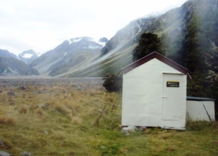
Louper Bivouac
Louper Bivouac (2 beds, matresses, tank water) is a basic bivvy on the flats of the north bank of the Raikaia River. It's about 1km downriver from the confluence with the Louper Stream, which leads to the Whitcombe Pass and thus on to the West Coast.
If you're staying at Louper Biv, then you're probably tramping over Whitcombe or climbing the interstingly named peaks to the North. 'The Amazon's Breasts' are understandable, but what vehicle reached the heights of Mazda Spur?
Travel further up the Raikaia is generally on the soutern bank, where the NZDA Reischek Hut (opposite Louper) is open to the public, and has a mountain radio.
Fording the milky-white Raikaia is always serious proposition, but was possible (waist-deep) in moderate river conditions directly between Louper Biv and Reischek Hut where it is braided into 5 channels: a cairn marks the direction to take. In bad conditions, the recommended crossing is 20km downriver at Glenfalloch Station.
|
Owner
|
Owner: DOC |
|---|---|
|
Category
|
Basic Hut/Bivvy |
|
Sleeps
|
Sleeps 2
2
|
|
Facilities
|
None |
|
Water supply
|
Tap or tank water |
|
Getting there
|
Whitcombe roadend (J33 482038): 34km track/route. Biv -> Neave Hut (11km,5-9 hrs) -> Wilkinson Hut turnoff (3.5km,1.5-3hrs) -> Prices Flat Hut (5.5km,2.5-5 hrs) -> Frew Hut (9km,3.5-7hrs) -> Rapid Ck Hut (7km) -> roadend (9km) Raikaia Valley (Glenfalloch Station): 20km. River flats route & crossing of Raikaia. Erewhon Stn (Havelock River): 30km unmarked alpine route. Biv -> Lawrence Biv via Butler Saddle (11km,7-14hrs) -> Lawrence Hut (9km,3-5hrs)-> roadend (10km,2-3hrs) |
|---|---|
|
Unlocked
|
This hut is unlocked and open to access. |
|
Bookings
|
No bookings — open access
No — open access
|
|
Altitude
|
680m |
|---|---|
|
Mobile phone coverage
|
No coverage |
|
Maps
|
NZTopo50-BW18
|