To get there from Auckland city, follow the North Western Motorway to the end, turn left, and then at the next roundabout right, onto state highway 16. Follow this all the way to Waimauku (about 12km after the roundabout), where you turn left into Muriwai road. Approx. 8km further, turn left into Oaia road. About 3.5km on, turn right into Constable road, and the start of the track is 250m further on the left, at a DOC information sign and map.
The track starts just to the left of the sign, and descends gently through Kanuka scrub for the first 5 minutes, after which one abruptly enters the gloom of the podocarp forest, consisting mostly of Kauri and Tanekaha – some good specimens to be seen. The track now descends more steeply, but is well graded and easy to follow. After rain, certain sections can be slippery, and there are some sizeable mudholes to traverse. About 20 minutes from the start one reaches a fence, with some convenient steps over it. Turn right here, downhill. The vegetation again changes to Manuka/Kanuka scrub, interspersed with gorse. After climbing over another fence, one reaches the Mokoroa stream, about 30 minutes from the start – cross over here. There used to be a footbridge at this point, but fortunately the water is shallow enough to keep the feet dry during normal river flow.
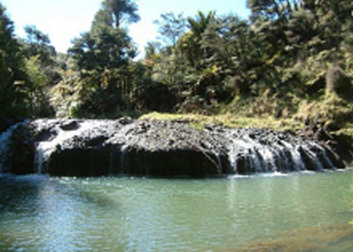
On the other side it’s up the bank we go, for a short, sharp climb of about 100 metres, after which the track levels off, and meanders through the forest at a gentle incline. The track is wide, well marked and easy, and gives one some good opportunities to study the surrounding bush, which on this section consists of some pretty tall Kanuka, with the occasional decent-sized Kauri visible. There are many juvenile Kauri rickers all over the place though, as well as numerous Nikau palms, Lancewoods and various Coprosmas. Some good Rimu specimens can also be seen. About 40 minutes after crossing the stream, one arrives at the first junction, where a track from Horseman road joins in from the right. Keep left, and about 10 minutes later one arrives at the junction with the Mokoroa falls track. Another track from Horseman road joins in from the right - turn left at this junction, and follow the wide, easy track (keep an eye out for a few large, noteworthy Kauri’s on the left) heading down to the Mokoroa falls, which one reaches about 20 minutes after the junction.
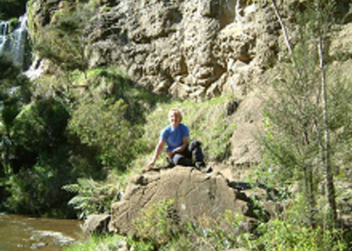
If you want a great panoramic view of the falls before dropping down to the Mokoroa stream, at a junction in the track just before the falls keep right, and about 20 metres further on you suddenly break out of the forest onto a sunny, open spot overlooking the falls - quite beautiful! Retrace your steps to the junction, and scramble down the track to the Mokoroa stream. This is a delightful, sunny, place to have a break, lunch, or boil the billy, and explore the falls. A lovely pool under the falls beckons those brave enough to take a dip (in summer!).
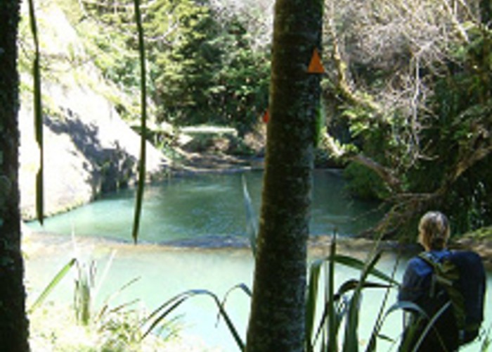
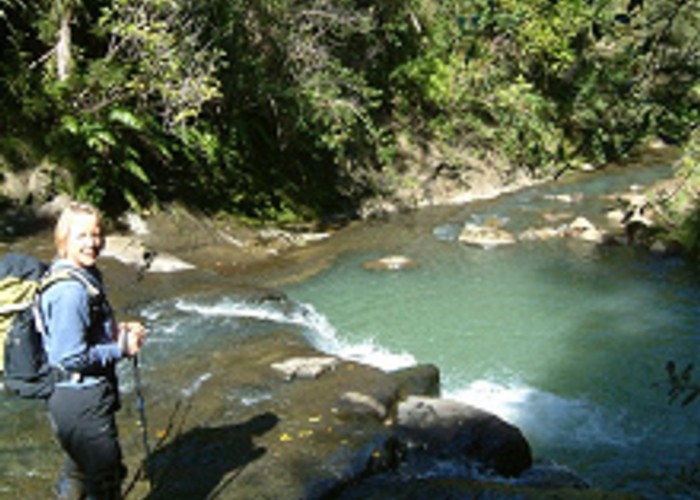
From this point the track continues down the true left bank of the Mokoroa stream. Although it looks easy enough for the first bit, DOC describes this as a marked route - it involves at least 12 stream crossings, and some parts where there is no alternative but to walk in the stream itself. There are some sections where one has to scramble over steep, rocky outcrops on the true left bank, and these need to be traversed with care. The streambed consists mostly of mud- and sandstone covered with algae, and can be very slippery (Do not attempt this section on your own, or if inexperienced -sturdy and appropriate footwear is also a must). It is supremely worth the effort, however – to me this is one of the most rewarding tracks in the Waitakeres. The vegetation along the banks is quite diverse, with Nikau, Kauri, Totara, Cabbage trees, Rangiora and Parataniwha to be seen, amongst many others. The bird life also appears to be thriving – we saw several Kererus along the way, and heard a warbler and some Tuis. The aerobatic antics of the many fantails were also a delight to watch. Many more delightful and inviting pools await the hot and bothered tramper, some with sunny patches of grass alongside. An hour and a half after leaving the falls you again reach the original crossing point, after which it is a steepish 35 minute climb back to the car.
Total walking time was about 4 hours for the circuit (if fit – allow longer if not!), excluding stops. In my book this day walk rates about 8 out of 10 for pure enjoyment and satisfaction. I’d recommend making a day out of this trip – start early, and after the walk enjoy a latte at one of several excellent cafes on the road back, in Waimauku (Bees Online – on the right just after turning back onto SH 16 from Muriwai road), or in Huapai (Carriages, on the right – situated in a plant nursery, in some restored train carriages). For those interested in wine, there are some great wineries to visit - Coopers Creek, Soljans and Riverhead Estate, to name a few.
Further reading:
- Walking the Waitakeres: Alison Dench and Lee-Ann Parore, New Holland publishers.
- Waitakere Ranges Recreation and Track guide: Auckland Regional Council, available from the Arataki visitor’s centre, off Scenic Drive, near Titirangi
- Te Henga-Goldie Bush Walkway: DOC, Auckland Conservancy.
- Map: Q11, Waitakere 1:50 000 topomap, published by Land Information NZ.