Kiwi Burn Hut
Kiwi Burn Hut (12 bunks, wood-burning stove, water, firewood available) is a purpose built tramping hut, located on the grassy flats of Kiwi Burn. Despite it's large size, and two bedrooms plus kitchen layout, the hut is not heavily used.
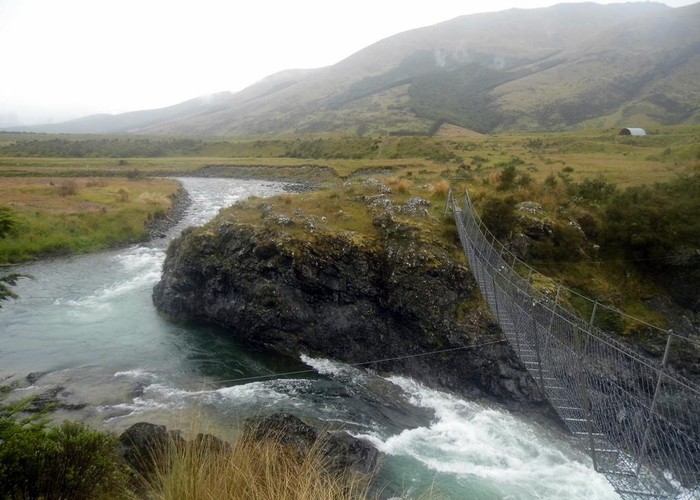
At 1-2 hours from the roadend it makes a pleasent evening walk in via the track along Kiwi Burn. A marked route cuts back to the swingbridge roadend from 3km north of the hut, allowing a round trip walk to / from the hut. This route is not shown on all map editions, and cuts through the saddle on the very edges of maps D42 and D43.
A poorly maintained track / route also runs north to the Whitestone and Upukerora valleys, and on to the SH94 Milford Road at Boyd Creek. Huts in the Whitestone Valley are private, but good campsites are present on flats 1km before the track reaches the Whitestone River (D42 250335). Army hut in the Upukerora is DOC owned and a good half-way point between Kiwi Burn and the Milford Road.
|
Owner
|
Owner: DOC |
|---|---|
|
Category
|
Standard Hut |
|
Sleeps
|
Sleeps 12
12
|
|
Facilities
|
Toilet, Enclosed wood/coal burner |
|
Water supply
|
Tap or tank water |
|
Getting there
|
Mavora Lakes Road / swingbridge (D43 283284): 4.5km (1-1.5 hours) via well maintained river track, 6km (2-3 hours) via saddle route Army Hut: 20km (6-12 hours) poorly maintained track, along river flats and through mature beech forest. SH94 / Boyd Creek (D42 127516): 2 days via Army Hut |
|---|---|
|
Unlocked
|
This hut is unlocked and open to access. |
|
Bookings
|
No bookings — open access
No — open access
|
|
Altitude
|
500m |
|---|---|
|
Mobile phone coverage
|
No coverage |
|
Maps
|
NZTopo50-CD09
|