Griffin Creek - Rocky Creek
- 2 – 3 days loop track with a 2.5km road section
- Medium
- Red and white Permolat (metal) squares and strips.
- Pink cruise tape
- plastic strips and plastic bags tied to trees
- blue painted circles (final section above Taipo River)
- Cut tree stumps and branches
- Cairns in the creeks, which often indicate critical points
An isolated circuit west of Arthur's Pass along lightly used tracks and rocky riverbeds that are home to blue ducks.
|
Walking time
|
2 – 3 days
13 hr – 14 hr
|
|---|---|
|
Distance
|
13.0km |
|
Type
|
Loop track with a 2.5km road section
|
|
Grade
|
Medium |
|
Bookings
|
No bookings — open access
No — open access
|
|
Starts
|
Harrington Creek, SH73 west of Jacksons |
|---|---|
|
Ends
|
Taipo River mouth, SH73 west of Jacksons |
|
Maps
|
NZTopo50-BV19
NZTopo50-BV20 |
|
Altitude
|
120m
–
974m
Altitude change 854m
|
This circuit looks short on the Topomap but is actually relatively challenging, slow walking. The routes are informally marked and maintained by members of the public. Time below are approximate, and vary greatly with current track conditions: windfall and fading markings make substantial differences to walking times. The route out along Rocky Creek is difficult — it would be easier to return via point 974 to Harrington Creek. Expect a lot of clambering over windfall, slipping on rocks, and scratching around for the route. There is extensive riverbed travel in both Griffin and Rocky Creeks that would be impossible if rivers were up. Travel along Rocky Creek is particularly wet, and would be very cold in winter.
Griffin Creek Hut is an idyllic spot, lovingly maintained, with an outdoor bath and blue ducks in the river.
In following the trail, look for these markings:
Note that the Permolat strips generally do not point in the direction of travel. There are frequent windfalls. If the track disappears at a windfall, it probably continues on the other side.
Harrington Creek - Griffin Creek Hut: 5hr
Park at the car park just east of Harrington Creek or on the decaying, old section of highway behind the farm gate west of the creek. Follow the old highway toward Harrington Creek and climb over a gate. The track begins here on the true left bank and leads up the creek on the inside of the farm fence. The track is mostly marked with red or white Permolat strips or cruise tape. There are no familiar orange DOC markers.
After a few minutes the track leaves the fenceline behind, crosses to the true right and commences its 800m climb to point 974. With altitude, the forest becomes dominated by rata, supplejack vines and windfall. After 1.5 hours the track climbs alongside a large slip and into a forest of massive squat rata trees.
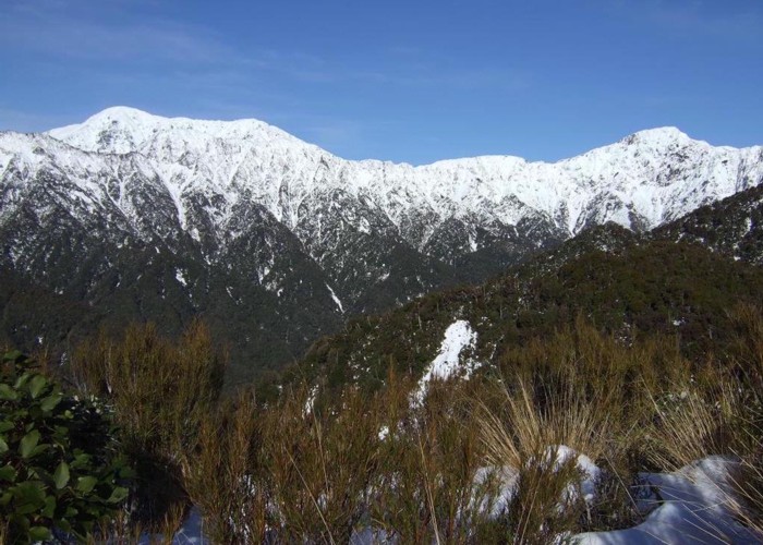
The track soon eases into scrub, with cedar, mountain neinei, mountain cabbage tree, and reaches a muddy junction 2.5-3 hours from the start, marked by a rusting water barrel. This junction at 974m is the highest point on the track with a trail right (south) leading along the tops of the Griffin Range. Don't reward yourself with lunch just yet as there is an excellent lookout a few metres onward with striking views of the Razorback Ridge and the Tara Tama Range.
From here, the track descends quickly down the hillside to the Griffin valley floor. It is easy to lose, but if you look for cut tree stumps as well as markers, you should find it. At one point near the bottom, the track comes abruptly onto a precipitous, narrow slip. Do not cross onto this chute, but pick your way through the trees on the true left. The grassy Griffin riverbank is reached 1 hour from point 974.
Pick your way up the riverbed and watch for blue ducks. They are very common along this stretch of river in pairs or as singles. Some will even come over to see you if you don't surprise them, the male making the high "Whi-oh" whistle and the female uttering deep croaks if she feels flustered. Green serpentine rock is visible in the river. The Mineral Belt passes nearby, and an old serpentine mine is located at the head of Griffin Creek. About 1 hour up the river, a track commences at the second of two nearby creeks, leading along an easy bush track, crossing another creek and coming out just above the hut in 15 minutes.
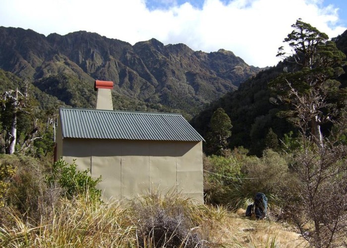
The small but comfortable and well decorated hut is situated on a small grassy flat above Griffin Creek (ample camping space). An outdoor bath with wood supply down by the river appear to be very popular. A brief walk upstream from the hut is recommended: there are several deep beautiful pools as well as a pretty waterfall.
Griffin Creek Hut - Rocky Creek Hut: 4hr
From the hut, the climb to the saddle between Griffin and Rocky Creeks takes 1-2 hours. Return through forest, crossing one creek and turning upstream at the second. A track crosses to the true right, then enters forest to cross to the unnamed creek leading to the saddle. Follow this creek past a slip to a defunct waterfall where two gullies meet. Take the true left gully and follow a steep track out onto the wedge of land between. This track climbs vigorously before dropping quickly into the other gully. Continue through tall grasses up the streambed until a track leads out on the true right just before the saddle.
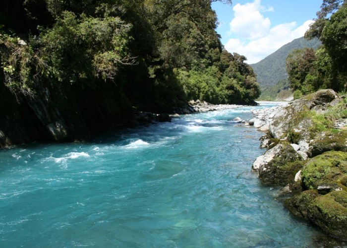
The longer descent on the Rocky Creek side is down the course of a bubbling little stream, meeting several tributaries. 45 minutes from the saddle, a large stream enters from the true right and it becomes possible to walk on the river bank. The river steadily grows with many crossings and fords required. This is a steep, pretty creek with waterfalls, large rocks, and deep blue pools. If you are travelling upstream from Rocky Creek Hut, you will pass the following: 2 creeks on the true left, two creeks on the true right, and a small creek on the true left.
Rocky Creek Hut is very easily missed, located discreetly on a terrace above the river. Look for a cairn and markers on the true right bank a minute below the second of two tributaries from the true left spaced 10-20 minutes apart. The hut is small but tidy, and surrounded my mountain cabbage trees.
Rocky Creek Hut - Taipo River bridge: 4-5hr
From the hut, a track leads through forest and back toward the river over the course of 15 minutes. As at April 2009, the end of the track is thoroughly damaged, and you are best to just push through toward the river once it disappears. Beyond three creeks on the true right, a series of short sections of track commence on the true left, generally marked by cairns in the creekbed and white and red Permolat on the trees. These tracks avoid harder sections of creekbed, but are often not essential. The markers for the track sections are fading, and it is often necessary to abandon them and return to the creek bed. Despite the Topomap depiction, there is not one continuous section of track running along the true left.
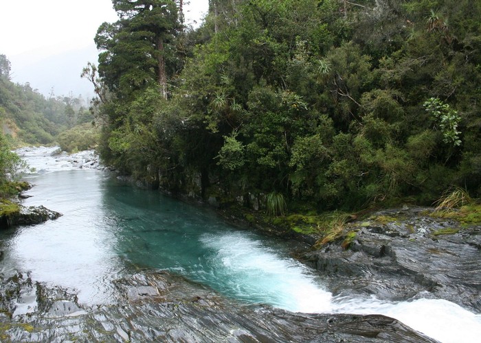
One lower section of track leads past some large pools and waterfalls in the creek bed. The next section climbs much higher than the others and bends away from the river. It is important to find this section as it is the route out. A relatively well-marked and smooth track sidles in front of Mount McInerney, diverting up a little streambed briefly.
The track leads past a spectacular bend in the Taipo River far below, then drops quickly and easily to the riverbank. Step out onto the river stones here, and climb up onto a grassy terrace and pick your way through gorse. Turn left at the deep watercress swamp and locate a track in the forest at left, becoming a farm track (look for glow worms if you are finishing late). The track ends just south of the Taipo River bridge, and it's another 45 minutes of road walking to your car.
If you are walking in from the Taipo River bridge, locate the farm track just south of the Taipo bridge, and follow it down to grassy flats. Follow these until they run out, then drop down to the river bed, and climb back up where a very small side stream enters from the true left, just nearby. This track winds across the face of Mount McInerney and into Rocky Creek. Locate the track to the hut immediately after the fourth creek on the true right. As at April 2009, the downstream track to the hut is very hard to find due to storm damage —consider continuing up to the top track, cairned just beneath a stream from the true left.
If you miss the track out of Rocky Creek
It is easy to miss the final section of track leading out of Rocky Creek. If you do so, you will come out on the banks of the turbulent Taipo River. DO NOT attempt to cross it. Instead, head upstream for a few hundred metres to a braided section. The crossing here is straightforward in normal flow. The Taipo River Track is a 4WD road at this point on the opposite bank. It's a pleasant walk westward over a low saddle to the highway, although there is an extra 2km road bash back to your car. Walking time is 1 hour from the end of Rocky Creek to the road.