Griffin Creek - Rocky Creek
- 2 days loop track with a 2.5km road section
- Medium
An isolated circuit west of Arthur's Pass along lightly used tracks and rocky riverbeds.
|
Walking time
|
2 days
10 hr – 12 hr
|
|---|---|
|
Distance
|
13.0km |
|
Type
|
Loop track with a 2.5km road section
|
|
Grade
|
Medium |
|
Bookings
|
No bookings — open access
No — open access
|
|
Starts
|
Harrington Creek, SH73 west of Jacksons |
|---|---|
|
Ends
|
Taipo River mouth, SH73 west of Jacksons |
|
Maps
|
NZTopo50-BV19
NZTopo50-BV20 |
|
Altitude
|
120m
–
974m
Altitude change 854m
|
This track appears not to be maintained by DOC, but rather by members of the Christchurch Tramping Club. It is a very interesting loop, deceptively short on the topomap but quite slow going, into isolated valleys. Expect a lot of clambering over windfall, slipping on rocks, and scratching around for the route. Griffin Creek Hut is an idyllic spot, lovingly maintained, with an outdoor bath and blue ducks in the river. This would have to be one of the best huts in the country.
The route is lightly marked and relatively hard to follow. There is extensive riverbed travel in both Griffin and Rocky Creeks that would be impossible if rivers were up and would be very cold in winter. Walking up Rocky Creek would be a navigational challenge as there are many confluences that are not clearly marked. The turn off in lower Rocky Creek is very easy to miss, although there is an alternative route out.
Harrington Creek - Griffin Creek Hut: 4-5 hours
Even the beginning of the track is secret. Park at the car park just east of Harrington Creek or on the decaying, old section of highway west of the creek. Follow the old highway past farmland a minute or two to a gate by the creek. The track begins here on the true left bank and leads up the creek on the inside of the farm fence. The track is mostly marked with red or white Permolat strips or with riboons tied to trees. There are no familiar orange DOC markers.
After a few minutes the track leaves the fenceline behind, crosses to the true right and commences its 800m climb. With altitude, the forest becomes dominated by rata, supplejack vines and windfall. After 1.5 hours the track climbs alongside a large slip and into a forest of massive squat rata trees.
The track soon eases into scrub, with cedar, mountain neinei, mountain cabbage tree, and reaches a muddy junction 2.5 hours from the start. This junction at 974m is the highest point on the track with a trail right (south) leading along the tops of the Griffin Range. However the views are disappointing. An old rusty barrel provides a water supply if you need it. Don't stop for lunch here, as there is an excellent lookout just a few metres onward with striking views of the Razorback Ridge and the Tara Tama Range.
From here, the track descends quickly down the hillside to the Griffin valley floor. It is easy to lose the track, but if you look for cut tree stumps as well as actual markers, you should find it. At one point near the bottom, the track comes abruptly onto a precipitous, narrow slip. Do not cross onto this chute, but pick your way through the trees on the true left. The grassy Griffin riverbank is reached 1 hour from point 974.
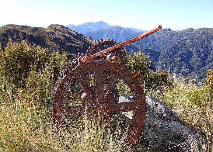
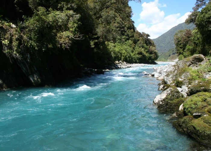
Pick your way up the riverbed and watch for blue ducks. They are very common along this stretch of river in pairs or as singles. They will even come over to see you if you don't surprise them, the male making the high "Whi-oh" whistle and the female uttering deep croaks if she feels flustered. Green serpentine is visible in the river. The Mineral Belt passes nearby, and an old serpentine mine is located at the head of Griffin Creek. About 1 hour up the river, a track commences at the second of two nearby creeks, leading along an easy bush track, crossing another creek and coming out just above the hut in just 10 minutes.
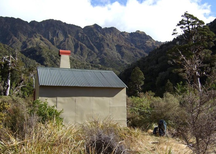
The small but comfortable and well decorated hut is situated on a small grassy flat above Griffin Creek. There is a bath and wood supply down by the river, and a small beach where blue ducks like to gather. Water is more easily obtained from another creek along the track to the hut's toilet, as it's quite a clamber back up from Griffin Creek with full billies.
Griffin Creek Hut - Rocky Creek Hut - Taipo River: 6-7 hours
From the hut, the climb to the saddle between Griffin and Rocky Creeks takes only 45 minutes. Return through forest to the start of the bush track at the stream side. Another track turns upstream through a boggy section, soon crossing to the true right, then leaving the stream for a few minutes to cross to another tributary. Follow this ever-smaller stream through tall grasses and spider webs to a point just below the saddle, where a track climbs directly up the hillside for a few minutes.
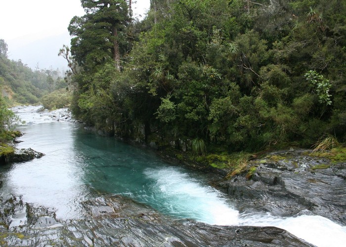
The longer descent on the Rocky Creek side is down a bubbling little stream, meeting several tributaries. 45 minutes from the saddle, a large stream enters from the true right and it becomes possible to walk on the river bank. The river steadily grows with many crossings and fords required. This is a steep, pretty creek with waterfalls, large rocks, and deep blue pools. It is a pleasantly wet descent on a hot day.
Rocky Creek Hut is located very discreetly amongst trees on a small flat by the river. Two tributaries enter 10 mintes apart on the true left, and the side track to the hut commences nearby on the true right.
3 hours from the summit, a small section of track commences on the true left above a dark gorge. Intermittent track sections are very poorly marked. Nearby, a track leaves Rocky Creek, bends across a terrace beneath Mount McInerny and leads out to the road by the Taipo River bridge.
This track is very easily missed. If you do so, you will come out on the banks of the turbulent Taipo River. Downriver, the Tapo becomes a gorge and difficult to follow. Instead, head upstream for a few hundred metres. Where the river becomes braided, it is easy to cross in normal flow. Climb onto the bank opposite, where you will find the Taipo River Track, a 4WD road at this point. It's a pleasant walk westward over a low saddle to the highway, although there is an extra 2km road bash back to your car. Times are 1 hour from the end of Rocky Creek to the road, and another hour back to the car park.