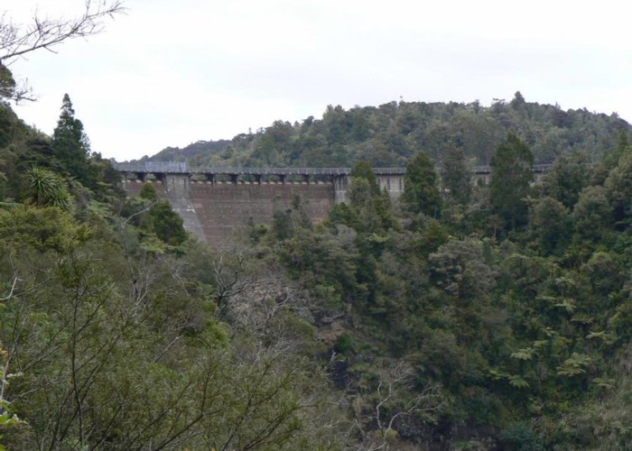
After having missed out on a 3-day tramp in the Waioeka Forest due to high river levels, my wife (Celia) and I still had plenty of energy to spare, and so decided to do a reasonably strenuous day walk or tramp in the Waitakere Regional Park, about a 45 minute drive from our home. We chose a combination of tracks, which we calculated would give us about 5 hours walking time, and a good workout. The only snag was that it wasn't a loop track, and we had to use two cars - left one at the end point on Mt Donald McLean, and then drove back to the start, where we left the other car for collection later.
Having left home early, we were on the track by 8.10am, and puffing our way up the Twin Peaks track, which starts just inside the gate to the Lower Huia reservoir, on the left. The first part of the track is quite steep, and soon got the blood pumping. About half an hour later we reached our first signposted junction with the Tom Thumb bypass track. We carried on up the main Twin Peaks track, and not too long thereafter we got our first stunning surprise - a huge, gnarled Kauri tree (Tom Thumb!), surrounded by a boardwalk (to protect the sensitive roots) - truly a magnificent specimen, with some impressive side branches and shapes - it almost appears as if two trees have grown together. The second signposted junction is also at this spot - the right one goes up to the summit of Goat Hill (352m asl), and to the left is the Tomb Thumb track proper - carry on along the main (Twin Peaks) track.
The track now undulated for a while, with each undulation taking us relentlessly higher, eventually reaching the Twin Peaks after which the track is named. The first is 443m asl, and the second (about 15 to 20 minutes later) 448m asl. There are no real views to be seen from these peaks, both being covered in bush. Aside from this there are several spots on the track before this point where beautiful views of Huia town, and the Manukau harbour unfold before you. Truly lovely on a clear day.
After trotting off from the summit of the second Twin, the track drops off quite steeply into a valley, and one can occasionally catch a glimpse of the Huia ridge ahead and slightly to the left. Just before reaching the valley floor, surprise no. two - another magnificent Kauri on the left of the track - this one with a straight trunk, soaring into the sky - as good as any other I've seen in this park. There are also some excellent Rimu specimens, festooned with epiphytes. Birdlife is prolific - noisy Tuis, the helicopter-like sounds of Kereru wings, the usual antics of the Fantails, etc. The vegetation varies quite a bit - from relatively mature forest, with an open, airy understorey, to thick, impenetrable bush, scrub and recovering forest, all growing prolifically - great to see! Would love to go back in 10 or 15 years to see how it has changed.
Anyway, on we went, and after a total of an hour and 50 minutes reached the highest point in the Waitakeres - Te Toiokawharu, 474m asl. The only way you know you've reached it is a signpost telling you this important fact! In fact, it says that the elevation is 459m asl, but as the sign has been there for quite some time, we assume the latest map has the correct figure. This is a great spot to have a breather, and boil up a brew. Just a note - the track was quite muddy in places, even after a week's dry weather, and would be quite a challenge in winter or after rain. Some parts have had boardwalks installed, but not all have mesh on the walking surface - treacherous with muddy boots!
Having enjoyed a cuppa and a snack, we carried on to the next signposted junction with the Huia Ridge track, where we turned left (south). The bush along this track is predominantly regenerating forest - the track was quite overgrown, sometimes to the point where we couldn't see our feet. It seems the track had not had much maintenance work done to it in a while. The track follows (logically) the Huia ridge, and undulates up and down for most of its length - a pleasant walk. After a short while, surprise no. 3 - a well-constructed, mesh-covered boardwalk, which must have been several hundred metres long. Well done, ARC - made this part of the track an absolute pleasure. About half an hour or so down the Huia Ridge track we came to the first water on this tramp - a small tributary of the Karamatura Stream. We re-filled one of our empty water bottles here (to be used for the next boil-up - not recommended for drinking without boiling). An hour and 15 minutes from the junction with the Twin Peaks track we reached the next signposted junction - the Karamatura Forks. Don't stop here - carry on down the Donald McLean track to the next junction, about 5 minutes further on, with the Bob Gordon and Karamatura tracks. There is a lovely, shady clearing here, where we again made use of our trusty billy, had lunch, as well as a pleasant chat with another couple going in the opposite direction.
We then decided to try the Bob Gordon track, not having walked this before. Initially it went gently downhill, and was also somewhat overgrown with toetoe and cutty grass - we recommend, by the way, that gaiters be worn from mid-January onwards, failing which you will find your socks (and hairy legs, if you have them) covered in hook-grass seeds! To continue, the track progressively became steeper downhill, until we reached the second stream on this tramp, about 15 minutes after the junction. The track then climbs steeply, but soon evens out somewhat before re-joining the Donald McLean Track. Turn right (south) - the track from here on is beautifully benched and metalled, and after 20 minutes, we reached the end of our walk - the car park on Mt Donald McLean. An excellent walk, all in all, which left us with a sense of satisfaction and achievement.
In conclusion, the total time taken for this walk, stops included, was 6 1/2 hours, maintaining a good steady pace, but not rushing it. In my view this is an excellent training tramp for those wanting a good workout for lengthier and more strenuous excursions. However, take plenty of water - there are only two small streams en route, and they may not always have water in them, especially at the height of summer.
If you are from outside Auckland, do yourself a favour and visit the Arataki Visitor's centre on the road to Piha first, and buy a map of the park - there are many superb walks in the Waitakeres (besides the one described here), well worth doing. The Centre also has many other publications for sale, and is staffed by very helpful and knowledgeable rangers. The Waitakere Ranges RP is a great, well maintained facility so close to Auckland - the ARC has done, and is still doing, a great job here.
Waitakere Ranges FP - Twin Peaks/Huia Ridge track
Waitakere Ranges Regional Park
A great daywalk for those seeking solitude and a good workout in or around Auckland.
Comments
-
 Dztramping A week may be spent tramping in and around this area of Auckland. Thanks.
14 November 2007
Dztramping A week may be spent tramping in and around this area of Auckland. Thanks.
14 November 2007
ID 172
About this article
82 views in the past year (7 per month).