
I had wanted to get to Maitland Hut and beyond into Snowy Gorge but the cocky had told me there were hunters staying in Maitland Hut when I asked for access permission. I got the feeling this would always be the case but then decided to get there via Snowy Gorge and hopefully get up to Dumb-Bell Lake which had eluded me some years before when a member of our party developed a stomach ache and the leader had been unprepared to split the group.
As usual we were slower getting away than I’d hoped so the evening walk into Snowy Gorge Hut wasn’t a goer as it would take an estimated 4 hours. Instead we stayed at the surprisingly empty Ahuriri Base Hut despite seeing numerous fisher-folk on the drive up the valley. I’d thought ahead and brought the ingredients for a road end meal plus breakfast but Frank made inroads into his tramping rations for his breakfast. My can of beans opened with a small hiss and they tasted sour but I had a spare can. Frank expressed concerns about botulism: do you have a headache?
The revised plan was to walk into the Maitland Hut in one go, hopefully up to Dumb-Bell Lake the next day for a look-see, along the tops and over Pts 1929 and 1781 back into the Snowy Gorge valley. Alas, we tarried at the hut and set off too late to get to Maitland Hut in one day so Snowy Gorge Hut it was. We parked due south of Snowy Gorge Creek and went down to the Ahuriri River’s edge. It had formed a very deep pond-like channel so we went a bit further downstream via a footpad in the long grass to where it was only shin-deep, albeit with a strong current due to a slight drop but crossed unlinked. It hadn’t rained for a few days luckily.
Then there was a 2 km walk across an arid very flat area formed by outflow from Snowy Gorge, followed by crossing the stream to gain higher ground on the true right as the distance upstream would be less being on the inside of a curve. Unfortunately I avoided the higher ground which would have been cooler. Instead our travel was on softer swampy ground with long grass which jarred Frank’s recently twisted knee as he couldn’t see the ground to place his foot with the knee in proper alignment. It began to click. Not a good start. Frank wasn’t impressed when I called for a lunch stop within the hour from when we’d set off.
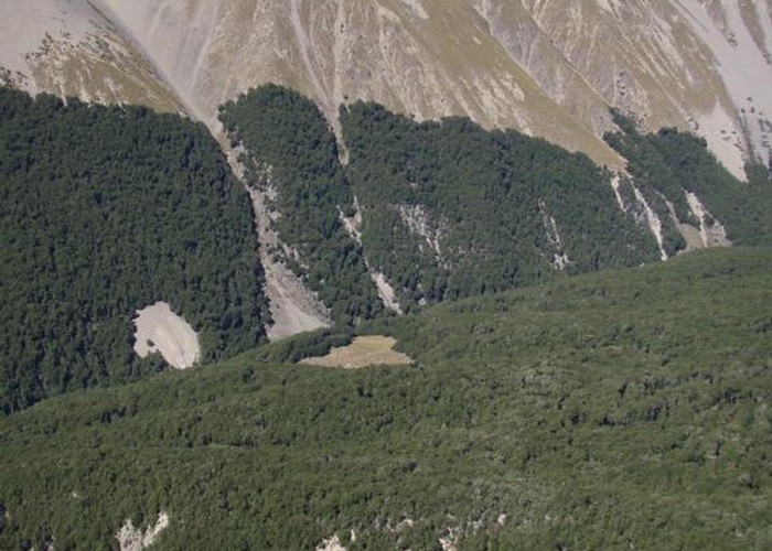
With his slower careful pace we carried on via easy terrain booby-trapped with spikes of spaniards. We managed to get all the way up to the forks on the true right but then crossed there where the stream bed rises and cut across a lumpy terrace. Travel got downright unpleasant with teetering boulders so I climbed away from the stream up these to smoother ground on a low grassy rise and had a very pleasing vista of a completely flat broad valley. A horse paddock was visible which told me the hut was tucked around the corner, nestled in a large pile of partially vegetated boulders, sheltered from any NW’ers.
Of course with no large shrubs or forest, there was no chimney in the hut but a very flash recently installed toilet. We opened the door to a pleasant vibe of wooden floor, comfortable furniture and 5 bunks. Frank stayed outside most of the evening and we kept the door open as it was mild with no sandflies to speak of. The toilet had wooden walls and was solid with the door on the side – most unusual. After a good long sleep we rose late as we only had a 4 hour walk to Maitland Hut via a gentle 250m climb to a low saddle then descent into the head of the Maitland. We studied the map and I decided travel would be best via the true right of the second incised stream up valley. I hoped there was a trail formed from horse trekkers but there was no mention of this and not much of horses, even, in the hut book. Frank didn’t have much of an opinion but tagged along with my idea.
We followed the plan and I was surprised to find 3 single green marker poles at the start of a subtle track originating where we left the valley floor. The third pole led us to an adjacent spur 50m north which was comparatively devoid of vegetation so easy travel. At the top of this, once again after only 56 minutes I called for a lunch break, and sat on a large flat rock handy to a streamlet.
I set off towards the low point over to the east indicating where the saddle was by point 1352. Frank followed on higher up the slope where the vegetation was less boggy and got to Pt 1352 and saw me down from the saddle, sheltered from the light breeze waiting for him. Travel was initially easy down the slope towards Maitland Stream but Frank often traveled in the tussock on the true left, up the slope a little as the stream had a lot of spaniards.
Eventually we dropped down and traveled by the stream on flats, crossing to the true right and getting stabbed regularly by sneaky little spaniards hiding under tussocks. We crossed the outlet stream which comes down from Dumb-bell Lake, and climbed up the slope, traveling on the true right of Maitland Stream. Three-fifths of the way along this stretch Frank led us down through big spaniards, finding tussocks to travel through and we crossed the stream, climbing up to a plateau via similar vegetation.
Travel on the plateau in contrast was easy and we could see the orange triangle marking the start of the track at the forest edge as per the map. We traced some higher ground and I was surprised to see a lone cairn on one. At times there were faint ground-trails, presumably anthropogenic as we hadn’t seen a single skerrick of deer sign. We moved quickly across a firm green strip of vegetation and then pleasant brown-top grass down to cross the final western tributary before the forest.
I could see a faint track wending through large spaniards but Frank found his own way a bit further upstream and I followed. We entered the forest and immediately wondered where the track went. Frank went to an open area to the right but I think that was a decoy so we ventured more directly down valley. Markers were few and far between. I had estimated it would take us 15 minutes to get to the hut but there was so much windfall it took us 25 minutes. I thought we could do some track clearing after settling into the hut as a lot of it could simply be picked up off the track and Frank had carried his Silky saw but when we got to the hut we were content to take it easy.
The old NZFS era hut was in a big grassy clearing with a large woodshed and toilet. A little down the slope was a very shallow stream so Frank scooped up water in his 2L milk bottle as the bucket I’d grabbed served only to disturb silt into the water. It was a warm night so we didn’t need a fire but I laid one for the morning. The fireplace was very high on a pile of rocks. Nearby in the trees was a food safe and mindful of the fact we would be spending an extra day tramping, I took from it 2 packets of oatmeal sachets, a little milk powder and some 2 minute noodles, plus sugar to sweeten the rice pudding I made that night.
Frank said we’d need to get up early to tramp all the way out the following day but I said we could instead go from Snowy Gorge up on the range via a low saddle east of the hut and then travel south to Hideaway Biv as I still had another evening meal plus the extra breakfast for him. So we got up at 7am and were on the track at 8.30am. This time I led us through the little trail that led down to the first stream crossing but it wasn’t as Spaniard-free as Frank’s route the day before Frank led the way slightly more on the eastern side of the valley and by this time I’d figured out how to travel in Spaniard country: walk through tussocks if they’re growing in the midst of these pernicious prickly plants. Place your foot midway between 2 spaniards and be careful following through with the other foot. Frank also believes in stepping on the Spaniard itself but not having decent gaiters (neither did he) I only tried this trick once and it worked fine.
We crossed each stream exactly at the same point on the way back. Both days I kept my boots dry with boulder hopping. We were 15 minutes faster going back to Snowy Gorge even though there was 120m extra height gain. I certainly felt a lot fresher which was just as well as we then had a 400m ascent via scree to the low saddle east of the S.G. Hut, followed by a more gentle climb to the high point of 1622m.
Mercifully there was a bit of breeze and it was occasionally overcast. Frank suggested starting by climbing to a low spur but I said I preferred the strong visible trail in a slight basin that diagonally led up to that tussocked spur to avoid sustained clambering on potentially teetering boulders. We walked to the foot of my route and at the base was an attractive pond on flat green grass which would make for a lovely campsite, especially in an easterly.
We toiled across the bands of scree, linking them with leads of vegetation where I could focus on a bit of effective height gain. I’m faster climbing scree so gained the saddle and found shelter behind a boulder from the wind and very occasional and short episodes of spitting. Silly me, I should have waited further down on the sunny side where there was less wind as I waited there for 25 minutes, rugged up but eventually cooling down a bit. Frank joined me and then we lingered some more while he put on his jacket but by now I had my pack on my right sheltering me from the wind and Frank was doing the same on my left flank.
We set off up the high point with me fully clothed but doffing as I warmed up. The ground surface was flattened scree – easy to walk on and not a spaniard in sight. At point 1508, we had a conflab on our options down to the biv and decided to head towards Pt 1115 after a little initial travel down the spur. We could link up sections of creamy coloured scree with vegetated areas with consolidated small grey boulders for fast travel. Then the ground became flatter and moister with what I thought to be Alice Shank’s bristle grass but alas, it wasn’t the same species at all. Frank opted to go directly over Pt 1115 but I traveled down valley to a low saddle. Unfortunately my way involved walking in damper ankle-turning uneven grass though I was only a few metres behind him when I gained the low spur.
By then he had his hut boots on and was relishing being able to see where he was placing his foot so I concentrated on keeping up and only managed this on the short section of uphill. The ground was carpeted in a lovely thick white moss. We dropped down easily to the unnamed stream by the biv and found a place for me to boulder hop across and climb up between matagouri bushes. It had taken us slightly more than 9 hours plus a lengthy restorative lunch break at S.G. Hut.
The biv was actually a 5 bunk hut tucked against a low cliff behind matagouri bushes. With the rustic looking concreted/mud floor and faux ancient furniture it had a pleasant ambiance. Frank was all for carrying on to the road end – another 2 hours but I mutinied and said this was as far as I was going as after that pace down the hill, I was pretty shot. Strangely enough as time went on, he felt more tired and I felt more energized. The fireplace has been removed and there’s a concrete edifice outside for fires.
Like S.G. Hut this one had a record of frequent attention from DoC, beyond mere inspections. It was built in 1876 though you wouldn’t think so, with a replacement door and all. It had beech pole rafters and framing of the bunks but fortunately on 2 of them the chicken wire has been replaced with slats and there is the full complement of mattresses bar one. The stools in particular are admirable, very big and held together with wooden pegs, held in place with horseshoe nails for the rustic look.
Frank expressed concern about possible rain bringing up the Ahuriri and making for a dodgy crossing the next morning but I reassured him that any forecast NW rain was minimal. Even so he didn’t sleep so well that night though there was no rain at all. I hung the uneaten emergency food from the rafters and we headed out, passing the green lagoon and 2 fishermen – the first people we’d seen since we’d left the car. There was a good foot trail as horses come in frequently and from the outlet of the lagoon there were tyre tracks though they didn’t carry onto the flat debris flow plain which someone had referred in the hut book to as ‘the gobi desert’.
I crossed this without using my topomap and had to travel west along the edge of the escarpment to our crossing point. Frank had gone closer to our original line of travel where the ground was flatter but by taking a direct line to the crossing point I got there before him. We were able to cross singly though the stones at the bottom were very slimy so slippery in the strong shin-high current. It was a hot day but there was a merciful breeze at the car. So 3 new huts, plans for further trips in the area and it was great to get up high out of those valleys away from those damn spaniards.