Section: Edwards River - McArthur Track
St James Conservation Area
- 2 days one way
- Easy/medium
- Car park to Scotties Camp Hut: 14.5km, 3 hours 30 minutes
- Scotties Camp Hut to Pool Hut: 8.2km, 2 hours 30 minutes
- Pool Hut to Lake Guyon junction: 18.2km, 5 hours 30 minutes
- Maling Pass - Moki Track, 1 day from Lake Guyon junction to Tophouse Road at Lake Tennyson]]
- Lake Guyon - Fowler Pass, 1 day from Lake Guyon junction to Tophouse Road at Fowler Hut]]
The southernmost section of the St James Cycle Trail, between Tophouse Road and the Lake Guyon junction on the Waiau Uwha River. Currently the McArthur bridge is missing completely so you can only go as far north as the site where the bridge was. It is to be replaced soon!
The river can be forded just north of where the bridge was.
|
Walking time
|
2 days
11 hr 30 min
|
|---|---|
|
Distance
|
40.8km |
|
Type
|
One way
|
|
Grade
|
Easy/medium |
|
Bookings
|
No bookings — open access
No — open access
|
|
Starts
|
Edwards River Track car park, Tophouse Road, north of St James Homestead |
|---|---|
|
Ends
|
Lake Guyon junction, Waiau Uwha River |
|
Maps
|
NZTopo50-BT24
|
|
Altitude
|
610m
–
946m
Altitude change 336m
|
The St James Cycle Trail is open to walkers, horses, and mountain bikes, with some motorised vehicle access. This section leads down the Edwards River and over Charlies Saddle into the deep Waiau Uwha Valley, Turning upriver, the McArthur Track leads on up to the junction west of Lake Guyon. From here, you can continue the trail north, or cut eastward back across Fowler Pass.
Access
To reach the track start, take the road out of Hanmer Springs over Jacks Pass. Turn off at the Clarence River and take Tophouse Road. The road is dirt and suitable for regular vehicles. However, it may be corrugated, and slow going.
The southern end of the St James Cycle Trail is at the nearby St James Homestead. The route described here starts just north, at the signposted Edwards River track end, although you could start at either point.
Car park to Scotties Camp Hut
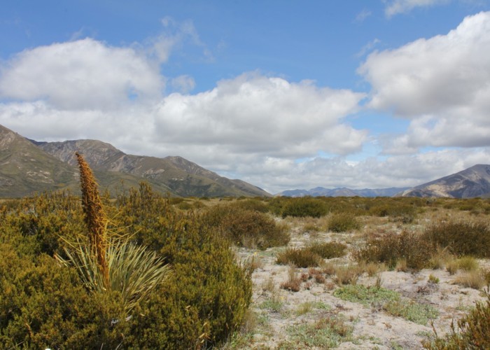
Over a stile, a vehicle track leads gently up and over alpine herbfields: daisies, gentians, orchids, harebells, and bog pine. The track flattens off and bends into a stand of shrubby mānuka before meeting the track from the homestead.
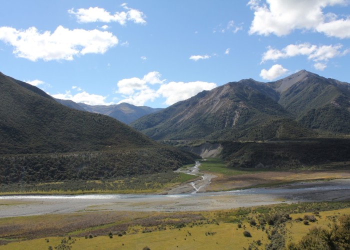
The track drops quickly to meet Edwards River in the valley floor. The grassy valley is clad in matagouri, briar rose, with stands of bulbinella occupying the damp spots. After an hour, the track crosses to the true right, then crosses Sadds Stream from the right.
A long eroded terrace marks the point where Cow Stream and Cadwallo Stream enter from the true left and right respectively. Cadwallo Stream has dumped a load of fresh rubble in the river bed. Crossing Edwards and climbing onto the terrace, the track branches left and right. The left branch leads up to the Cow Stream hot spring. The right branch continues onward.
After a small gorge, the track turns out at Scotties Camp Hut, located next to the Edwards Swingbridge. The small hut features solar lighting, a horse paddock nearby and a dog kennel.
Scotties Camp Hut to Pool Hut
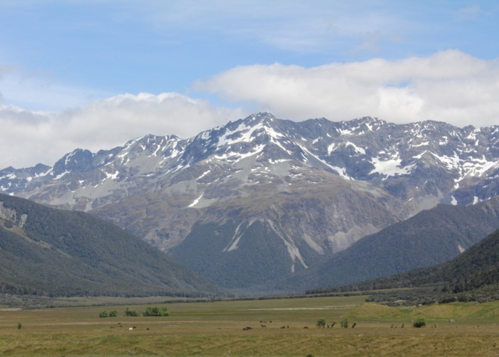
Over the Edwards Bridge, the track follows river flats briefly before climbing quickly and sidling across a broom-choked hillside. From here it's possible to see Stony Stream biv and the newly cut track leading to it from the eponymous stream. Before long, the track leads over the saddle into grand views of the Waiau Uwha valley. The poled Stanley River route leads off from the saddle. This track takes you into a hidden basin called the Racecourse, then along Stanley River to the Stanley Vale Hut.
Keeping to the main trail, it drops quickly and turns upriver. In this valley, the mountains get bigger and the views get longer. The track leads over mānuka flats before dropping off a terrace opposite Jervois Stream. The track sidles above the river to the site of the former McArthur Bridge. The Old Bridge Hut and Pool Hut are nearby on the true right of the Waiau. Pool Hut is rough looking, but fitted out with new bunks, and comfortable enough though has no source of heating.
Pool Hut to Lake Guyon junction
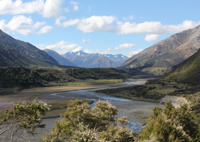
From Pool Hut, the track climbs onto a high grassy terrace and crosses Camping Stream. As the terrace runs out, it climbs along Saddle Stream, dips into the ribbonwood gully and climbs onto Saddle Spur. This spot affords good views of the grass flats around Saddle Spur Bridge, through to the distant Spenser Mountains.
Back on the flat, Henry Track leads off left to link with the Waiau Pass Track and St James Walkway. Our track turns right, and heads for the bridge. This bridge spans the head of an impressive little gorge. The track leads up to the back of the Downs and passes by Little Lake and the Ada Flat.
The St James Walkway occupies the broad Ada and Henry Valleys off to the left. Ada Homestead is visible, and the wild horses of the St James are commonly seen here. The handsome Faerie Queene (2236m) is visible up the Ada valley.
The signposted Lake Guyon junction is a couple kilometres farther onward.
Walking times
Connecting sections