Section: Maling Pass - Moki Track
St James Conservation Area
- 4 hr one way
- Easy/medium
- Car park to Maling Pass: 1 hour 20 minutes
- Maling Pass to Waiau Pass Track turn-off: 1 hour 45 minutes
- Waiau Pass Track junction to Lake Guyon junction: 50 minutes
- McArthur Track - Edwards River, 2 days to Tophouse Road
- Lake Guyon - Fowler Pass, 1 day to Tophouse Road
The northernmost section of the St James Cycle Trail, between Lake Tennyson and the Lake Guyon junction on the Waiau Uwha River.
|
Walking time
|
1 day
4 hr
|
|---|---|
|
Distance
|
17.8km |
|
Type
|
One way
|
|
Grade
|
Easy/medium |
|
Bookings
|
No bookings — open access
No — open access
|
|
Starts
|
Marked car park at Molesworth boundary gate, Tophouse Road behind Hanmer Springs |
|---|---|
|
Ends
|
Lake Guyon junction, Waiau Uwha River |
|
Maps
|
-
|
|
Altitude
|
777m
–
1,306m
Altitude change 529m
|
The St James Cycle Trail is open to walkers, horses, and mountain bikes, with some motorised vehicle access. This section leads across Maling Pass down into the deep Waiau Uwha Valley to the vicinity of Lake Guyon. From here, you can continue the trail south, or cut eastward back across Fowler Pass.
Access
To reach the track start, take the road out of Hanmer Springs over Jacks Pass. Turn off at the Clarence River and take Tophouse Road. The road is dirt and suitable for regular vehicles. However, it may be corrugated, and slow going. This is black-fronted tern country: look for them darting around the river and over the road.
The southern end of the St James Cycle Trail is at the nearby St James Homestead. Fowlers Hut is further along on the left, clearly visible. At a boundary gate, a car park marks the northern end of the St James Cycle Trail. This is the starting point for the route described here. A toilet and information board is here. The Lake Tennyson campsite is also nearby, just up the road.
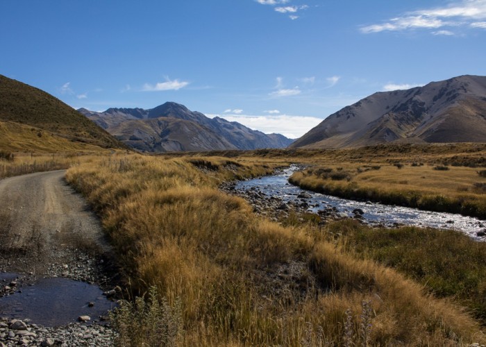
Car park to Maling Pass (1308m)
The route sets off along a 4WD track through handsome alpine herbfields, following the line of Maling Pass Stream. It is marked by blue cycle trail posts, and open to both vehicles and bicycles as well as walkers.
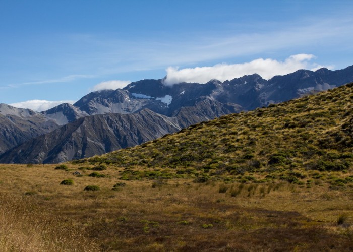
The climb begins after almost an hour, as the trail bends past Mts McCabe and Princess. The final climb next to the stream is painless, yet dramatic, as the deep void of the Waiau Uwha Valley opens up, with the rugged Spenser Mountains opposite.
The pass is named after Christopher Maling, a military man turned surveyor, whose father was killed at the Wairau Incident. Maling and Henry Lewis would discover the Lewis Pass in 1860 (it was already known to Ngāi Tahu Māori).
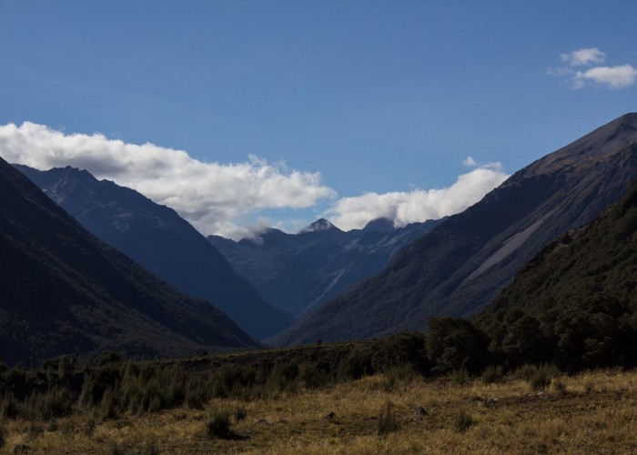
Maling Pass to Waiau Pass Track turn-off
Over the pass, the road sidles above the valley floor, dropping steeply down to the river. On the right is a rabbit-proof fence, completed in 1889 and once running for 78 miles from the Main Divide to the coast.
The track passes through a pocket of dry forest and levels out amongst mānuka, coprosma, and matagouri scrub. The track turns down valley, leading away from the enticing views toward Waiau Pass. Markers for the Waiau Pass Track are sometimes visible on the far bank of the river.
Eventually, signs mark the end of vehicle access down the valley. A toilet is located here, and there is often an informal vehicle camp. A marked track junction to Waiau Pass is just a little further on.
Waiau Pass Track junction to Lake Guyon junction
The track follows the top edge of the river flats, climbing above a bend in the river and soon crossing a bridge amongst scrub. This is the Lake Guyon outlet. The track junction is nearby. The cycle trail continues south toward Pool Hut, while another route turns left, heading for Lake Guyon Hut and Fowler Pass.