Tanekaha falls, Puriri track loop
- 3 hr – 4 hr return by the same track
- Easy
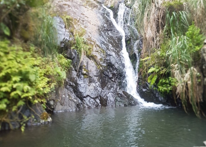
Following a stream up the valley to a large Puriri tree, then back via some waterfalls, swimming possible.
|
Walking time
|
3 hr – 4 hr |
|---|---|
|
Distance
|
4.0km |
|
Type
|
Return by the same track
|
|
Grade
|
Easy
Sheltered walk, stream could swell after heavy rain. Grades explained
|
|
Bookings
|
No bookings — open access
No — open access
|
|
Starts
|
Cullen Road, Waipu Cove |
|---|---|
|
Maps
|
NZTopo50-AY31
|
|
Link
|
https://www.mangawhaitracks.com/tanekaha-trackshttps://www.mangawhaitracks.com/tanekaha-tracks |
|---|
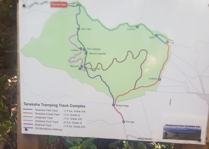
Access
Up the far end of Cullen Rd, which is off Cove Rd in Waipu Cove. Continue after sealed road gives way to gravel and pine forest, then once road goes back into bush its 5 mins to the start of the track. Park by the water tank on the right, there's not really parking further up.
Description
Follow the Langsview track until the sign showing the start of the Tanekaha Falls Track (5 min), then 10 mins later take the turn-off to the Tanekaha Puriri track, just before the first waterfall. This track climbs to a lookout onto a waterfall.
After a small waterfall the track winds down to the second big Puriri. A short side track will take you to this, but the Puriri track continues down the hill to the stream, and a junction with the Tanekaha Falls track.
Following this track along the stream will take you past some nice waterfalls, the second of which is best for swimming, as there is a sunny pool on the hill.
The track follows this waterfall up the hill back to the Langsview track and then back to the car.