Langsview track
- 2 hr – 4 hr return by the same track
- Easy/medium
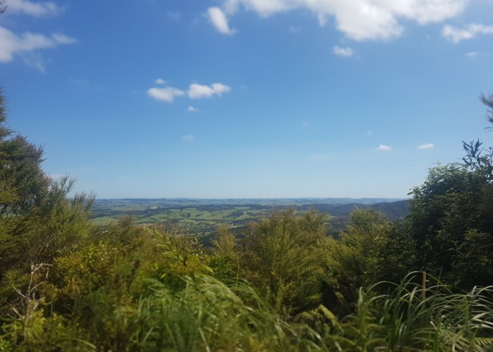
An easy walk overlooking Langs Beach with views out to Mangawhai and inland to Kaiwaka
|
Walking time
|
2 hr – 4 hr |
|---|---|
|
Distance
|
5.5km |
|
Type
|
Return by the same track
|
|
Grade
|
Easy/medium
Well marked track, mostly sheltered by bush. Grades explained
|
|
Bookings
|
No bookings — open access
No — open access
|
|
Maps
|
NZTopo50-AY31
|
|---|
|
Link
|
https://www.doc.govt.nz/parks-and-recreation/places-to-go/northland/places/waipu-area/things-to-do/langsview-track/https://www.doc.govt.nz/parks-and-recreation/places-to-go/northland/places/waipu-area/things-to-do/langsview-track/ |
|---|
Access
Up the far end of Cullen Rd, which is off Cove Rd in Waipu Cove. Continue after sealed road gives way to gravel and pine forest, then once road goes back into bush its 5 mins to the start of the track. Park by the water tank on the right, there's not really parking further up.
Track can also be approached from Cove Rd past Langs Beach, there's a DOC carpark just past Bream Tail Road on your right (going away towards Mangawhai).
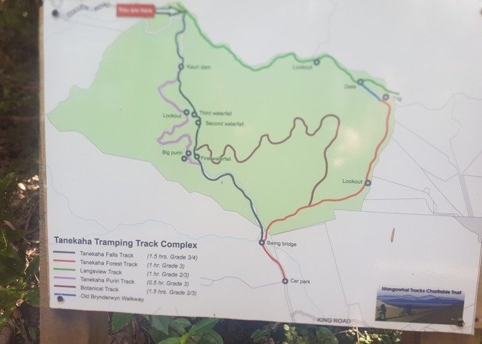
Description
An easy 3 hour walk through ex-Kauri forest with optional loops as shown in photos.
Track is well marked and is part of the Te Araroa so is well used.
Excellent views over Langs Beach to the Hen and Chicken Islands (Taranga and Marotiri Islands), Mangawhai and inland to Kawaka and Brynderwyn. There are a few nice lookout spots in either direction.