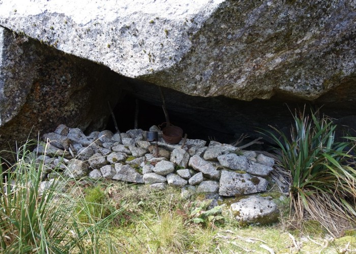
Historic Rock Bivvy, Hohonu Range

This snap shows a man made rock wall at the bivvy. I've displayed a few of the many relics found about the place on the wall for the photo. Research tells that the bivvy was first used in the 1890's by graziers who grazed sheep on the native tussock and plants above the bushline during the summer seasons from about 1891 thru to the early 1900's. After this the bivvy was used by the Geological Survey and it appears on their 1906 map as "Cave Rock". Hunters have used the bivvy over the years but in 2017 I suspect that I was the first human to sleep in the bivvy for a long time. (Chamois had laid claim to the place and the old wooden bunk platform and table were decayed and unusable)
This bivvy is located in the head of Smart Creek. Most trampers should allow a day to walk in to the bivvy via Mt Smart. It is approx a 45 minute walk down to the bivvy from the major ridge lines north or south of the bivvy. (longer if you don't nail your route finding through scrub & small bluffs)
Comments
-
 glennj Since I posted about this rock biv in 2017 at least three parties have made an effort to visit the historic bivvy. The West Coast Alpine Club went in after Tate Bradley got route info off me. A note book has been left in the bivvy as a hut book by Nina Dickerhof and James Thornton. It also lists Duncan Gray having visited. Now me again as I spent another two nights there.
30 December 2018
 -
 glennj It is now only a 30 minutes or less walk down to the bivvy from the northern ridge line as I've cut a track through the two scrubbiest sections. It is largely unmarked except for the starts of the cut bits thru scrub. From the ridge line if coming the Mt Smart way take an obvious sloping bench toward the top of a slip/rocky area then use a tussock lead to get on to the slip. Follow almost to the bottom of the slip and a track leads off to the left thru flax & scrub to another slip/rocky area. At the bottom of this on the right a track takes you all the way down to the tussock and scattered scrub in the basin. The bottom end has black plastic rubbish bag markers and cairns. Crossing the basin to the rock bivvy it is best to do a dogs leg sticking to the open going rather than to take a straight line through some scrub and small creek heads!
30 December 2018