Kylie Bivouac
Ruahine Forest Park
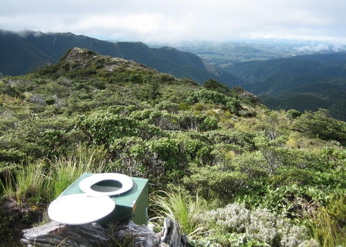
Kylie Bivouac (sleeps 2-3, tank water) may one day save someone's life on the exposed tops of the Ruahine Ranges - but I suspect that will be the only time anyone will truly enjoy staying there.
A waist-high biv with two matresses on the floor, it sleeps three at a push. There is a door with nine 6mm ventilation holes drilled in it, but apart from that no window or other ventilation provided. In a nor-westerly it may receive some shelter from the main ridge above, but in the southerly blowing when I visited, it bore the full brint of the wind, meaning that leaving the door open was not an option.
Kylie biv is located about 600m from the main ridge between Tupari and Totora Spur. When approaching from the South/West, the hut is on the second spur running SW after passing Tupari Peak. The hut is only visible from the brow of the ridge. A signpost on the ridge indicates the route, on the broad unpoled tops is easy to miss in bad weather.
|
Owner
|
Owner: DOC |
|---|---|
|
Category
|
Standard Hut |
|
Sleeps
|
Sleeps 3
3
|
|
Facilities
|
None |
|
Water supply
|
Tap or tank water |
|
Getting there
|
Makaroro Roadend / Wakarara Road (278960,615920): 15/18km via Colenso Spur / Sparrowhawk biv Sparrowhawk Biv: 10km (3-6 hours) unmarked route Barlow Hut: 9.5km (time unknown) track / unmarked route tops Upper Makaroro Hut: 5km (1.5-3 hours) unmarked route over tops Aranga Hut: 11.5km (4-8 hours) partially poled route over tops |
|---|---|
|
Unlocked
|
This hut is unlocked and open to access. |
|
Bookings
|
No bookings — open access
No — open access
|
|
Altitude
|
1,330m |
|---|---|
|
Mobile phone coverage
|
No coverage |
|
Maps
|
NZTopo50-BK36
|