Valley Track, Mount Vernon Park
- 1 hr one way
- Easy/medium
- Mount Vernon Park car park to lunch shelter: 15 minutes
- Lunch shelter to Rapaki Track car park: 45 minutes
Easy walking through regenerating forest and over tussockland on Christchurch's Port Hills.
|
Walking time
|
1 hr |
|---|---|
|
Distance
|
3.1km |
|
Type
|
One way
|
|
Grade
|
Easy/medium
Track is well graded to picnic shelter. Beyond there, track is rougher and often vague. Grades explained
|
|
Bookings
|
No bookings — open access
No — open access
|
|
Starts
|
Mount Vernon Park, The Crescent, Hillsborough, Christchurch |
|---|---|
|
Ends
|
Summit Road, Hillsborough, Christchurch |
|
Maps
|
NZTopo50-BX24
|
|
Altitude
|
15m
–
316m
Altitude change 301m
|
The Valley Track runs alongside the popular Rapaki Track, but keeps to the valley floor. You can form a circuit by returning via the Rapaki Track and dropping down Rogers Track back to the car park. For a short and easy option, the return walk to the lunch shelter is 30 minutes.
From Hillsborough Terrace, continue on to The Crescent. The car park and picnic area is on the left.
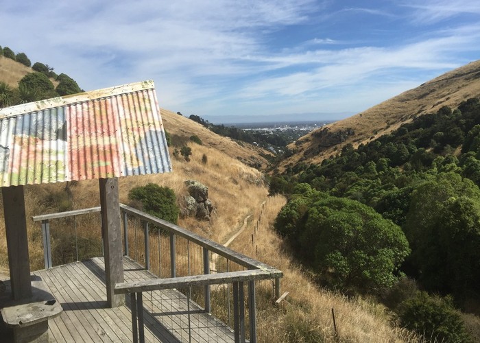
Take the marked Valley Track, climbing gently through regenerating forest. You soon pass the end of Rogers Track and come to a nice little hillside lunch shelter. From here, a rougher track clambers up some rocks and continues upvalley and over grassland. You soon pass the end of the Marette Taylor Track which is an alternate route back down.
Eventually the view opens up to Witch Hill and Rapaki Rock. The track pulls alongside Rapaki Track at a saddle. From here, the track is very vague and hard to follow. Eventually, you turn out at the Rapaki Track car park on Summit Road.
Walking times: