
Day 1. Kahutara river mouth to Wardens Hut
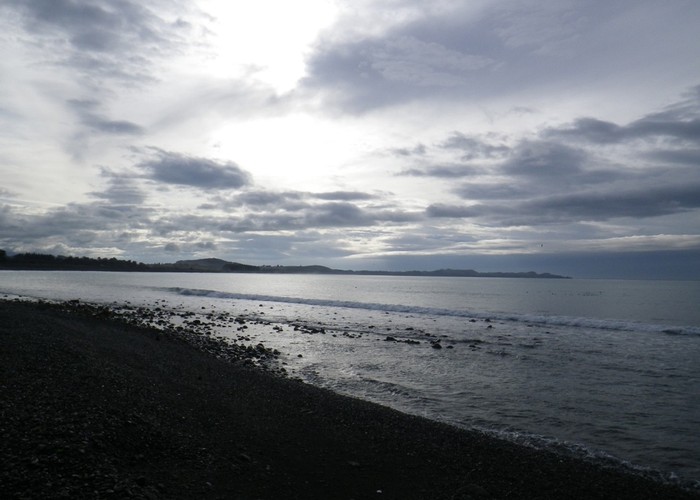
The intercity bus drops me off at Peketa – the small township at the south end of the Kaikoura Bay. Not a regular stop, the driver informs me, but he’s cheerful, and wishes me good tramping. A track on the inland side of the bridge leads to the riverbed, and cutting under the road I walk the 100m to the shore. The Pacific Ocean is dark and choppy, the water uninviting, reflecting the dismal colour of the sky. To the north the long flat sweep of the bay leads uninterrupted to the Kaikoura Peninsula some 7km away. To the south the road and railway squeeze improbably round a vertical coastline, navigating bluffs and spurs by sheer cuttings and tunnels. I’m relieved to see that the Kahutara River is no more than a trickle – the forecast for the last few days having been for rain.
Might as well get on with it then.
A 4WD track leads back under the road and rail bridges, heading up the riverbed – carving a canyon through tall lupine and buddleia. The river gravel is soft, walking takes effort, like running on sand-dunes. I follow the track, which in turn follows the Kahutara as it winds inland. The Seaward Kaikoura range frames the horizon 20km inland, peaks barely peeking through rapidly enveloping cloud, low ranges lying between me and their base, forcing both river and myself to twist and wind our way inland. Pigs grunt and shuffle in the lupin. A startled brrrr of departing quail. The chirp of dotterel making their way upriver.
After a few kilometres the weeds in the riverbed recede sufficiently to offer views of the surrounding valleysides. Faces once cleared for farming, now returning to nature, of a sort. Slopes green with broom, patches of manuka pushing through – offer hope. The river winds through a broad-based gorge, crosses the gravelled Dairy Farm Road, narrows, confined to a single bed between weeping banks of old-man willow. I eat lunch under one, branches reach out over the riverbed, providing shade from a sapping sun.
Trudge on upriver. A lone heron watches a pool. Pines appear dotting islands in the riverbed. Wattle too. Hard riverstones – feet hot and sore. The bridge forever round the next bend. I finally relent, get out the map, work out how much further. 500m to go to the Inland Route. 20 paces later I see it – a dozen concrete arches spanning dry riverstones.
We pass under the Inland Road, pick up a 4WD track on the northern riverbank. A lone DOC triangle on a pole confirms the route to Blind Saddle. Off the riverstones at last. A locked gate, stile. 4 cars, each with empty trailers & ramps in the paddock beyond. The river has been dry for the last several kilometers, cattle sign on the riverbed making it an uninviting drink below that. Water bottles are near dry, but the only source is a cattle trough, murky-green with algae. I push on.
The good farm track climbs through bush to terraces of farmland above. An easy gradient, gentle rise to the base of the range beyond. A series of zigzags take us off the flat, climbing between pine forest south and rough hill country to the north. Cloud has been lowering all day, lofty peaks no longer visible, and within minutes we enter it’s grey, damp world - climbing. Passing Bushy Saddle, the gradient increases, becomes steep, the track bulldozed into near vertical, crumbling faces. Three sips of water remain in my last bottle, and the sound of a truck approaching through the mist is a relief. I flag it down, ask if they have water to spare. ‘We have beer’, they reply. They rummage under the seats and finally find a bottle that resembles water. I slug some down, from the taste suspect beer would have been preferable. Try not to wonder how long it’s been there, what the bottle was used for previously.
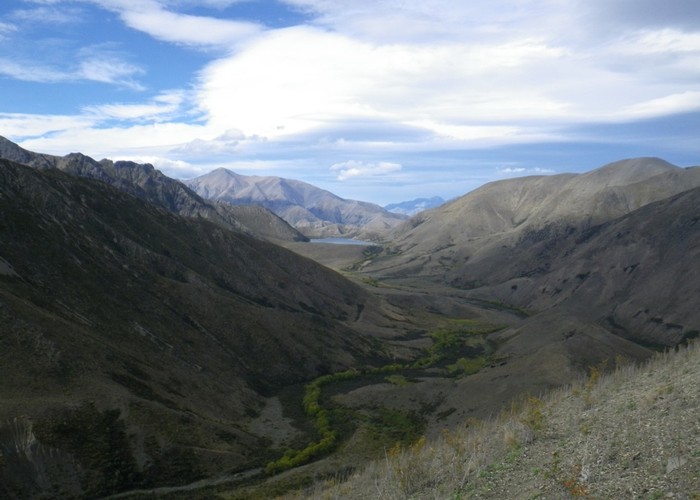
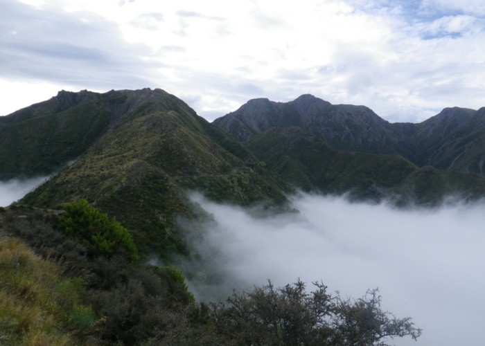
Above the zigzags we break through cloud. A sea of white stretches east, interrupted only by the top-most 50m of the coastal range. North and west the high peaks of the Kaikouras rise to bare pyramid summits – less formidable now – we have climbed a good distance unseeing through the mist. Scrubby valleys separate narrow spurs of dry tussock and rock. The track cuts onto the northern face, climbs to Blind Saddle 1190m. Not a saddle at all, merely a shoulder on a sidespur 200m below the pass. Nearing the true pass, creeks appear - flowing with clean water, crisp tasting, welcome.
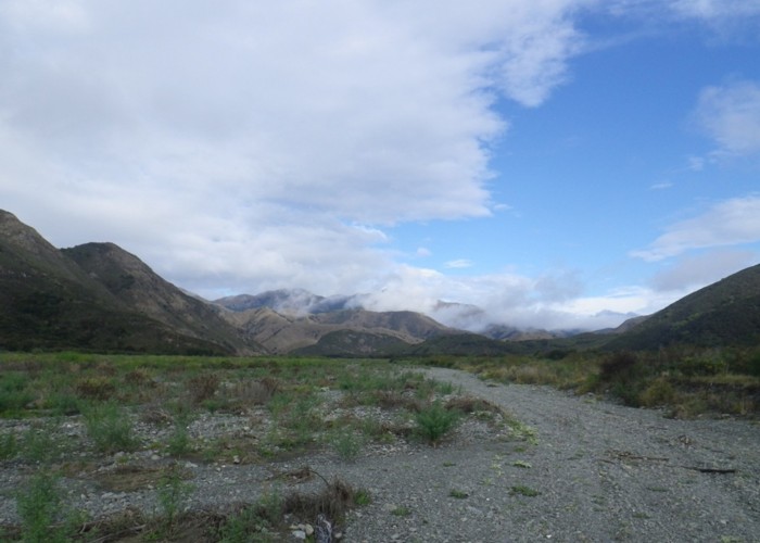
And so, refreshed, we cross the Seaward Kaikoura range. Beyond the unnamed pass the track sidles into a changed landscape. Steepsided valleys host more dirt than vegetation. Bluffs of deep veined rock - twisted, warped - melted candle drawn in stone. The road becomes even more precipitous as it drops, cut – a shelf – into sheer rock faces. Sidling, twisting through guts & spurs, until finally it finds a leading ridge, dropping with it towards the Heron below.
Finally, a hut. Tentpoles sits on the flat valley floor below the track. The side-creek off the Heron more swale than valley – dry, grassy with no bed for water to flow- the hut angled carelessly in its centre. No water now - no means to stay. What happens when it rains, I can only imagine. We push on: 2.5km to the main Heron River.
Where a collection of huts awaits: the historic Bluff Dump Hut, like Tentpoles, is stripped bare. A place of comfort for so long, now an empty shell for inspection by the curious. A modern DOC structure, stark and modern, sits nearby. But removing that day-1 pack, stretching out on the broad platform bunk on those firm DOC mattresses, Wardens Hut feels like paradise. It’s all I can do to force myself up for a wash and tea, before I collapse contentedly into soft down and oblivion.
Coast (SH1 Kahutara River bridge) -. Inland Route (Kahutara River bridge).
3hr15. Riverbed route with 4WD tracks. River ankle-deep or dry in normal flows. Easy going but mix of soft tiring surface and hard river stones. Forks in river require attention to map to choose the correct (main) river. Limited (or no) clean drinking water due to cattle in the riverbed until the Inland Route, above which the river is likely to be dry.
Inland Route (Kahutara River Bridge) -> Saddle
3hr. A 4wd track starts from the highway at the bridge, following the northern bank. After 2km a locked gate is reached. A 4WD track climbs first through farmland and later bush / scrub / tussock passing Blind Saddle to reach the unnamed saddle on the watershed. Only reliable water is in the last 500m to the summit.
Saddle -> Tentpoles Hut
1hr. A good 4WD track sidles through sheer bluffs before descending a spur towards the Heron River. Tentpoles Hut sits 20m off the track up a dry riverbed 2.5km before the Heron is reached. The turnoff is signposted.
Tentpoles Hut -> Wardens Hut
20 mins. The good 4WD track continues to wind down from Candlesticks Hut until it reaches the Heron River. Crossing twice, a grassy flat containing both Wardens Hut and the historic Bluff Dump hut is reached.
=========================================
Day 2 – Wardens Hut to Robinson Creek
An easy walk down the valley-floor 4WD track soon leaves Wardens Hut behind. The sky is a quilt of cloud – its diamond patchwork wearing thin in places to reveal blue beyond. A heron flaps lazily downriver – its wingbeats matching my pace.
Black Spur Hut hides behind a sharp dividing spur of coal-black rock. Fancy that. A old slab hut, shaded by a grove of poplars. Iron bunks and fireplace remain – with a mattress it would still provide a cozy stay.
Wind whispers in poplars. We rejoin the Heron, continue downstream.
3km before the Clarence, the road splits. 4WD tracks head north and south. The good roadbed we’ve followed departs with then, and a rough riverbed 4WD route continues the last few kilometres to the Clarence River. Black rock changes abruptly to dazzling white. A twisting gorge, then the broad gravel Clarence flats.
Seymore Hut lies 500m downriver, on broad grassy paddocks behind a briar-covered bank. Hunters are resident, but absent, so I eat my smoko alone, and continue.
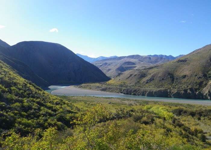
Heading up the Clarence, crossing the waist-deep flow three times. The current is swift - just beginning to tug, but comforting, flat gravel lies underfoot. The ice-axe provides reassurance against the flow – but with good runouts it’s a safe crossing. For a group with their mutual support, a doddle.
1km upriver a lone triangle beside a broom bush marks the start of the route to Lake McRae. A cut track climbs west up a sidecreek, reaching the saddle through a forest of rosebriar. At the pass, the track ends, but beyond the briar is sparser and we make a winding descent between the worst of the scrub, swinging left to the Elliot Stream. A forested valley floor of old-man willow awaits. We weave upriver between twisted trunks, fallen, still growing trees, cutting occasionally out onto sun-baked rosebriar flats.
Elliot Biv takes some finding - hidden atop a low terrace north of the river, itself obscured by tall willows. A hunter’s gear is in residence, unpacked but tidy. The hut stinks of death, like dead possum under the floorboards after 5 days of sun. The clearing abuzz with flies. Hot, unwelcoming. I return to the creek, eat lunch beside the clear flow in the shade of willows.
Above Elliot Biv we leave the willows behind. A good ground trail heads upriver, seeking out grassy clearings, forcing its way through rosebriar flats. The trail broadens, becomes an overgrown 4WD track, benched for a sidling climb to the saddle with Lake McRae. A gully, overgrown with briar, blocks our easy progress - forcing instead a brief, steep climb to the summit. Brown-white goats watch, unconcerned, from the valley floor below. Beyond the saddle, Lake McRae fills the valley floor. A wind lifts small white-caps, blows them, with short slapping splashes, onto the shore beneath me. At the far, southern, end willows shade a broad bay. A quick, refreshing swim follows in its clear, still water. An even quicker re-robing as sandflies descend for the kill.
Lake McRae Hut lies a full kilometer beyond the lake from which it takes its name, and a full 100m below it. The 4WD track descends in sweeping zigzags to a line of willows which mark the river below, the hut tucked – sheltered – at their start. Three hunters emerge as I approach, checking rifles, paying no attention to my presence. They depart: ‘Bit of a mess in there. We’ll tidy up when we get back’. A deer’s head rests against the porch, flies circling. More clouds orbit muslin bags of meat tied to trees, eaves nearby. Inside, gear covers every surface: beds, tables, floor. The hunters said that two parties are in residence, but how they’ll know which gear is who’s is hard to guess. I’d been mentally erecting my tent outside, coming in to read, cook tea, have a yarn. But to even do that would require tidying up gear, finding a surface on which to sit and to cook. And mixing up the strewn mess further will probably make me no friends. I could just lie up in my tent outside, await their return on dusk. But out there, in the company of flies …. well I might as well be further downriver and in peace.
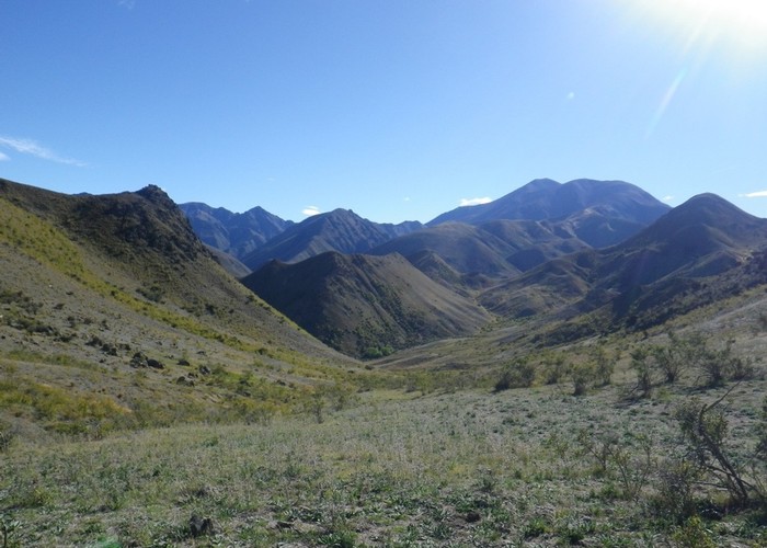
So I chew down a muesli bar, reshoulder my pack, and head on down the valley. The 4WD track winds south, cutting along sparse grass-and-briar river terraces on the western valleyside. Two kilometers downriver a broad valley joins from the west, a flat-floored incline rising towards a cirque of black scree-draped peaks. The East-West route heads up the valley floor, picking between willows and briar until it finds a ‘good spur’ on the southern face. Climbs steeply through first low briar, later bugloss and hieracium, to reach the southern ridgeline. A stepped series of ascents follow up the ridgeline, frequent stops to wipe sweat from my eyes. With each ascent the vegetation gets sparser, reduced to just a handful of weeds in each meter of rocky brown soil. And with each ascent the range of black peaks tower a little less. A cold wind picks up, chill sweat stinging skin. A final steep climb leads onto a face of fine black rock, sidling first north then south of low black peaks we reach the saddle, and cross our second range.
Beyond: a new landscape. Valley floors flush with green growth. Tussocks punctuate the faces, where previously briar and bugloss reigned unopposed. I drop steeply down rolling tussock into the valley below, tired and eager to rest, descent watched by scores of black goats. The chill wind whips up the valley floor, and I push on a few more kilometres, finding shelter on flat grass terraces in the shade of the first patch of willows. Cattle too have appreciated their protection, and I find a new use for an ice-axe, clearing a spot for my tent. Sandflies appear and attack, but after a wash in the chill water of the creek I’m cold enough to cover up and cook tea. Retire, relieved to finally lie in the comfort of my tent.
I lie thinking: critical. I’m rushing the trip, I know it. My failing as always, the urge to push on. Tomorrow, I know, I won’t stop at Molesworth Camp as planned. I’ll push the day that bit more to reach the comfort of Saxton Hut. A roof over my head, table to sit at and read, cook, relax. A mattress and a bed, in place of another night under canvas. I should learn to stop, relax, accept whatever I find when I reach my planned destination. I fear the story of this trip will become another story of pushing against daylight and fatigue. This dreamed of tale of a transect through a half-dozen new ranges, ecosystems, environments reduced to that of just another slog.
Warden Hut -> Seymore Hut
Good 4WD track down the valley floor. Frequent crossings – ankle deep. Stick with the riverbed where the track climbs towards Quail Flat. Seymore Hut is 500m downriver on the eastern bank.
Seymore Hut -> Elliot Biv
Head upriver from Seymore Hut for 1.5km, ideally making three crossings of thr Clarence. The river was waist deep with steady, rapid flows but a good stable gravel bed when I visited in ‘normal’ conditions (recent light rain, no major storms). The first 2 crossing can be avoided by climbing over the low knob north of the Heron. The track to Elliot starts on the western side of the 2nd side-creek shown on maps upriver (and opposite) the Heron. A cut track climbs through briar to the saddle and ends. Cattle / goat tracks lead north down the far side in the valley before swinging sharply west to join the Elliot Stream. Follow the Elliot valley upriver in willows / briar flats. Elliot Biv is 1.5km upriver just above the next major forks. On the true left of the main river (above the forks) push through the willows and ascend onto a low terrace beyond. An overgrown bulldozed track may be visible climbing through willows from the creek. The hut is is the location shown by topomaps, atop this terrace.
Elliot Biv -> Lake McRae Hut
Above Elliot Biv, willows end and a good ground trail heads up the main Elliot valley. Take care to swing left at each of the three major forks until you pick up an old 4WD track climbing to the low saddle due east of Lake McRae. Drop to the lakeshore and follow the northern bank to the north-western end of the lake. Push though a narrow band of rosebriar on cattle tracks and pick up the 4WD track as it emerges from the scrub. Follow it as it sweeps down to the valley floor below, where Lake McRae Hut lies 1km beyond the lake, tucked against the riverside willows.
==========================================
Day 3 – Robinson Creek -> Saxton Hut via Molesworth Cob Cottage
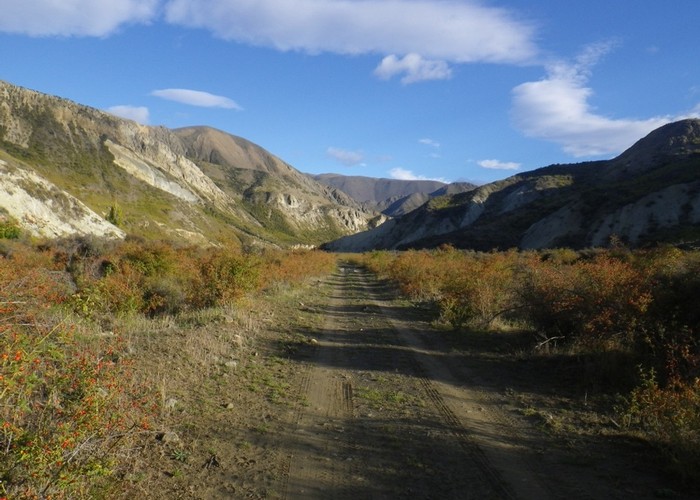
The remainder of the walk down Robinson Creek is uneventful. An old bulldozed track appears and disappears – we follow it or the riverbed to the forks with the Awatere. Broad flats of rich green grass are almost overrun with willows, but a good farm track follows the northern bank downriver and makes its way to the Molesworth Road. Hundreds of field mushrooms dot the flats, and I lift a prime specimen for breakfast.
A sheltered DOC campsite surrounds the original Molesworth Homestead site – the original two-room cob building still present in its centre. Stooping first under the eaves, then through the low doorway, I again wonder if people really were so much shorter in the past. A ranger is in residence at the campground – he gets his own tidy modern DOC hut, not for public use. He radios up for a forecast for me – three days of occasional showers: more of the same. Great.
I fry up my huge mushroom at a picnic table – I have to cook it a bit at a time as it’s too bit to fit in the pan. Then it gets boiled down into a rich soup. Some grey nomads observe the process and call out ‘bacon & eggs?’ In my dreams, perhaps, but the soup is delicious all the same.
Avoiding the hard gravel of the Molesworth Road, the east-west route swings north on a softer farm track over the Saxton Pass – confusingly, several kilometres from the Saxton itself. An easy 5km climb beside a ribbon of willows leads to the saddle, followed a sweeping descent down short-cropped grass faces to the Acheron. Two kilometres later we’re back on the Molesworth Road, now west of Wards Pass, with the endless broad expanse of the Acheron flats stretching west into the distance – punctuated at 400m intervals by tall electricity pylons. 2.5km of straight, unchanging gravel road lies between us and the turnoff to Saxton Hut. Just 6 pylons to go! A V of ducks pass overhead, but the day is silent except for the static-hiss over overhead HV lines.
Hot-footed I’m resting at the Saxton roadend, reclined in the sun against the DOC signpost. Net-curtains of drizzle drape the upper valley, drawn and opened as each brief shower passes. A flash of light on Wards Pass vanishes, becomes a car – inching down the zigzags in a slow-motion helter-skelter, marble madness. Becomes a cloud of dust, accelerating across the flats towards us. I wait till it reaches the last pylon, lever myself up off the ground, and open the gate for them. A conversation follows, words inconsequential – already forgotten – but the cheerful warm aftertaste of which lingers still.
An easy six kilometre tramp up a little used farm track leads to Saxton Hut, criss-crossing the river at shin-deep fords. A little more water seeping into otherwise dry boots at each, until after the last I’m forced to admit that socks, boots, feet are finally wet. Saxton Hut perches on a small terrace above the forks – a pleasant six-bunker in the Whirinaki Style: bunks down one side, fire on the other. A spacious porch covers a water tank, gated to keep out curious neighbourly cattle-beasts. And I have the place to myself – a welcome sight.
Lake McRae Hut -> Molesworth Cob Cottage
Follow the overgrown farm track 2km downriver from Lake McRae Hut to the first major confluence from the west. Leave the track and head up the river through willows / briar scrub for 1.5km until you are level with the saddle between pt914 and pt1193. Climb the spur west of the saddle leading to pot 1193. Going is briefly scrubby but soon opens to a steep face of dirt and sparse rosebriar. Follow the ridgeline west climbing in a series of steps, over the summit east of Robinson Saddle, then sidling the southern face of the next peak directly west to the saddle on a well worn track across fine scree. Descend the tussock slopes into the valleyhead and follow the Robinson downstream on good open flats, cattle tracks and gravel riverbed. An old bulldozed track appear and disappears and can be followed where still present. At the confluence with the Awatere, cross the fenceline and Awatere River and pick up the good farm track heading down the true left. This can be followed all the way to the Molesworth Road, crossing the river twice more. Crossings are ankle deep in normal flows. Cob Cottage and the homestead campsite are 1km east along the gravel Molesworth Road.
Molesworth Cob Cottage to Saxton roadend
Head north from the Molesworth campground along the road (towards the east coast) for 1km, and take the signposted turnoff up Molesworth Stream. A good farm track follows the stream, climbing gently to the Saxton Pass, before descending into the Acheron. The track rejoins the Molesworth Road 2km down the Acheron. The Saxton Roadend is 2.5km further west along the gravelled Molesworth Road.
Saxton Roadend to Saxton Hut
A rough farn track head up the flats on the east bank of the Saxton, crossing three times in the next 2.5km. Crossings are shin deep in normal flows, but can clearly flood after rain. Saxton Hut is on a small terrace above the western bank, upstream of the first major confluence on the true right.
==========================================
Day 4: Saxton Hut to Sedgemere Sleepout
Mist hangs low above the unnamed valley, moisture ripening the subalpine colours all around. For the first time we’re rewarded with a truly native palette. No more bichromatic landscapes of dirt and briar. Red and gold tints tussocks. Green, reds - hebes and speargrass cling on narrow ledges on the bluffed valleysides. Coprosma sparking, bark a wash of fiery orange. Stands of blue-green ribbonwood against black faces of matagouri. For the first time I feel myself relax, feel at ease. No longer making an effort to appreciate the landscape. No longer trying to see past the exotic, imported vegetation, to appreciate that even such a man-modified landscape can hold beauty. At last I tramp through New Zealand.
And truly I am tramping. A lovely valleyfloor route ascends to an easy saddle. Cattle tracks lead the way. Mist lightens as I climb, white rainbows spanning the valley ahead. Then, at the saddle, an abrupt change. Behind: a green gentle valley lush with vegetation. Ahead: a black scar gouged from the mountain. A deep, tight, dark V descending to the flats of the Severn far below, where sunlight shines on tussock, glistens off water. A fun, scree-running descent – but pity those who try to ascend it.
Severn Hut is new. Sitting tightly fenced on tussock terraces, looking up the broad valley to ranges at its head. Newly built to the original NZFS 6-bunk deign – simple, practical, warm and homely.
The walk down the valley from Severn Hut is easy – terraces of short grass lead down the true left. A large creek, carved deep from black rock, descends from peak opposite. Downstream, a second attempts to follow it, finds its way blocked by a low ridge of impassable rock, swings to flow parallel to the Severn, unable to pass. Finally, the side-stream finds a weakness, cuts a narrow, twisting gorge through the ridge to join the main river: Dog Creek.
Beyond Dog, we climb west onto a low ridge - the continuation of that ridge that for so-long defied Dog Creek - now separating Waimea Stream from the main valley. A broad, flat valley, the Waimea rises gently to a low saddle 3km west. Tussock and sedge cover the marshy northern faces, the southern side short cattle-cropped grass. Sick of hunting cattle up and down valleys, I pick my way between mashed, navigating blind through head-high tussock. Finally I reach the pass, the tumble-zone in it lea crowned by row of dead wind-blown pines.
From a small lake below, a vast basin stretches into the distance – kilometres of undulating disturbed landscape, finally rising to peaks some 10km west. Tarns dot the landscape, filling each hollow. Mountains on all sides. Magic.
Cattle-tracks lead down to the lake, a 4WD track following its southern shore and running west to the gravel highway at Sedgemere. Even on the good trail, the basin takes hours to cross: trees, fenceposts, tarns appear, pass, recede, but the far mountains appear unchanging. South down the valley a single line of mature pines crosses the valley from east to west– the shelterbelt of some long-failed attempt at agriculture. Downwind a green rash peppers the valley for 10’s of kilometres. In places continuous, in others a mere decorative green sprinkle: 10,000 hectares of ‘busy progeny’ of those 100-odd original trees.
We finally reach the far side of the basin. A dark mark of the valley floor resolves itself into a small circle of pines. Sedgemere Chalet sheltered in its centre. No chalet for us though, 20 yards away a small, simple hut boasts the green DOC sign: Segdemere Sleepout. But with its six bunks and wood stove, in the shelter of those ‘busy pines’, it makes a welcome home after a long day in this vast landscape.
Sedgemere also marks the end of the Molesworth East-West route. We’ve traversed over 100km of high country farmland – seen land both actively farmed and retired. We’ve witnessed the changes that man has heaped upon the landscape – entire days of country dominated by introduced plants and animals. Tomorrow we finally leave that all behind and move on into the mountains of the Nelson Lakes National Park. I rest impatient – filled with anticipation of days in untouched valleys of tussock and beech, of challenging passes – rock and scree to the skyline. But also wary: uneasy at the thought of exchanging my days of solitude in a vast landscape, for huts and valleys packed with the scores of people who traverse the park every day. I try to guess what effect that change will have on the mood of the trip. Tomorrow, we find out.
Saxton Hut -> Severn Hut
An unmarked route follows the unnamed valley west from Saxton Hut. Good cattle tracks lead up the gentle valley to the pass. A steep scree ‘V’ descends beyond to the Severn. This can either be ‘run’ on it’s northern side, or you can climb the creek to the north of the saddle and follow a firm tussock ridge down to the Severn valley floor. Severn Hut is at the confluence, on the eastern bank.
Severn Hut -> Sedgemere Sleepout
Follow the Severn River downstream. There is no track but going is good on terraces on the eastern side, with a brief climb over low bluffs. Look for the 2nd major stream entering from the west – Dog Stream. Cross to the western valleyside, and climb the low ridge downstream of the Dog confluence and drop west into the Waimea. Travel is easiest low on the southern face of the Waimea where short cattle-cropped grass and cattle trails provide travel west to the saddle. Follow good cattle trails down to Bowscale Tarn, following the eastern then southern banks of the lake until you pick up a good 4WD track heading west. Follow the track 4km to the Sedgemere information kiosk where the public roadend and carepark are also located. Sedgemere Chalet (private) and Sedgemere Sleepout (DOC) are 1km west along the track from the kiosk / public roadend just before the junction with the Rainbow Road.
To be continued ....