Mt. Kapakapanui is a mountain that is purported to have excellent views that stretch as far north as Mts. Taranaki and Ruapehu, and as far south as the Marlborough Sounds and Kaikoura Mountains. However, if you plan to see anything at all it is highly recommended to pick a weekend that is forecast for fine weather otherwise you will see little once reaching the summit (thus speaks the author from experience, ahem). The track is definitely do-able in one day, though it is not a 5-6 hour pushover unless you are quite fit and motor it (a friend claims to have walked it in 4 hours - I'll take his word for it). I would recommend you give yourself 6-8 hours for the tramp, which allows you plenty of stops, particularly at the top to enjoy the scenery. You can of course split the walk into two days, either sleeping at the Kapakapanui Hut or on the summit.
Getting there and starting off
Access to the track is relatively simple to get to - turn right at the traffic lights at Waikanae north of Wellington so you find yourself on the Akatarawa Road and follow until you reach a turnoff around 5km along the road on the left called Ngatiawa Road (and has a sign for Ngatiawa Campsite) which you need to follow for another 3-4km or so to the "carpark", which constitutes a dead-end with a few houses and some grass you can park your car on. Follow the poled route through the farmland and ford the river, and then follow the track for another 20 minutes or so until you reach a junction - where you get to decide whether to head up the mountain clockwise or anti-clockwise. The author will assume you take the clockwise route (as he did), although it is possible to take anti-clockwise route as well (perhaps even slightly easier).
Junction to Kapakapanui Hut (2-3 hours)
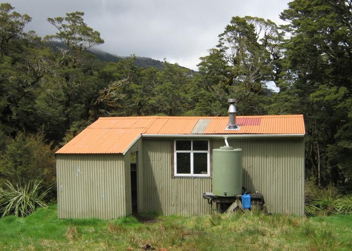
Take the turnoff to the left (that is, don't cross the river and carry on but follow the orange markers up the hill) and begin advancing up the hill. The first 4-500 metres are very steep, and don't feel embarrassed at stopping. Eventually the steep gradient lessens off, and you should come to a grassy knoll (or something that approximates it) called Ngatiawa. Good photo opportunity here of the Waikanae area and out to Kapiti Island. Carry on along the track which proceeds much more gracefully up the mountain until you reach Kapakapanui Hut, which is run by the local Deerstalkers club. It can sleep 6, and has the basic facilities, although if you intend to stay the night you should bring along a portable cooker. Another possibility is to carry on up to the summit and sleep under fly for the night. Whatever your decision if you stay the night make sure to see the sunset and watch the stars for a bit - my tramping group spotted more than a dozen shooting stars in less than 20 minutes.
Kapakapanui Hut to Mt. Kapakapanui summit (1 Hour)
Having had a break or stayed the night at the hut, carry on up the track as it winds its way up to the summit. You'll pass through a couple of small clearings before ducking back into some bush until you finally reach the summit at 1102m which is marked by a large trig station. Take some time to view the area and look out to the North and South, and if you wish to pique your curiosity at some of the graffiti which plasters the trig station do so. Also have a look for signs of scarring from fire and strong winds - the summit of Kapakapanui was apparently stripped bare of bush by a fire and a strong gale some 80-100 years ago.
Kapakapanui Summit to the Junction (3-4 Hours)
Once you have decided to carry on with your journey, proceed onwards past the junction at the summit (which leads down towards Maymorn Junction and Renata) and follow the track as it drops back down into the bush and winds down towards the junction. The descent is mostly fairly leisurely and gentle, but there are occasional steep patches which should not be taken lightly (particularly if it has recently rained) but should not cause too much hassle. Also be aware of a rather large felled tree that rudely blocks the track not far from the bottom. It is fairly easy to navigate around but as of when the author walked this track there had been no efforts to cut in any steps, so it is advisable to go around it. Keep meandering down the hill and you will eventually meet up with the river which you cross a couple of times and finally end up back at the Junction.
Once you are back at the Junction it is simply a case of walking straight out the way you came in, albeit with a few new rewarding experiences and hopefully some memories of some fine views - if you picked a good weekend for it. One last note: While you are driving out see if you can pick out the fault line in the rock beside the road as you drive out along Ngatiawa Road (hint: look on the left hand side).